18 Firtree Walk, Groby, Leicester, LE6 0FN
About 18 Firtree Walk
18 Firtree Walk is a three-bedroom mid-terrace house in Groby, Leicester, Leicester (LE6 0FN). It has a recorded floor area of 82 m² (around 883 sq ft), construction records dating it to 1967-1975 and council tax band B. The latest certificate (October 2012) shows a C (score 71). The recommended improvements would push it to B (score 86). The latest certificate is from October 2012, so improvements made since then won't be reflected.
Across 1995–2015, sale prices on this property compounded at 6.6% per year. Today's modelled estimate of £230,000 sits 59.7% above the 2015 sale of £144,000. Last changed hands 11 years ago, in October 2015.
What this property has
Inside
- Bedrooms3
- Bathrooms1
Everything you need to know about 18 Firtree Walk
The true value, the hidden risks and the full sale history, in one report.
30-day money-back guarantee

The data behind every report


Energy performance
18 Firtree Walk's EPC is over a decade old — improvements since won't be reflected.
EPC Expired
This certificate is over 10 years old and is no longer valid.Expired 14 Oct 2022
EPC Rating
Planning history
18 Firtree Walk has no planning applications on record.
The full report still covers planning activity across the surrounding area.
Sales history & valuation
Sale price has grown by over 3x since 1995.
£230,000
Modelled from EPC, postcode comparables and a sale-price growth of 6.6% per year over 20 years.
£144,000
Growth on file: 6.6% per year over 20 years.
Sales timeline
1 October 2015Most recent
£144,000
+269.2%over 20 years12 April 1995
£39,000
Median price across the last 5 sales in LE6 0FN: £219,000 (2025–2024).
Nearby sales in LE6 0FN
15 Firtree Walk, Groby, Leicester, LE6 0FN
Sold Mar 2025
£206,0002 Firtree Walk, Groby, Leicester, LE6 0FN
Sold Mar 2025
£272,00014 Firtree Walk, Groby, Leicester, LE6 0FN
Sold Jun 2024
£205,00012 Firtree Walk, Groby, Leicester, LE6 0FN
Sold Jun 2024
£225,0003 Firtree Walk, Groby, Leicester, LE6 0FN
Sold Mar 2024
£219,000
Versus other Firtree Walk homes
Floor Area for 18 Firtree Walk runs comfortably ahead of the street norm.
Price per m²
£1,756
Street avg £2,397
Floor Area
82 m²
Street avg 74 m²
Habitable Rooms
4 rooms
Street avg 5 rooms
CO₂ Emissions
2.7 t/year
Street avg 3.1 t/year
Everything you need to know about 18 Firtree Walk
The true value, the hidden risks and the full sale history, in one report.
30-day money-back guarantee
The data behind every report
Similar properties nearby
1 Bumblebee Close, Ratby
LE6 0PB
1 Ash Court, Groby
LE6 0EH
1 Castle Rise, Groby
LE6 0YQ
1 Brook Drive, Ratby
LE6 0AQ
1 Carmen Grove, Groby
LE6 0BA
1 Bailey View, Groby
LE6 0FF
1 Castell Drive, Groby
LE6 0DE
1 Cedar Court, Groby
LE6 0ET
The neighbourhood at a glance
Crime
2/mo
Steady year-on-year across the wider district.
Nearest stop
0.1 km
Stephenson Close — bus stop.
Closest school
0.3 km
Martinshaw Primary School. 8 schools nearby.
Go deeper on the local area
The full report breaks down crime, transport links, schools and air quality in depth.
Road noise across the postcode
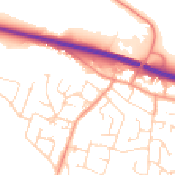
Daytime· 07:00 – 23:00
53.0dB

Night-time· 23:00 – 07:00
43.4dB