25 Lower Lane, Liverpool, L9 7AD
About 25 Lower Lane
25 Lower Lane is a three-bedroom semi-detached house in Liverpool (L9 7AD). It has a recorded floor area of 97 m² (around 1044 sq ft), construction records dating it to 1930-1949 and council tax band B. The latest certificate (November 2016) shows an E (score 47), well below the UK norm with real room to improve. The recommended improvements would push it to D (score 67). Other recorded features include attached land beyond the plot. Records show the property has been extended at some point in its history.
It hasn't traded since October 1995, a hold of 31 years that's notably long for the area. Only one transfer is on record with HM Land Registry, suggesting it has stayed in the same hands for a long time. Today's modelled estimate of £231,000 sits 450% above the 1995 sale of £42,000. On a £-per-square-foot basis, the last sale (£40/sq ft) was about 70.9% below the postcode norm.
Know exactly what you're buying at 25 Lower Lane
Before you offer, see what the listing won't tell you, the true value, the red flags and the full history.
Valuation
against the asking price
Risks
planning & flood
Sold prices
similar homes nearby
Trends
the local market
What this property has
Inside
- Bedrooms3
- Dining roomYes
Outside
- LandYes
Building
- Central heatingYes
- Previously extendedYes
Energy performance
25 Lower Lane's carbon output runs well above what efficient homes in the postcode produce.
EPC Rating
Planning history
25 Lower Lane has no planning applications on record.
The full report still covers planning activity across the surrounding area.
Sales history & valuation
25 Lower Lane's modelled value sits at over four times its earliest registered sale price (1995).
£231,000
Modelled from EPC, postcode comparables.
£42,000
Recorded with HM Land Registry.
Sales timeline
15 October 1995Most recent
£42,000
Median price across the last 5 sales in L9 7AD: £134,000 (2025–2013).
Everything we know about 25 Lower Lane, in one report
What it's really worth, what could be wrong, and the planning, sales and area data in full.
- Am I paying too much?
- Is something wrong with it?
- Is the agent's story true?
- Will it hold its value?

Versus other Lower Lane homes
Price per m² for 25 Lower Lane lags the street by a wide margin.
Price per m²
£433
Street avg £1,949
Floor Area
97 m²
Street avg 88 m²
Habitable Rooms
6 rooms
Street avg 6 rooms
CO₂ Emissions
6.5 t/year
Street avg 5.0 t/year
Similar properties nearby
107 Ashbrook Drive
L9 7LU
103 Ashbrook Drive
L9 7LU
105 Ashbrook Drive
L9 7LU
105 Whitewood Park
L9 7LF
101 Whitewood Park
L9 7LF
1 Hartleys Village
L9 7AH
102 Whitewood Park
L9 7LG
1 Ashbrook Drive
L9 7LU
The neighbourhood at a glance
Rail-style transport is unusually close for this postcode.
Crime
33/mo
Steady year-on-year across the wider district.
Nearest stop
0.1 km
Fazakerley Station — bus stop.
Closest school
0.2 km
Holy Name Catholic Primary School. 26 schools nearby.
Go deeper on the local area
The full report breaks down crime, transport links, schools and air quality in depth.
Road noise across the postcode
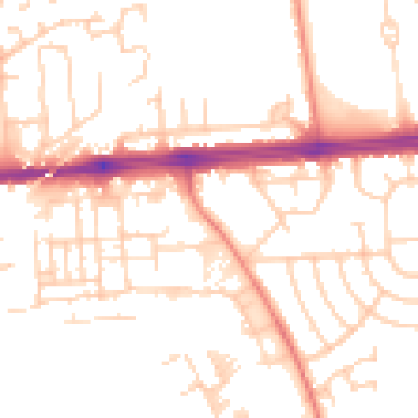
Daytime· 07:00 – 23:00
51.5dB

Night-time· 23:00 – 07:00
40.6dB