5 Amethyst Close, Litherland, Liverpool, L21 7RD
About 5 Amethyst Close
5 Amethyst Close is a three-bedroom detached house in Litherland, Liverpool, Liverpool (L21 7RD). It has a recorded floor area of 102 m² (around 1098 sq ft), construction records dating it to 2003-2006 and council tax band C. The latest certificate (December 2014) shows an E (score 52), well below the UK norm with real room to improve. Earlier certificates rated it C (October 2009); the latest reading is 2 bands lower. Between certificates, roof efficiency went from Good to Very Good; while wall efficiency dropped from Good to Poor and hot-water efficiency dropped from Good to Poor. The recommended improvements would lift it to B (score 87), a 3-band jump. The latest certificate is from December 2014, so improvements made since then won't be reflected.
It hasn't traded since February 2010, a hold of 16 years that's notably long for the area. At 102 m² the property is well over the postcode median (67 m² across 12 EPCs), placing it in the larger end of the local stock. On energy efficiency it sits in the bottom 10% of properties in this postcode — significant headroom for improvement. Across 2002–2010, sale prices on this property compounded at 5.8% per year. Today's modelled estimate of £194,000 sits 51% above the 2010 sale of £128,500. One planning record on file: an extension approved in 2016. Past consents include an extension, meaningful when judging how the property has evolved.
What this property has
Inside
- Bedrooms3
- Dining roomYes
Building
- Central heatingYes
Everything you need to know about 5 Amethyst Close
The true value, the hidden risks and the full sale history, in one report.
30-day money-back guarantee

The data behind every report


Energy performance
5 Amethyst Close sits at the bottom of the postcode for energy efficiency — meaningful headroom to improve.
EPC Expired
This certificate is over 10 years old and is no longer valid.Expired 02 Dec 2024
EPC Rating
Property Improvements
Changes detected from historical EPC data
Heating controls changed
Hot water system changed
Loft insulation upgraded to recommended levels
Low energy lighting percentage decreased
Planning history
5 Amethyst Close has an approved single-storey rear extension on the planning record.
- Nov 2016ExtensionFullIn report
Extension: Single storey · Rear of property
Erection of a single storey extension to the rear of the dwellinghouse.
- Agent
- Proserve Survey LTD
- Documents
- 5 docs on file
- Reference
- DC/2016/01947
What's in 5 Amethyst Close, Litherland, Liverpool, L21 7RD's planning history?
Refusals, disputes and full decisions on this property and nearby, in the report.
Sales history & valuation
5 Amethyst Close saw 3 transfers in just over a decade — high turnover for the postcode.
£194,000
Modelled from EPC, postcode comparables and a sale-price growth of 5.8% per year over 8 years.
£128,500
Growth on file: 5.8% per year over 8 years.
Sales timeline
5 February 2010Most recent
£128,500
+18.4%over 6 years21 August 2003
£108,500
+29.7%over 1 year26 June 2002
£83,650
Median price across the last 5 sales in L21 7RD: £155,000 (2024–2021).
Nearby sales in L21 7RD
3 Amethyst Close, Litherland, Liverpool, L21 7RD
Sold Nov 2024
£155,50016 Amethyst Close, Litherland, Liverpool, L21 7RD
Sold Sept 2022
£125,0004 Amethyst Close, Litherland, Liverpool, L21 7RD
Sold Nov 2021
£125,0001 Amethyst Close, Litherland, Liverpool, L21 7RD
Sold Oct 2021
£155,00010 Amethyst Close, Litherland, Liverpool, L21 7RD
Sold Jul 2020
£125,500
Versus other Amethyst Close homes
5 Amethyst Close is notably below the street on epc rating.
Price per m²
£1,260
Street avg £1,769
Floor Area
102 m²
Street avg 69 m²
Habitable Rooms
5 rooms
Street avg 4 rooms
CO₂ Emissions
5.9 t/year
Street avg 2.7 t/year
Everything you need to know about 5 Amethyst Close
The true value, the hidden risks and the full sale history, in one report.
30-day money-back guarantee
The data behind every report
Similar properties nearby
1 Amethyst Close, Litherland
L21 7RD
1 Boundary Road, Litherland
L21 7LA
1 Ruby Close, Litherland
L21 7RH
1 Gale Road, Litherland
L21 7QR
1 Amos Avenue
L21 7QH
1 Kent Avenue, Litherland
L21 7QJ
1 Oxford Avenue
L21 7LT
1 Opal Close, Litherland
L21 7RE
The neighbourhood at a glance
Reported crime in the wider district is trending notably upward year-on-year.
Crime
4/mo
Rising year-on-year across the wider district.
Nearest stop
0.1 km
Springfield Avenue — bus stop.
Closest school
0.4 km
St Philip's Church of England Controlled Primary School. 40 schools nearby.
Go deeper on the local area
The full report breaks down crime, transport links, schools and air quality in depth.
Road noise across the postcode
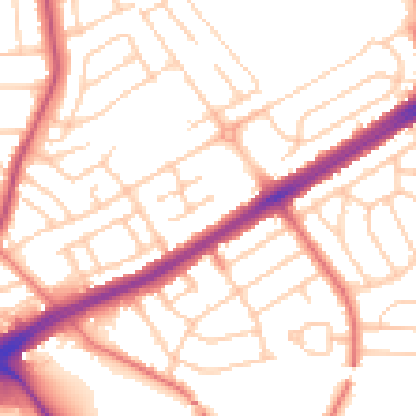
Daytime· 07:00 – 23:00
53.1dB

Night-time· 23:00 – 07:00
42.5dB