7 Springfield Avenue, Liverpool, L21 7PY
About 7 Springfield Avenue
7 Springfield Avenue is a three-bedroom mid-terrace house in Liverpool (L21 7PY). It has a recorded floor area of 79 m² (around 850 sq ft), construction records dating it to 1950-1966 and council tax band A. The latest certificate (May 2022) shows a D (score 59), a step below the typical UK home. The rating has held steady at D across 2 certificates since September 2011. Between certificates, lighting went from Average to Very Good; while wall efficiency dropped from Good to Very Poor and roof efficiency dropped from Good to Very Poor. The recommended improvements would push it to C (score 80).
Today's modelled estimate of £162,000 sits 62% above the 2014 sale of £100,000. On a £-per-square-foot basis, the last sale (£118/sq ft) was about 17.4% above the typical sold price in the postcode. Last sold in January 2014, so it's been off the market for around 12 years.
What this property has
Inside
- Bedrooms3
- Bathrooms2
Everything you need to know about 7 Springfield Avenue
The true value, the hidden risks and the full sale history, in one report.
30-day money-back guarantee

The data behind every report


Energy performance
EPC Rating
Property Improvements
Changes detected from historical EPC data
More low energy lighting installed
Planning history
7 Springfield Avenue has no planning applications on record.
The full report still covers planning activity across the surrounding area.
Sales history & valuation
7 Springfield Avenue valuation sits well clear of the typical sold price in this postcode.
£162,000
Modelled from EPC, postcode comparables.
£100,000
Recorded with HM Land Registry.
Sales timeline
16 January 2014Most recent
£100,000
Median price across the last 5 sales in L21 7PY: £150,000 (2025–2018).
Nearby sales in L21 7PY
13 Springfield Avenue, Liverpool, L21 7PY
Sold Sept 2025
£160,00019 Springfield Avenue, Liverpool, L21 7PY
Sold Jul 2023
£150,0005 Springfield Avenue, Liverpool, L21 7PY
Sold Jun 2022
£170,00023 Springfield Avenue, Liverpool, L21 7PY
Sold Jan 2019
£99,40025 Springfield Avenue, Liverpool, L21 7PY
Sold May 2015
£65,000
Versus other Springfield Avenue homes
Floor Area for 7 Springfield Avenue lags the street by a wide margin.
Price per m²
£1,266
Street avg £1,348
Floor Area
79 m²
Street avg 87 m²
Habitable Rooms
5 rooms
Street avg 5 rooms
CO₂ Emissions
4.2 t/year
Street avg 5.1 t/year
Everything you need to know about 7 Springfield Avenue
The true value, the hidden risks and the full sale history, in one report.
30-day money-back guarantee
The data behind every report
Similar properties nearby
1 Amos Avenue
L21 7QH
1 Kent Avenue, Litherland
L21 7QJ
1 Gale Road, Litherland
L21 7QR
1 Ruby Close, Litherland
L21 7RH
1 Amethyst Close, Litherland
L21 7RD
1 Boundary Road, Litherland
L21 7LA
1 Oxford Avenue
L21 7LT
1 Opal Close, Litherland
L21 7RE
The neighbourhood at a glance
Reported crime in the wider district is trending notably upward year-on-year.
Crime
4/mo
Rising year-on-year across the wider district.
Nearest stop
0.1 km
Springfield Avenue — bus stop.
Closest school
0.2 km
St Philip's Church of England Controlled Primary School. 41 schools nearby.
Go deeper on the local area
The full report breaks down crime, transport links, schools and air quality in depth.
Road noise across the postcode
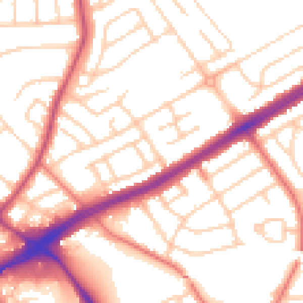
Daytime· 07:00 – 23:00
53.8dB

Night-time· 23:00 – 07:00
43.3dB