1 Kirkstone Road South, Liverpool, L21 5HJ
About 1 Kirkstone Road South
1 Kirkstone Road South is a four-bedroom semi-detached house in Liverpool (L21 5HJ). It has a recorded floor area of 89 m² (around 958 sq ft), construction records dating it to 1930-1949 and council tax band D. The latest certificate (September 2022) shows a D (score 66), on the cusp of jumping into the C band. The recommended improvements would lift it to B (score 84), a 2-band jump.
On a £-per-square-foot basis, the last sale (£280/sq ft) was about 124.9% above the typical sold price in the postcode. Sold June 2023 for £268,000.
What this property has
Inside
- Bedrooms4
- Bathrooms1
Everything you need to know about 1 Kirkstone Road South
The true value, the hidden risks and the full sale history, in one report.
30-day money-back guarantee

The data behind every report


Energy performance
Recommended upgrades on file would lift this property by multiple EPC bands.
EPC Rating
Planning history
1 Kirkstone Road South has no planning applications on record.
The full report still covers planning activity across the surrounding area.
Sales history & valuation
Latest sale on 1 Kirkstone Road South was the highest on Land Registry record across the postcode.
£282,000
Modelled from EPC, postcode comparables.
£268,000
Recorded with HM Land Registry.
Sales timeline
6 June 2023Most recent
£268,000
Median price across the last 5 sales in L21 5HJ: £195,000 (2024–2019).
Nearby sales in L21 5HJ
37 Kirkstone Road South, Liverpool, L21 5HJ
Sold Sept 2024
£130,0007 Kirkstone Road South, Liverpool, L21 5HJ
Sold Apr 2024
£220,00033 Kirkstone Road South, Liverpool, L21 5HJ
Sold Jun 2023
£235,00015 Kirkstone Road South, Liverpool, L21 5HJ
Sold Dec 2021
£171,0009 Kirkstone Road South, Liverpool, L21 5HJ
Sold Oct 2019
£195,000
Versus other Kirkstone Road South homes
Price per m² for 1 Kirkstone Road South runs comfortably ahead of the street norm.
Price per m²
£3,011
Street avg £1,607
Floor Area
89 m²
Street avg 104 m²
Habitable Rooms
7 rooms
Street avg 5 rooms
CO₂ Emissions
3.6 t/year
Street avg 5.7 t/year
Everything you need to know about 1 Kirkstone Road South
The true value, the hidden risks and the full sale history, in one report.
30-day money-back guarantee
The data behind every report
Similar properties nearby
1 Thirlmere Drive
L21 5JL
10 Silverdale Drive
L21 5HU
1 Netherton Park Road
L21 5JD
1 Thornbridge Avenue
L21 5JU
1 St Matthews Avenue
L21 5JP
1 Ennerdale Drive
L21 5HX
11 Ennerdale Drive
L21 5HX
1 Hawkshead Drive
L21 5JE
The neighbourhood at a glance
Reported crime in the wider district is trending notably upward year-on-year.
Crime
4/mo
Rising year-on-year across the wider district.
Nearest stop
0.0 km
Eccleshall Avenue — bus stop.
Closest school
0.6 km
St Philip's Church of England Controlled Primary School. 41 schools nearby.
Go deeper on the local area
The full report breaks down crime, transport links, schools and air quality in depth.
Road noise across the postcode
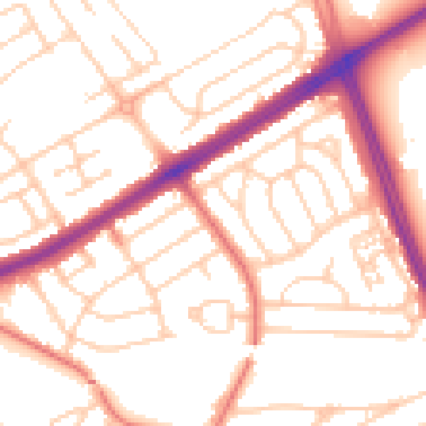
Daytime· 07:00 – 23:00
53.5dB

Night-time· 23:00 – 07:00
42.8dB