9 Rockville Road, Liverpool, L14 3LP
About 9 Rockville Road
9 Rockville Road is a three-bedroom semi-detached house in Liverpool (L14 3LP). It has a recorded floor area of 87 m² (around 936 sq ft), construction records dating it to 1930-1949 and council tax band C. The latest certificate (January 2016) shows a D (score 65), on the cusp of jumping into the C band. The recommended improvements would push it to C (score 79). The latest certificate is from January 2016, so improvements made since then won't be reflected.
Across 1997–2016, sale prices on this property compounded at 5.2% per year. Today's modelled estimate of £270,000 sits 70.9% above the 2016 sale of £158,000. 10 years since the last transfer (September 2016).
What this property has
Inside
- Bedrooms3
Everything you need to know about 9 Rockville Road
The true value, the hidden risks and the full sale history, in one report.
Pick your report · every report is £14.99
One time fee only - money back guarantee

The data behind every report


Energy performance
EPC Expired
This certificate is over 10 years old and is no longer valid.Expired 14 Jan 2026
EPC Rating
Get a survey for this property
Level 2 HomeBuyer Report
We've checked 10 risk factors against the available data for this property and believe a Level 2 HomeBuyer Report could be a suitable option for you.
From £545 · Includes VAT
Planning history
9 Rockville Road has no planning applications on record.
A planning report still maps activity across the surrounding area and reads this property's extension & conversion potential.
Sales history & valuation
Sale price has at least doubled since 1997.
£270,000
Modelled from EPC, postcode comparables and a sale-price growth of 5.2% per year over 19 years.
£158,000
Growth on file: 5.2% per year over 19 years.
Sales timeline
8 September 2016Most recent
£158,000
+163.6%over 19 years5 August 1997
£59,950
Median price across the last 5 sales in L14 3LP: £215,000 (2025–2023).
Nearby sales in L14 3LP
Versus other Rockville Road homes
On epc rating, 9 Rockville Road stands well clear of the street.
Price per m²
£1,816
Street avg £2,105
Floor Area
87 m²
Street avg 95 m²
Habitable Rooms
5 rooms
Street avg 5 rooms
CO₂ Emissions
3.8 t/year
Street avg 5.4 t/year
Everything you need to know about 9 Rockville Road
The true value, the hidden risks and the full sale history, in one report.
Pick your report · every report is £14.99
One time fee only - money back guarantee
The data behind every report
Similar properties nearby
10 Hackworth Close
L14 3AB
1 Renville Road
L14 3LN
10 Renville Road
L14 3LW
1 Old Thomas Lane
L14 3NA
10 Norville Road
L14 3LY
10 Orchard Avenue
L14 3NQ
1 Staplands Road
L14 3LJ
1 Bowring Court, Roby Road, Bowring Park
L14 3NU
The neighbourhood at a glance
Rail-style transport is unusually close for this postcode.
Crime
6/mo
Rising year-on-year across the wider district.
Nearest stop
0.1 km
Queens Drive — bus stop.
Closest school
0.5 km
Dixons Broadgreen Academy. 51 schools nearby.
Go deeper on the local area
A Local Area report breaks down crime, transport links, schools and air quality in depth.
Road noise across the postcode
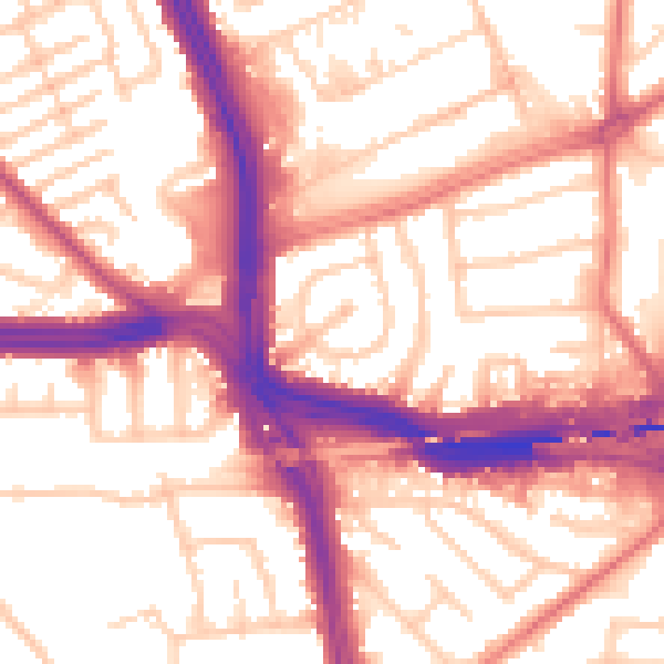
Daytime· 07:00 – 23:00
56.5dB
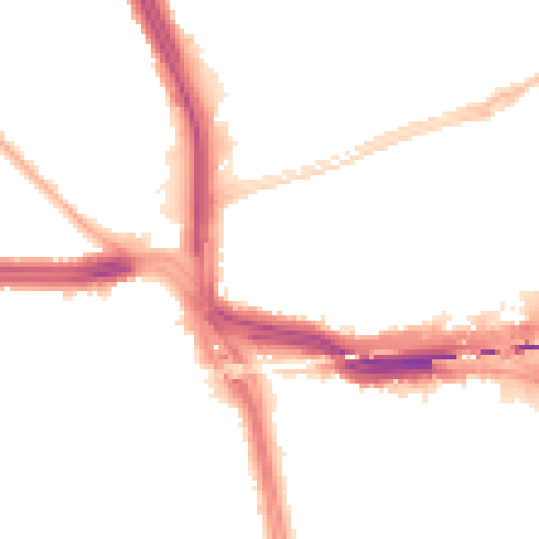
Night-time· 23:00 – 07:00
47.3dB