Model valuation£417,0008 Busby Close
Local market context
Apartment 15 is a two-bedroom mid-terrace house in Liverpool (L1 8DS). It has a recorded floor area of 47 m² (around 506 sq ft), construction records dating it to 1996-2002 and council tax band C. At 47 m² this is the 3rd smallest of 32 units on EPC record in the building, where floor areas span 42–92 m². The building's EPC ratings span D to B across 32 units on file. The latest certificate (February 2024) shows a C (score 79), near the top of the C band. Main heating runs on electricity.
Untraded for 20 years, with the last transfer in February 2007. That sale landed at the peak of the pre-credit-crunch market, which is a useful reference point when interpreting the price. On a £-per-square-foot basis, the last sale (£332/sq ft) was about 47.2% above the typical sold price in the postcode. At 47 m² it's 27.7% smaller than the typical home in the postcode (65 m² median across 31 EPCs).
The true value, the hidden risks and the full sale history, in one report.
Pick your report · from £14.99
One time fee only - money back guarantee

The data behind every report


Apartment 15's carbon output is low for the local stock.
Certificate validity
Valid until 28 February 2034

Get a survey for this property
Because the property has no mains gas supply, we believe a Level 3 building survey should be considered.
From £820 · Includes VAT
Apartment 15 has no planning applications on record.
A planning report still maps activity across the surrounding area and reads this property's extension & conversion potential.
The latest sale landed at the peak of the pre-credit-crunch market — a high-water reference point.
£152,000
Modelled from EPC, postcode comparables.
£168,000
Recorded with HM Land Registry.
9 February 2007Most recent
£168,000
Median price across the last 5 sales in L1 8DS: £130,000 (2022–2019).
Apartment 9, 24 Cornhill, Liverpool, L1 8DS
Sold Jun 2022
Apartment 4, 24 Cornhill, Liverpool, L1 8DS
Sold Aug 2021
Apartment 6, 24 Cornhill, Liverpool, L1 8DS
Sold Dec 2020
Apartment 10, 24 Cornhill, Liverpool, L1 8DS
Sold Aug 2019
Apartment 25, 24 Cornhill, Liverpool, L1 8DS
Sold May 2019
Price per m² for Apartment 15 runs comfortably ahead of the street norm.
Price per m²
£3,574
Street avg £2,428
Floor Area
47 m²
Street avg 65 m²
Habitable Rooms
3 rooms
Street avg 3 rooms
CO₂ Emissions
1.5 t/year
Street avg 2.0 t/year
Property research, connected
Explore sale histories, valuations, energy ratings and local areas. Ask the assistant to connect the details and take your research further.
Start your researchL1 8DX
L1 8DP
L1 8DS
L1 8ND
L1 8DN
L1 8DG
L1 8DT
L1 8DN
Crime
577/mo
Steady year-on-year across the wider district.
Nearest stop
0.1 km
Forrest Street — bus stop.
Closest school
0.2 km
St Vincent de Paul Catholic Primary School. 38 schools nearby.
Go deeper on the local area
A Local Area report breaks down crime, transport links, schools and air quality in depth.
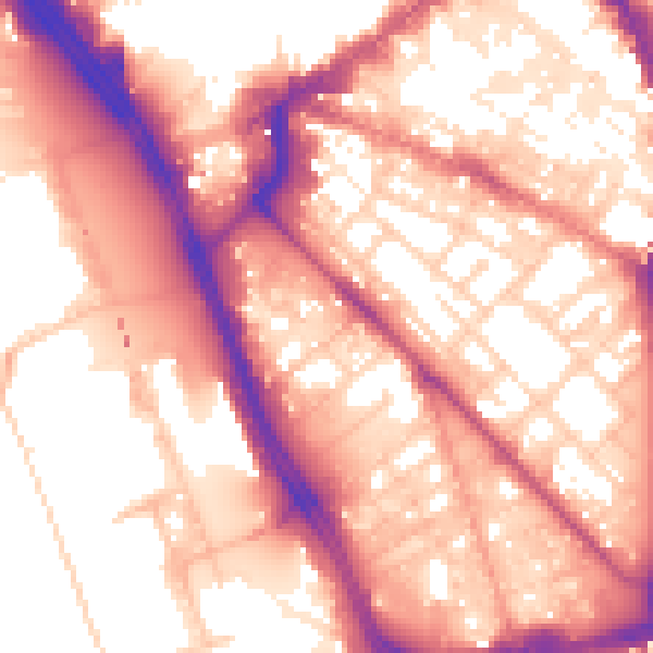
Daytime· 07:00 – 23:00
57.9dB
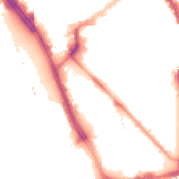
Night-time· 23:00 – 07:00
48.6dB