Model valuation£417,0008 Busby Close
Local market context
Marfield House is a one-bedroom mid-terrace house in Bury St Edmunds (IP33 1HG). It has a recorded floor area of 45 m² (around 484 sq ft) and construction records dating it to 1900-1929. At 45 m² this is the largest unit on EPC record across Marfield House (26–45 m²). The building's EPC ratings span F to C across 5 units on file. The latest certificate (November 2020) shows a D (score 58), a step below the typical UK home. When first surveyed in October 2009 the rating was F, the property has climbed 2 bands since. Between certificates, hot-water efficiency went from Very Poor to Good, lighting went from Very Poor to Poor and main heating went from Poor to Good; while wall efficiency dropped from Poor to Very Poor. The recommended improvements would push it to C (score 70).
One historical planning record sits against the property in 2020. The record references conservation-area consent, which constrain future alterations. Most recent transfer: May 2024 at £168,000. Across the public record there are 6 sales, relatively high churn for a single property. At 45 m² it's 29.4% larger than the typical home in the postcode (35 m² median across 26 EPCs). Across 2004–2024, sale prices on this property compounded at 3.4% per year. On a £-per-square-foot basis, the last sale (£347/sq ft) was about 125.8% above the typical sold price in the postcode.
The true value, the hidden risks and the full sale history, in one report.
Pick your report · from £14.99
One time fee only - money back guarantee

The data behind every report


Certificate validity
Valid until 22 November 2030
Changes detected from historical EPC data
Window efficiency improved
More low energy lighting installed
Replaced storage heaters with gas boiler
Connected to mains gas supply
Hot water system upgraded

Get a survey for this property
Because the property was built before 1919 and has solid (non-cavity) walls, we believe a Level 3 building survey should be considered.
From £820 · Includes VAT
Marfield House sits within a conservation area — exterior works face additional planning controls.
1 application on record at Marfield House, Flat 5, 124 Northgate Street, Bury St Edmunds, IP33 1HG
Tree in a Conservation Area Notification - 1no. Acacia (T1 on plan) - fell
You're seeing the shape of it. The report has the substance.
One time fee only - money back guarantee
Marfield House has changed hands more often than typical for the area.
£171,000
Modelled from EPC, postcode comparables and a sale-price growth of 3.4% per year over 20 years.
£168,000
Growth on file: 3.4% per year over 20 years.
27 May 2024Most recent
£168,000
+1.8%over 2 years25 May 2022
£165,000
+5.8%over 4 years9 October 2017
£156,000
+9.1%over 2 years19 December 2014
£143,000
+10.0%over 7 years3 May 2007
£130,000
+52.9%over 3 years16 February 2004
£85,000
Median price across the last 5 sales in IP33 1HG: £490,000 (2021–2015).
2 Northgate Street, Bury St Edmunds, IP33 1HG
Sold Jan 2021
119 Northgate Street, Bury St Edmunds, IP33 1HG
Sold Mar 2018
Marfield House, Flat 4, 124 Northgate Street, Bury St Edmunds, IP33 1HG
Sold Jan 2016
Marfield House, Flat 2, 124 Northgate Street, Bury St Edmunds, IP33 1HG
Sold Jun 2015
Marfield House, Flat 3, 124 Northgate Street, Bury St Edmunds, IP33 1HG
Sold Feb 2015
On years held, Marfield House runs well behind the street norm.
Price per m²
£3,733
Street avg £2,908
Floor Area
45 m²
Street avg 42 m²
Habitable Rooms
2 rooms
Street avg 2 rooms
CO₂ Emissions
2.7 t/year
Street avg 3.4 t/year
Property research, connected
Explore sale histories, valuations, energy ratings and local areas. Ask the assistant to connect the details and take your research further.
Start your researchIP33 1EH
IP33 1EF
IP33 1EF
IP33 1LW
IP33 1LY
IP33 1LW
IP33 1LW
IP33 1LW
Rail-style transport is unusually close for this postcode.
Crime
134/mo
Steady year-on-year across the wider district.
Nearest stop
0.1 km
Cotton Lane — bus stop.
Closest school
0.5 km
Guildhall Feoffment Community Primary School. 16 schools nearby.
Go deeper on the local area
A Local Area report breaks down crime, transport links, schools and air quality in depth.
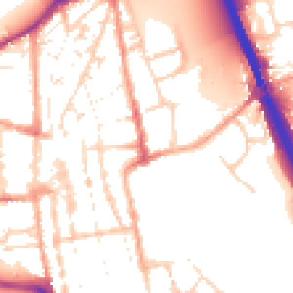
Daytime· 07:00 – 23:00
53.4dB

Night-time· 23:00 – 07:00
43.9dB