The Oaks, Whitakers Way, Loughton, IG10 1SQ
About The Oaks
The Oaks is a five-bedroom detached house in Loughton (IG10 1SQ). It has a recorded floor area of 191 m² (around 2056 sq ft), construction records dating it to 1976-1982 and council tax band G. The latest certificate (May 2015) shows an E (score 54), well below the UK norm with real room to improve. The recommended improvements would lift it to C (score 74), a 2-band jump. The latest certificate is from May 2015, so improvements made since then won't be reflected.
At 191 m² the property is well over the postcode median (137 m² across 5 EPCs), placing it in the larger end of the local stock. 9 planning records sit against the property, 7 approved, 2 refused. Past consents include tree works and an extension, meaningful when judging how the property has evolved. Today's modelled estimate of £1,185,000 is 17.3% above the 2016 sale price. On a £-per-square-foot basis, the last sale (£491/sq ft) was about 90.4% above the typical sold price in the postcode. Last sold in January 2016, so it's been off the market for around 10 years.
Know exactly what you're buying at The Oaks
Before you offer, see what the listing won't tell you, the true value, the red flags and the full history.
Valuation
against the asking price
Risks
planning & flood
Sold prices
similar homes nearby
Trends
the local market
What this property has
Inside
- Bedrooms5
- Dining roomYes
- EnsuiteYes
- StudyYes
Building
- Central heatingYes
Energy performance
The Oaks's carbon output runs well above what efficient homes in the postcode produce.
EPC Expired
This certificate is over 10 years old and is no longer valid.Expired 14 May 2025
EPC Rating
Planning history
The Oaks has been through 7 approved planning applications — a well-evolved property.
- May 2024Tree WorksTreesIn report
TPO/EPF/04/79 (Ref: T15 & T16) T1 & T2: 2 x Oak - Crown reduce by up to 1m, as specified.
- Documents
- 5 docs on file
- Reference
- EPF/0330/24
- Mar 2018Tree WorksTreesIn report
TPO/EPF/04/79 T15 & T16: T1 Oak (T15) - Lateral reduction to provide 2.5 metres clearance from adjacent property. Clear stem to crown break. T2 Oak (T16) - Lateral reduction of limb over road by 3-4 metres.
- Documents
- 6 docs on file
- Reference
- EPF/3473/17
What's in The Oaks, Whitakers Way, Loughton, IG10 1SQ's planning history?
7 more on this property, plus refusals, disputes and full decisions nearby, in the report.
Sales history & valuation
Latest sale on The Oaks was the highest on Land Registry record across the postcode.
£1,185,000
Modelled from EPC, postcode comparables.
£1,010,000
Recorded with HM Land Registry.
Sales timeline
25 January 2016Most recent
£1,010,000
Median price across the last 5 sales in IG10 1SQ: £475,000 (2024–2002).
Nearby sales in IG10 1SQ
Fairview Cottage, Whitakers Way, Loughton, IG10 1SQ
Sold Nov 2024
£510,0003 Lanterns, Whitakers Way, Loughton, IG10 1SQ
Sold Jan 2011
£475,0001 Lanterns, Whitakers Way, Loughton, IG10 1SQ
Sold Jul 2010
£562,500Monkwood Cottage, Whitakers Way, Loughton, IG10 1SQ
Sold Jul 1999
£322,0002 Lanterns, Whitakers Way, Loughton, IG10 1SQ
Sold Jul 1996
£156,000
Everything we know about The Oaks, in one report
What it's really worth, what could be wrong, and the planning, sales and area data in full.
- Am I paying too much?
- Is something wrong with it?
- Is the agent's story true?
- Will it hold its value?

Versus other Whitakers Way homes
Price per m² for The Oaks runs comfortably ahead of the street norm.
Price per m²
£5,288
Street avg £3,563
Floor Area
191 m²
Street avg 137 m²
Habitable Rooms
8 rooms
Street avg 7 rooms
CO₂ Emissions
9.7 t/year
Street avg 8.5 t/year
Similar properties nearby
1 Baldwins Hill
IG10 1SA
1 Eleven Acre Rise
IG10 1AN
1 Church Lane
IG10 1PD
1 Grasmere Close
IG10 1SL
1 Elmores
IG10 1NS
1 Ashfields
IG10 1SB
1 Hill Top Place, Hill Top Close
IG10 1PW
1 Forest Way
IG10 1JG
The neighbourhood at a glance
Daytime road noise here sits well below conversation level — a quiet pocket of the postcode.
Crime
4/mo
Steady year-on-year across the wider district.
Nearest stop
0.2 km
Goldings Road — bus stop.
Closest school
1.2 km
Staples Road Primary School. 12 schools nearby.
Go deeper on the local area
The full report breaks down crime, transport links, schools and air quality in depth.
Road noise across the postcode
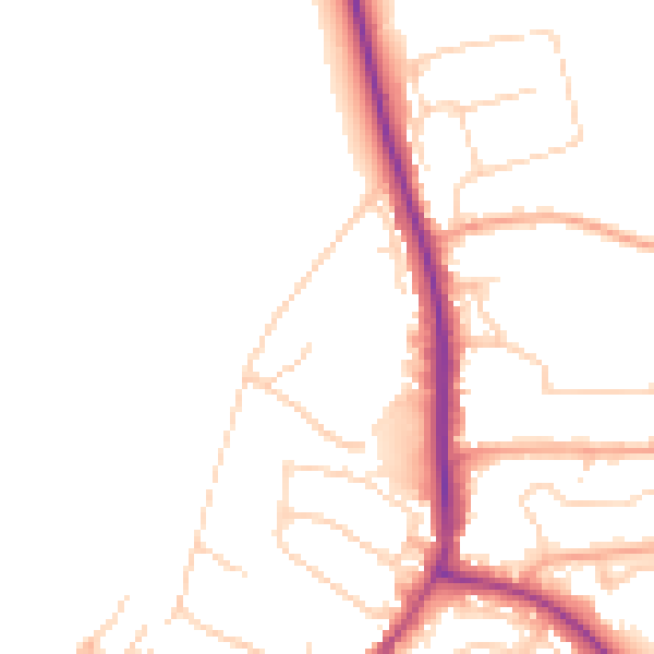
Daytime· 07:00 – 23:00
48.0dB

Night-time· 23:00 – 07:00
40.3dB