1 Burnside Avenue, Halifax, HX3 7RA
About 1 Burnside Avenue
1 Burnside Avenue is a three-bedroom semi-detached house in Halifax (HX3 7RA). It has a recorded floor area of 85 m² (around 915 sq ft), construction records dating it to 1930-1949 and council tax band C. The latest certificate (August 2019) shows a D (score 58), a step below the typical UK home. The recommended improvements would push it to C (score 74). Period features are noted in the property record. The home occupies a corner plot.
One planning application is currently pending a decision in 2026. At 85 m² the property is well over the postcode median (44 m² across 38 EPCs), placing it in the larger end of the local stock. It changed hands recently, sold April 2025 for £235,000. Across 2020–2025, sale prices on this property compounded at 4.6% per year. Today's modelled estimate of £271,000 is 15.3% above the 2025 sale price. On a £-per-square-foot basis, the last sale (£257/sq ft) was about 59.6% above the typical sold price in the postcode.
What this property has
Inside
- Bedrooms3
- Dining roomYes
Outside
- Private gardenFront and rear
- GarageYes
- Corner plotYes
Building
- Period featuresYes
Everything you need to know about 1 Burnside Avenue
The true value, the hidden risks and the full sale history, in one report.
Pick your report · every report is £14.99
One time fee only - money back guarantee

The data behind every report


Energy performance
EPC Rating
Get a survey for this property
Level 2 HomeBuyer Report
We've checked 10 risk factors against the available data for this property and believe a Level 2 HomeBuyer Report could be a suitable option for you.
From £545 · Includes VAT
Planning history
There is a planning application currently awaiting a decision.
1 application on record at 1 Burnside Avenue, Halifax, HX3 7RA
1 live now- Feb 2026Demolition And RebuildFullOutcome in report
Demolition of garage and construction of dwelling (self build)
- Documents
- 19 docs on file
- Reference
- 26/00115/FUL
Unlock 1 Burnside Avenue, Halifax, HX3 7RA's full planning history
You're seeing the shape of it. The report has the substance.
- Every decision — granted, refused or withdrawn
- All 1 application on this property in full
- The 19 documents, officer reports & conditions
- What the pattern means for extending or converting here
One time fee only - money back guarantee
Sales history & valuation
1 Burnside Avenue valuation sits well clear of the typical sold price in this postcode.
£271,000
Modelled from EPC, postcode comparables and a sale-price growth of 4.6% per year over 5 years.
£235,000
Growth on file: 4.6% per year over 5 years.
Sales timeline
22 April 2025Most recent
£235,000
+26.3%over 5 years31 January 2020
£186,000
Median price across the last 5 sales in HX3 7RA: £235,000 (2024–2020).
Nearby sales in HX3 7RA
Versus other Burnside Avenue homes
Price per m² for 1 Burnside Avenue runs comfortably ahead of the street norm.
Price per m²
£2,765
Street avg £1,973
Floor Area
85 m²
Street avg 65 m²
Habitable Rooms
5 rooms
Street avg 4 rooms
CO₂ Emissions
5.1 t/year
Street avg 3.4 t/year
Everything you need to know about 1 Burnside Avenue
The true value, the hidden risks and the full sale history, in one report.
Pick your report · every report is £14.99
One time fee only - money back guarantee
The data behind every report
Similar properties nearby
1 Beech Close
HX3 7QR
1 Brow Lane, Shelf
HX3 7QJ
1 Baxter Lane
HX3 7EF
1 Brow Wood Rise
HX3 7QN
1 Aydonway, Shelf
HX3 7QA
1 2, Cock Hill
HX3 7TQ
1 Burned Grove
HX3 7PU
1 Burnley Hill Cottage, Score Hill
HX3 7LJ
The neighbourhood at a glance
Reported crime in the wider district is trending notably upward year-on-year.
Crime
3/mo
Rising year-on-year across the wider district.
Nearest stop
0.2 km
Carr House Rd Carr House Lane — bus stop.
Closest school
0.3 km
St Michael and All Angels CofE Primary & Pre School. 23 schools nearby.
Go deeper on the local area
A Local Area report breaks down crime, transport links, schools and air quality in depth.
Road noise across the postcode
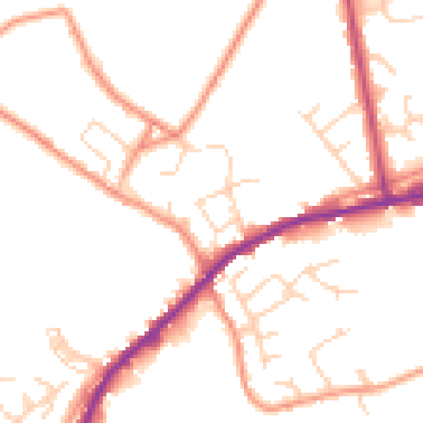
Daytime· 07:00 – 23:00
49.3dB

Night-time· 23:00 – 07:00
39.8dB