6 Library Close, Lepton, Huddersfield, HD8 0BT
About 6 Library Close
6 Library Close is a four-bedroom detached house in Lepton, Huddersfield, Huddersfield (HD8 0BT). It has a recorded floor area of 135 m² (around 1453 sq ft), construction records dating it to 1996-2002 and council tax band E. The latest certificate (December 2024) shows a D (score 66), on the cusp of jumping into the C band. The rating has held steady at D across 2 certificates since June 2011. Between certificates, window efficiency dropped from Good to Average. The recommended improvements would push it to C (score 75). Other recorded features include a conservatory.
Today's modelled estimate of £358,000 sits 93.5% above the 2013 sale of £185,000. On a £-per-square-foot basis, the last sale (£127/sq ft) was about 16.3% below the postcode norm. At 135 m² it's 15.2% larger than the typical home in the postcode (117 m² median across 3 EPCs). On the market in December 2013 and unlisted since — roughly 12 years.
What this property has
Inside
- Bedrooms4
- Bathrooms2
- EnsuiteYes
- ConservatoryYes
Outside
- Private gardenYes
- ParkingOff road
Everything you need to know about 6 Library Close
The true value, the hidden risks and the full sale history, in one report.
Pick your report · every report is £14.99
One time fee only - money back guarantee

The data behind every report


Energy performance
6 Library Close's carbon output runs well above what efficient homes in the postcode produce.
EPC Rating
Property Improvements
Changes detected from historical EPC data
More low energy lighting installed
Get a survey for this property
Level 2 HomeBuyer Report
We've checked 10 risk factors against the available data for this property and believe a Level 2 HomeBuyer Report could be a suitable option for you.
From £595 · Includes VAT
Planning history
6 Library Close has no planning applications on record.
But the area is active
5 notable applications nearby — larger schemes and conversions that could reshape the street. The report maps them all.
Sales history & valuation
6 Library Close saw 3 transfers in just over a decade — high turnover for the postcode.
£358,000
Modelled from EPC, postcode comparables and a sale-price growth of -0.4% per year over 9 years.
£185,000
Growth on file: -0.4% per year over 9 years.
Sales timeline
19 December 2013Most recent
£185,000
-5.6%over 5 years29 June 2008
£196,000
+2.1%over 4 years29 June 2004
£192,000
Median price across the last 5 sales in HD8 0BT: £194,000 (2014–2008).
Nearby sales in HD8 0BT
4 Library Close, Lepton, Huddersfield, HD8 0BT
Sold Dec 2014
£205,0002 Library Close, Lepton, Huddersfield, HD8 0BT
Sold Nov 2013
£194,0005 Library Close, Lepton, Huddersfield, HD8 0BT
Sold Oct 2013
£175,0001 Library Close, Lepton, Huddersfield, HD8 0BT
Sold May 2009
£192,0003 Library Close, Lepton, Huddersfield, HD8 0BT
Sold Jul 2004
£179,950
Versus other Library Close homes
On price per m², 6 Library Close runs well behind the street norm.
Price per m²
£1,370
Street avg £2,103
Floor Area
135 m²
Street avg 101 m²
Habitable Rooms
5 rooms
Street avg 6 rooms
CO₂ Emissions
6.0 t/year
Street avg 3.9 t/year
Everything you need to know about 6 Library Close
The true value, the hidden risks and the full sale history, in one report.
Pick your report · every report is £14.99
One time fee only - money back guarantee
The data behind every report
Similar properties nearby
1 Betula Way, Lepton
HD8 0ET
1 Burton Acres Mews, Kirkburton
HD8 0RE
1 Ashford Court, Kirkburton
HD8 0US
1 Burton Acres Drive, Kirkburton
HD8 0RD
1 Burton Acres Way, Kirkburton
HD8 0RF
1 Birkhead Close, Kirkburton
HD8 0GR
1 Cotswold Mews, Kirkburton
HD8 0XE
1 Acorn Croft, Fenay Bridge
HD8 0GE
The neighbourhood at a glance
Crime
3/mo
Steady year-on-year across the wider district.
Nearest stop
0.0 km
Ings Way — bus stop.
Closest school
0.3 km
Rowley Lane Junior Infant and Nursery School. 11 schools nearby.
Go deeper on the local area
A Local Area report breaks down crime, transport links, schools and air quality in depth.
Road noise across the postcode
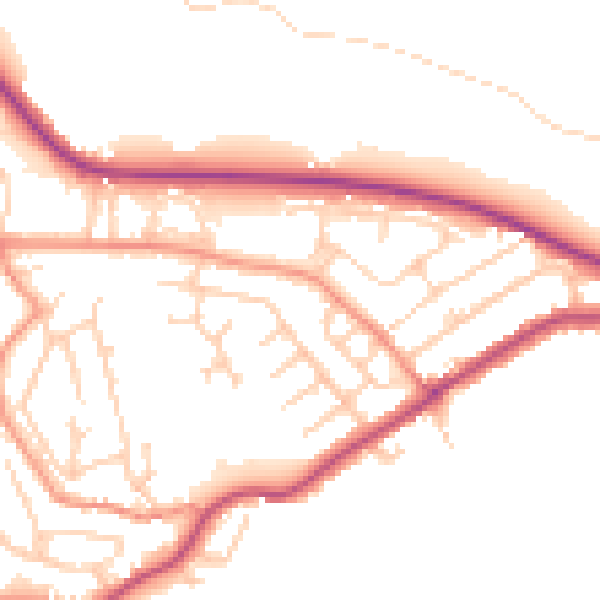
Daytime· 07:00 – 23:00
50.4dB

Night-time· 23:00 – 07:00
41.5dB