8 Fartown Green Road, Huddersfield, HD2 1AA
About 8 Fartown Green Road
8 Fartown Green Road is a three-bedroom mid-terrace house in Huddersfield (HD2 1AA). It has a recorded floor area of 97 m² (around 1044 sq ft), construction records dating it to before 1900 and council tax band A. The latest certificate (November 2013) shows a D (score 67), on the cusp of jumping into the C band. The recommended improvements would lift it to B (score 86), a 2-band jump. The latest certificate is from November 2013, so improvements made since then won't be reflected.
Held since November 2007 — that's 19 years off the open market, well above the local norm. That sale landed at the peak of the pre-credit-crunch market, which is a useful reference point when interpreting the price. At 97 m² it's 27.6% larger than the typical home in the postcode (76 m² median across 17 EPCs). Across 1995–2007, sale prices on this property compounded at 18.1% per year. On a £-per-square-foot basis, the last sale (£105/sq ft) was about 50.2% above the typical sold price in the postcode.
What this property has
Inside
- Bedrooms3
- Dining roomYes
Outside
- Private gardenFront and rear
Building
- Central heatingYes
Everything you need to know about 8 Fartown Green Road
The true value, the hidden risks and the full sale history, in one report.
Pick your report · every report is £14.99
One time fee only - money back guarantee

The data behind every report


Energy performance
Recommended upgrades on file would lift this property by multiple EPC bands.
EPC Expired
This certificate is over 10 years old and is no longer valid.Expired 06 Nov 2023
EPC Rating
Get a survey for this property
Level 3 Building Survey
Because the property was built before 1919, we believe a Level 3 building survey should be considered.
From £820 · Includes VAT
Planning history
8 Fartown Green Road has no planning applications on record.
But the area is active
1 notable application nearby — larger schemes and conversions that could reshape the street. The report maps them all.
Sales history & valuation
8 Fartown Green Road has more than quadrupled in price since its earliest registered sale in 1995.
£119,000
Modelled from EPC, postcode comparables and a sale-price growth of 18.1% per year over 12 years.
£110,000
Growth on file: 18.1% per year over 12 years.
Sales timeline
23 November 2007Most recent
£110,000
+243.8%over 5 years30 May 2002
£32,000
+128.6%over 6 years29 June 1995
£14,000
Median price across the last 5 sales in HD2 1AA: £90,000 (2025–2021).
Nearby sales in HD2 1AA
24 Fartown Green Road, Huddersfield, HD2 1AA
Sold Sept 2025
£116,2506 Fartown Green Road, Huddersfield, HD2 1AA
Sold Dec 2024
£90,00035 Fartown Green Road, Huddersfield, HD2 1AA
Sold Jun 2023
£75,00033 Fartown Green Road, Huddersfield, HD2 1AA
Sold Apr 2021
£39,95028 Fartown Green Road, Huddersfield, HD2 1AA
Sold Apr 2021
£118,000
Versus other Fartown Green Road homes
8 Fartown Green Road outperforms the street on price per m² by a wide margin.
Price per m²
£1,134
Street avg £842
Floor Area
97 m²
Street avg 107 m²
Habitable Rooms
5 rooms
Street avg 4 rooms
CO₂ Emissions
3.7 t/year
Street avg 6.2 t/year
Everything you need to know about 8 Fartown Green Road
The true value, the hidden risks and the full sale history, in one report.
Pick your report · every report is £14.99
One time fee only - money back guarantee
The data behind every report
Similar properties nearby
The neighbourhood at a glance
Reported crime in the wider district is trending notably upward year-on-year.
Crime
5/mo
Rising year-on-year across the wider district.
Nearest stop
0.0 km
Fartown Green Road — bus stop.
Closest school
0.5 km
Birkby Junior School. 24 schools nearby.
Go deeper on the local area
A Local Area report breaks down crime, transport links, schools and air quality in depth.
Road noise across the postcode
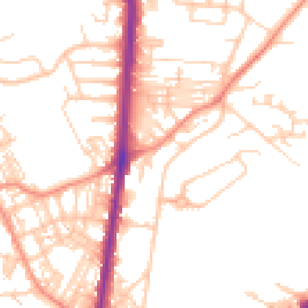
Daytime· 07:00 – 23:00
51.6dB

Night-time· 23:00 – 07:00
40.2dB