10 Bethecar Road, Harrow, HA1 1SF
About 10 Bethecar Road
10 Bethecar Road is a five-bedroom semi-detached house in Harrow (HA1 1SF). It has a recorded floor area of 120 m² (around 1292 sq ft), construction records dating it to 1930-1949 and council tax band E. The property has underfloor heating on record, all of which lower running costs and tend to lift resale appeal. Records show the property has been extended at some point in its history. The latest certificate (February 2013) shows an E (score 50), well below the UK norm with real room to improve. The recommended improvements would lift it to C (score 77), a 2-band jump. The latest certificate is from February 2013, so improvements made since then won't be reflected.
At 120 m² the property is well over the postcode median (75 m² across 8 EPCs), placing it in the larger end of the local stock. 5 bedrooms is on the larger side for this postcode, where 3 is the typical count. 3 planning records sit against the property, 2 approved, 0 refused. Past consents include an extension, meaningful when judging how the property has evolved. Today's modelled estimate of £785,000 is 11% above the 2021 sale price. On a £-per-square-foot basis, the last sale (£548/sq ft) was about 75.4% above the typical sold price in the postcode. Most recent transfer: March 2021 at £707,500. That sale was during the post-pandemic price surge, when transactions cleared materially above pre-2020 trend.
Know exactly what you're buying at 10 Bethecar Road
Before you offer, see what the listing won't tell you, the true value, the red flags and the full history.
Already flagged here
Valuation
against the asking price
Risks
planning & flood
Sold prices
similar homes nearby
Trends
the local market
What this property has
Inside
- Bedrooms5
- Bathrooms3
- CloakroomYes
- EnsuiteYes
Outside
- DrivewayYes
Building
- Underfloor heatingYes
- Previously extendedYes
Energy performance
10 Bethecar Road's carbon output runs well above what efficient homes in the postcode produce.
EPC Expired
This certificate is over 10 years old and is no longer valid.Expired 27 Feb 2023
EPC Rating
Planning history
10 Bethecar Road has been extended on multiple sides of the property across separate planning applications.
- Feb 2016ExtensionFullIn report
Extension: Single storey · Rear of property
Single storey rear extension: extending 6 metres beyond the original rear wall 3.849 Metres maximum height 2.55 Metres high to the eaves
- Documents
- 10 docs on file
- Reference
- P/5554/15
- Jan 2016ExtensionOutlineIn report
Extension: Single storey
Certificate of lawful development (proposed): demolition of attached garage at side; construction of single storey side extension to include new window and removal of existing window in rear elevation
- Documents
- 10 docs on file
- Reference
- P/5536/15
We flagged 1 thing worth checking at 10 Bethecar Road
Independent checks surfaced things a buyer would want to understand before offering. The report explains each one in full, with the underlying data and what to ask.
- Signs of HMO activity in the area
30-day money-back guarantee
Sales history & valuation
The latest sale landed in the post-pandemic price surge — useful context when reading the figure.
£785,000
Modelled from EPC, postcode comparables.
£707,500
Recorded with HM Land Registry.
Sales timeline
28 March 2021Most recent
£707,500
Median price across the last 5 sales in HA1 1SF: £302,000 (2025–2013).
Everything we know about 10 Bethecar Road, in one report
What it's really worth, what could be wrong, and the planning, sales and area data in full.
What we flagged
- Signs of HMO activity in the area

Versus other Bethecar Road homes
10 Bethecar Road outperforms the street on price per m² by a wide margin.
Price per m²
£5,896
Street avg £3,381
Floor Area
120 m²
Street avg 94 m²
Habitable Rooms
6 rooms
Street avg 5 rooms
CO₂ Emissions
6.7 t/year
Street avg 5.8 t/year
Similar properties nearby
The neighbourhood at a glance
Rail-style transport is unusually close for this postcode.
Crime
28/mo
Steady year-on-year across the wider district.
Nearest stop
0.3 km
Safari Cinema — bus stop.
Closest school
0.4 km
Marlborough Primary School. 39 schools nearby.
Go deeper on the local area
The full report breaks down crime, transport links, schools and air quality in depth.
Road noise across the postcode
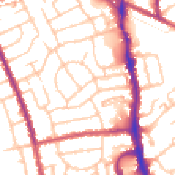
Daytime· 07:00 – 23:00
53.0dB

Night-time· 23:00 – 07:00
42.0dB