Park View, Flat 2, 1 Matson Avenue, Matson, Gloucester, GL4 6LA
About Park View
Park View is a property in Matson, Gloucester, Gloucester (GL4 6LA). It has council tax band A.
It hasn't traded since May 2006, a hold of 20 years that's notably long for the area. Across 2001–2006, sale prices on this property compounded at 20.4% per year.
Know exactly what you're buying at Park View
Before you offer, see what the listing won't tell you, the true value, the red flags and the full history.
Valuation
against the asking price
Risks
planning & flood
Sold prices
similar homes nearby
Trends
the local market
Energy performance
No EPC on record
This property doesn't have an Energy Performance Certificate yet. An EPC is required to sell or let — and unlocks our automated valuation.
Planning history
Park View has no planning applications on record.
Notable planning nearby
1applications of note in the surrounding area
Sales history & valuation
Park View has more than doubled in price since the earliest registered sale in 2001.
£76,000
Growth on file: 20.4% per year over 5 years.
Sales timeline
4 May 2006Most recent
£76,000
+137.5%over 4 years4 September 2001
£32,000
Median price across the last 3 sales in GL4 6LA: £52,000 (2018–2006).
Nearby sales in GL4 6LA
Everything we know about Park View, in one report
What it's really worth, what could be wrong, and the planning, sales and area data in full.
- Am I paying too much?
- Is something wrong with it?
- Is the agent's story true?
- Will it hold its value?

Similar properties nearby
36a, Flat 1, Matson Avenue, Matson
GL4 6LB
36a, Flat 2, Matson Avenue, Matson
GL4 6LB
36a, Flat 3, Matson Avenue, Matson
GL4 6LB
36a, Flat 4, Matson Avenue, Matson
GL4 6LB
49a, Flat 1, Redwell Road, Matson
GL4 6JH
Abbey View, Flat 1, 3 Matson Avenue, Matson
GL4 6LA
Abbey View, Flat 10, 3 Matson Avenue, Matson
GL4 6LA
Abbey View, Flat 11, 3 Matson Avenue, Matson
GL4 6LA
The neighbourhood at a glance
Daytime road noise here sits well below conversation level — a quiet pocket of the postcode.
Crime
6/mo
Steady year-on-year across the wider district.
Nearest stop
0.1 km
Awebridge Way School stop — bus stop.
Closest school
0.3 km
Hillside Primary School. 27 schools nearby.
Go deeper on the local area
The full report breaks down crime, transport links, schools and air quality in depth.
Road noise across the postcode
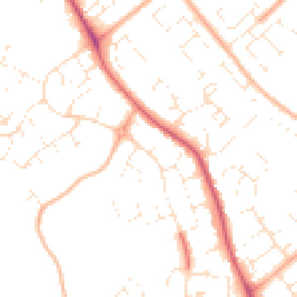
Daytime· 07:00 – 23:00
49.6dB

Night-time· 23:00 – 07:00
39.3dB