9 Bouvier Road, Enfield, EN3 5SQ
About 9 Bouvier Road
9 Bouvier Road is an end-of-terrace house in Enfield (EN3 5SQ). It has a recorded floor area of 84 m² (around 904 sq ft), construction records dating it to 1950-1966 and council tax band C. The latest certificate (September 2012) shows a C (score 70). The recommended improvements would push it to B (score 88). The latest certificate is from September 2012, so improvements made since then won't be reflected.
Untraded for 29 years, with the last transfer in September 1997. Only one transfer is on record with HM Land Registry, suggesting it has stayed in the same hands for a long time. Today's modelled estimate of £380,000 sits 424.1% above the 1997 sale of £72,500. On a £-per-square-foot basis, the last sale (£80/sq ft) was about 48.5% below the postcode norm. At 84 m² it's 24.4% larger than the typical home in the postcode (68 m² median across 22 EPCs).
Everything you need to know about 9 Bouvier Road
The true value, the hidden risks and the full sale history, in one report.
30-day money-back guarantee

The data behind every report


Energy performance
9 Bouvier Road's EPC is over a decade old — improvements since won't be reflected.
EPC Expired
This certificate is over 10 years old and is no longer valid.Expired 09 Sept 2022
EPC Rating
Planning history
9 Bouvier Road has no planning applications on record.
Notable planning nearby
24applications of note in the surrounding area
We flagged 2 things worth checking at 9 Bouvier Road
Independent checks surfaced things a buyer would want to understand before offering. The report explains each one in full, with the underlying data and what to ask.
- Signs of HMO activity in the area
- Larger development activity nearby
30-day money-back guarantee
Sales history & valuation
9 Bouvier Road's modelled value sits at over four times its earliest registered sale price (1997).
£380,000
Modelled from EPC, postcode comparables.
£72,500
Recorded with HM Land Registry.
Sales timeline
14 September 1997Most recent
£72,500
Median price across the last 5 sales in EN3 5SQ: £160,000 (2016–2007).
Versus other Bouvier Road homes
On floor area, 9 Bouvier Road runs well behind the street norm.
EPC Rating
70 (C)
Street avg 63 (D)
Floor Area
84 m²
Street avg 91 m²
CO₂ Emissions
2.7 t/year
Street avg 3.8 t/year
Habitable Rooms
5 rooms
Street avg 5 rooms
Everything you need to know about 9 Bouvier Road
The true value, the hidden risks and the full sale history, in one report.
30-day money-back guarantee
The data behind every report
Similar properties nearby
The neighbourhood at a glance
Rail-style transport is unusually close for this postcode.
Crime
8/mo
Rising year-on-year across the wider district.
Nearest stop
0.2 km
Ingersoll Road — bus stop.
Closest school
0.4 km
Enfield Heights Academy. 41 schools nearby.
Go deeper on the local area
The full report breaks down crime, transport links, schools and air quality in depth.
Road noise across the postcode
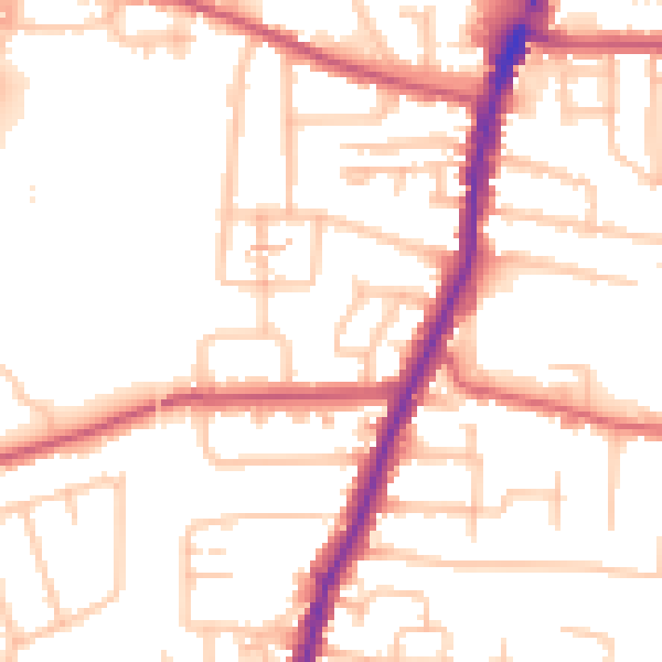
Daytime· 07:00 – 23:00
52.6dB

Night-time· 23:00 – 07:00
42.8dB