9 High Street, Castle Donington, Derby, DE74 2PP
About 9 High Street
9 High Street is a seven-bedroom detached house in Castle Donington, Derby, Derby (DE74 2PP). It has a recorded floor area of 401 m² (around 4316 sq ft), construction records dating it to before 1900 and council tax band G. It is a listed building, which means external alterations are tightly controlled but it may qualify for heritage tax reliefs. Period features are noted in the property record. The latest certificate (June 2024) shows a D (score 64), on the cusp of jumping into the C band. When first surveyed in May 2024 the rating was E, the property has climbed 1 band since. Between certificates, hot-water efficiency went from Very Poor to Average and main heating went from Very Poor to Good; while wall efficiency dropped from Good to Very Poor. The recommended improvements would push it to C (score 76).
Held since March 2000 — that's 26 years off the open market, well above the local norm. Only one transfer is on record with HM Land Registry, suggesting it has stayed in the same hands for a long time. At 401 m² the property is well over the postcode median (71 m² across 33 EPCs), placing it in the larger end of the local stock. 7 bedrooms is on the larger side for this postcode, where 4 is the typical count. Today's modelled estimate of £1,265,000 sits 264% above the 2000 sale of £347,500. On a £-per-square-foot basis, the last sale (£81/sq ft) was about 42.7% below the postcode norm. 19 planning records sit against the property, 14 approved, 2 refused. Past consents include tree works and a garage conversion, meaningful when judging how the property has evolved. The record references listed-building consent and conservation-area consent, which constrain future alterations.
What this property has
Inside
- Bedrooms7
- Bathrooms3
Outside
- Private gardenEast-facing
Building
- Listed buildingYes
- Period featuresYes
Everything you need to know about 9 High Street
The true value, the hidden risks and the full sale history, in one report.
Pick your report · from £14.99
One time fee only - money back guarantee

The data behind every report







Energy performance
9 High Street's carbon output runs well above what efficient homes in the postcode produce.
EPC Rating
Certificate validity
Valid until 6 June 2034
Property Improvements
Changes detected from historical EPC data
Upgraded to gas central heating
Connected to mains gas supply
Heating controls upgraded for better temperature management
Hot water system upgraded

Get a survey for this property
Level 3 Building Survey
Because the property was built before 1919, is a listed building, and is a large detached home over 300m², we believe a Level 3 building survey should be considered.
From £1,645 · Includes VAT
Planning history
9 High Street has multiple listed-building consents on file — alterations need formal heritage approval.
19 applications on record at 9 High Street, Castle Donington, Derby, DE74 2PP
1 live now- Apr 2003Tree WorksTreesOutcome in report
Pruning and topping of ten yew trees and pruning of two walnut trees (protected by Tree Preservation Order T302)
- Reference
- 03/00355/TPO
- More recent applications — locked
- Tree WorksApr 2026Decision
- Tree WorksJun 2024Decision
+ 16 more applications in the report
Unlock 9 High Street, Castle Donington, Derby, DE74 2PP's full planning history
You're seeing the shape of it. The report has the substance.
- Every decision — granted, refused or withdrawn (18 on record)
- All 19 applications on this property in full, plus 39 notable nearby
- The 50 documents, officer reports & conditions
- What the pattern means for extending or converting here
One time fee only - money back guarantee
Sales history & valuation
9 High Street's estimated value is more than triple its earliest registered sale price (2000).
£1,265,000
Modelled from EPC, postcode comparables.
£347,500
Recorded with HM Land Registry.
Sales timeline
24 March 2000Most recent
£347,500
Median price across the last 5 sales in DE74 2PP: £210,000 (2026–2021).
Nearby sales in DE74 2PP
66 High Street, Castle Donington, Derby, DE74 2PP
Sold Apr 2026
£210,00019 High Street, Castle Donington, Derby, DE74 2PP
Sold Sept 2022
£475,00050 High Street, Castle Donington, Derby, DE74 2PP
Sold Feb 2022
£226,00064 High Street, Castle Donington, Derby, DE74 2PP
Sold Apr 2021
£173,00046 High Street, Castle Donington, Derby, DE74 2PP
Sold Oct 2019
£164,000
Versus other High Street homes
On habitable rooms, 9 High Street stands well clear of the street.
Price per m²
£867
Street avg £2,335
Floor Area
401 m²
Street avg 156 m²
Habitable Rooms
12 rooms
Street avg 6 rooms
CO₂ Emissions
13.0 t/year
Street avg 8.0 t/year
Everything you need to know about 9 High Street
The true value, the hidden risks and the full sale history, in one report.
Pick your report · from £14.99
One time fee only - money back guarantee
The data behind every report
Similar properties nearby
1 Avocet Close, Diseworth
DE74 2BG
1 Balmoral Court, Hemington
DE74 2PX
1 Borough Street, Castle Donington
DE74 2LA
1 Brooklet Farm, Isley Walton, Castle Donington
DE74 2RL
1 Bentley Road, Castle Donington
DE74 2UL
1 Bondgate, Castle Donington
DE74 2NS
1 Ayrton Drive, Castle Donington
DE74 2BE
1 Apiary Gate, Castle Donington
DE74 2JA
The neighbourhood at a glance
Daytime road noise here sits well below conversation level — a quiet pocket of the postcode.
Crime
89/mo
Falling year-on-year across the wider district.
Nearest stop
0.2 km
High Street — bus stop.
Closest school
0.4 km
Orchard Community Primary School. 6 schools nearby.
Go deeper on the local area
A Local Area report breaks down crime, transport links, schools and air quality in depth.
Road noise across the postcode
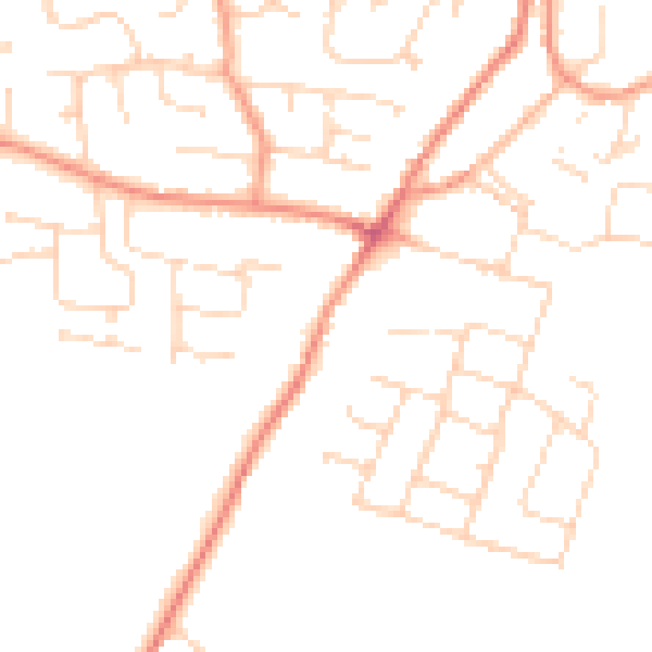
Daytime· 07:00 – 23:00
47.3dB

Night-time· 23:00 – 07:00
37.1dB