358 Tutbury Road, Burton On Trent, DE13 0AL
About 358 Tutbury Road
358 Tutbury Road is a three-bedroom detached house in Burton On Trent (DE13 0AL). It has a recorded floor area of 98 m² (around 1055 sq ft), construction records dating it to 1950-1966 and council tax band D. The latest certificate (June 2017) shows a D (score 57), a step below the typical UK home. The recommended improvements would lift it to B (score 83), a 2-band jump. Other recorded features include outbuildings.
Across 2002–2018, sale prices on this property compounded at 4.1% per year. Today's modelled estimate of £337,000 is 29.6% above the 2018 sale price. On a £-per-square-foot basis, the last sale (£246/sq ft) was about 26.3% above the typical sold price in the postcode. On the market in March 2018 and unlisted since — roughly 8 years.
What this property has
Inside
- Bedrooms3
- Bathrooms1
- Dining roomYes
- EnsuiteYes
Outside
- Private gardenRear
- GarageSingle
- OutbuildingsYes
Everything you need to know about 358 Tutbury Road
The true value, the hidden risks and the full sale history, in one report.
Pick your report · every report is £14.99
One time fee only - money back guarantee

The data behind every report


Energy performance
Recommended upgrades on file would lift this property by multiple EPC bands.
EPC Rating
Get a survey for this property
Level 3 Building Survey
Because the property has permanent outbuildings, we believe a Level 3 building survey should be considered.
From £955 · Includes VAT
Planning history
358 Tutbury Road has no planning applications on record.
But the area is active
13 notable applications nearby — larger schemes and conversions that could reshape the street. The report maps them all.
Sales history & valuation
358 Tutbury Road valuation sits well clear of the typical sold price in this postcode.
£337,000
Modelled from EPC, postcode comparables and a sale-price growth of 4.1% per year over 16 years.
£260,000
Growth on file: 4.1% per year over 16 years.
Sales timeline
26 March 2018Most recent
£260,000
+88.4%over 15 years4 July 2002
£138,000
Median price across the last 5 sales in DE13 0AL: £285,000 (2023–2014).
Nearby sales in DE13 0AL
Smallholding, 8, Tutbury Road, Burton On Trent, DE13 0AL
Sold Jul 2023
£285,000Smallholding, 11, Tutbury Road, Burton On Trent, DE13 0AL
Sold May 2021
£450,000370 Tutbury Road, Burton On Trent, DE13 0AL
Sold Jun 2016
£292,225366 Tutbury Road, Burton On Trent, DE13 0AL
Sold May 2014
£185,000350 Tutbury Road, Burton On Trent, DE13 0AL
Sold May 2014
£212,500
Versus other Tutbury Road homes
Price per m²
£2,653
Street avg £2,396
Floor Area
98 m²
Street avg 114 m²
Habitable Rooms
5 rooms
Street avg 5 rooms
CO₂ Emissions
5.5 t/year
Street avg 5.8 t/year
Everything you need to know about 358 Tutbury Road
The true value, the hidden risks and the full sale history, in one report.
Pick your report · every report is £14.99
One time fee only - money back guarantee
The data behind every report
Similar properties nearby
1 Bladon View, Stretton
DE13 0JE
1 Beam Close
DE13 0AH
1 Barrington Close, Stretton
DE13 0YD
1 Bamborough Close, Stretton
DE13 0WD
1 Beech Lane, Stretton
DE13 0DU
1 Balata Way
DE13 0TY
1 Alderholme Drive, Stretton
DE13 0FJ
1 Beech Gardens, Hurst Drive, Stretton
DE13 0FE
The neighbourhood at a glance
Daytime road noise here sits well below conversation level — a quiet pocket of the postcode.
Crime
5/mo
Steady year-on-year across the wider district.
Nearest stop
0.1 km
Glenville Farm — bus stop.
Closest school
0.3 km
St Modwen's Catholic Primary School. 14 schools nearby.
Go deeper on the local area
A Local Area report breaks down crime, transport links, schools and air quality in depth.
Road noise across the postcode
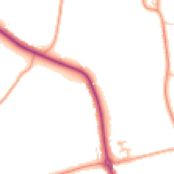
Daytime· 07:00 – 23:00
47.3dB

Night-time· 23:00 – 07:00
39.4dB