Fairlawns, Lavender Hall Lane, Berkswell, Coventry, CV7 7BN
About Fairlawns
Fairlawns is a detached house in Berkswell, Coventry, Coventry (CV7 7BN). It has a recorded floor area of 210 m² (around 2260 sq ft) and council tax band E. The latest certificate (June 2012) returns a B (score 82), comfortably above the UK average. The rating has held steady at B across 2 certificates since April 2012. Between certificates, roof efficiency dropped from Very Good to Good. The latest certificate is from June 2012, so improvements made since then won't be reflected.
It hasn't traded since September 2009, a hold of 17 years that's notably long for the area. That sale fell during the post-crash dip, which often skews comparisons against later neighbouring sales. At 210 m² the property is well over the postcode median (140 m² across 5 EPCs), placing it in the larger end of the local stock. On energy efficiency it sits in the top 10% of properties in this postcode. Today's modelled estimate of £724,000 sits 359.7% above the 2009 sale of £157,500. On a £-per-square-foot basis, the last sale (£70/sq ft) was about 81.2% below the postcode norm. 4 planning records sit against the property, 4 approved, 0 refused.
Everything you need to know about Fairlawns
The true value, the hidden risks and the full sale history, in one report.
Pick your report · from £14.99
One time fee only - money back guarantee

The data behind every report


Energy performance
Fairlawns ranks among the most efficient homes in the postcode for energy use.
EPC Expired
This certificate is over 10 years old and is no longer valid.Expired 11 Jun 2022
EPC Rating
Certificate validity
Expired on 11 June 2022
Property Improvements
Changes detected from historical EPC data
Heating controls upgraded for better temperature management
More low energy lighting installed

Get a survey for this property
Level 2 HomeBuyer Report
We've checked 10 risk factors against the available data for this property and believe a Level 2 HomeBuyer Report could be a suitable option for you.
From £995 · Includes VAT
Planning history
Fairlawns has been through 4 approved planning applications — a well-evolved property.
4 applications on record at Fairlawns, Lavender Hall Lane, Berkswell, Coventry, CV7 7BN
- Nov 2010Demolition And RebuildFullOutcome in report
Demolition of existing dwelling and replace with two new dwellings and additional access.
- Documents
- 18 docs on file
- Reference
- PL/2010/02169/FULL
- More recent applications — locked
- ConditionsJul 2011Decision
- ConditionsJul 2011Decision
+ 1 more application in the report
Unlock Fairlawns, Lavender Hall Lane, Berkswell, Coventry, CV7 7BN's full planning history
You're seeing the shape of it. The report has the substance.
- Every decision — granted, refused or withdrawn (4 on record)
- All 4 applications on this property in full, plus 7 notable nearby
- The 19 documents, officer reports & conditions
- What the pattern means for extending or converting here
One time fee only - money back guarantee
Sales history & valuation
Fairlawns's modelled value sits at over four times its earliest registered sale price (2009).
£724,000
Modelled from EPC, postcode comparables.
£157,500
Recorded with HM Land Registry.
Sales timeline
15 September 2009Most recent
£157,500
Median price across the last 5 sales in CV7 7BN: £780,000 (2020–2007).
Nearby sales in CV7 7BN
The Laurels, Lavender Hall Lane, Berkswell, Coventry, CV7 7BN
Sold Apr 2020
£860,000Fernbank, Lavender Hall Lane, Berkswell, Coventry, CV7 7BN
Sold Aug 2016
£780,000Oakwood House, Lavender Hall Lane, Berkswell, Coventry, CV7 7BN
Sold Aug 2013
£305,0002 Lavender Hall Lane, Berkswell, Coventry, CV7 7BN
Sold Jun 2008
£3,950
Versus other Lavender Hall Lane homes
On epc rating, Fairlawns stands well clear of the street.
EPC Rating
82 (B)
Street avg 59 (D)
Floor Area
210 m²
Street avg 169 m²
CO₂ Emissions
3.0 t/year
Street avg 6.9 t/year
Everything you need to know about Fairlawns
The true value, the hidden risks and the full sale history, in one report.
Pick your report · from £14.99
One time fee only - money back guarantee
The data behind every report
Similar properties nearby
1 Asbury Road, Balsall Common
CV7 7QN
1 Benton Green Lane, Berkswell
CV7 7DB
1 Childs Oak Close, Balsall Common
CV7 7QT
1 Clive Road, Balsall Common
CV7 7DW
1 Birch Grove, Balsall Common
CV7 7RS
1 Albany Meadows, Albany Lane, Balsall Common
CV7 7SR
1 Cedarwood Drive, Balsall Common
CV7 7DS
1 Agricultural Cottages, Maxstoke Lane, Meriden
CV7 7ND
The neighbourhood at a glance
Rail-style transport is unusually close for this postcode.
Crime
168/mo
Steady year-on-year across the wider district.
Nearest stop
0.7 km
Berkswell Rail Station — railway station.
Closest school
1.2 km
Berkswell Church of England Voluntary Aided Primary School. 3 schools nearby.
Go deeper on the local area
A Local Area report breaks down crime, transport links, schools and air quality in depth.
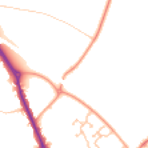
Road noise across the postcode
Daytime· 07:00 – 23:00
47.9dB

Night-time· 23:00 – 07:00
38.2dB