32 Stanley Road, New Ferry, Wirral, CH62 5AS
About 32 Stanley Road
32 Stanley Road is a semi-detached house in New Ferry, Wirral, Wirral (CH62 5AS). It has a recorded floor area of 320 m² (around 3444 sq ft), construction records dating it to 1900-1929 and council tax band C. The latest certificate (February 2017) shows a D (score 64), on the cusp of jumping into the C band. When first surveyed in July 2009 the rating was F, the property has climbed 2 bands since. Between certificates, wall efficiency went from Very Poor to Poor, window efficiency went from Very Poor to Good and hot-water efficiency went from Average to Good. The recommended improvements would push it to C (score 75).
Today's modelled estimate of £283,000 is 93.5% below the 2020 sale of £4,337,209, an unusual pattern given regional price growth and worth checking against the EPC condition. On a £-per-square-foot basis, the last sale (£1,259/sq ft) was about 1614.6% above the typical sold price in the postcode. At 320 m² the property is well over the postcode median (76 m² across 21 EPCs), placing it in the larger end of the local stock. 3 planning records sit against the property, 1 approved, 2 refused. Past consents include an extension and subdivision, meaningful when judging how the property has evolved. Sold May 2020 for £4,337,209.
Know exactly what you're buying at 32 Stanley Road
Before you offer, see what the listing won't tell you, the true value, the red flags and the full history.
Launch offer · save £5
Valuation
against the asking price
Risks
planning & flood
Sold prices
similar homes nearby
Trends
the local market
Energy performance
32 Stanley Road's carbon output runs well above what efficient homes in the postcode produce.
EPC Rating
Property Improvements
Changes detected from historical EPC data
Heating controls upgraded for better temperature management
Hot water system upgraded
Single glazing replaced with double or better glazing
Wall insulation improved
More low energy lighting installed
Planning history
Council records show a subdivision application — the property's legal arrangement has been altered.
- May 2010SubdivisionFullIn report
Extension: Rear of property
Conversion of building into 5 flats, erection of a single storey and two-storey rear extension.
- Agent
- D.P.D
Extension- Documents
- 6 docs on file
- Reference
- APP/10/00388
- Feb 2010FullIn report
Partial Demolition of property to create 2 additional flats.
- Agent
- Design Planning Developments
- Documents
- 4 docs on file
- Reference
- APP/10/00043
What's in 32 Stanley Road, New Ferry, Wirral, CH62 5AS's planning history?
1 more on this property, plus refusals, disputes and full decisions nearby, in the report.
Sales history & valuation
The latest sale landed in the post-pandemic price surge — useful context when reading the figure.
£283,000
Modelled from EPC, postcode comparables.
£4,337,209
Recorded with HM Land Registry.
Sales timeline
31 May 2020Most recent
£4,337,209
Median price across the last 5 sales in CH62 5AS: £140,000 (2025–2021).
Nearby sales in CH62 5AS
14 Stanley Road, New Ferry, Wirral, CH62 5AS
Sold Oct 2025
£210,0008a, Stanley Road, New Ferry, Wirral, CH62 5AS
Sold Apr 2025
£33,00036 Stanley Road, New Ferry, Wirral, CH62 5AS
Sold Mar 2025
£105,0008 Stanley Road, New Ferry, Wirral, CH62 5AS
Sold Feb 2023
£165,00034a, Stanley Road, New Ferry, Wirral, CH62 5AS
Sold May 2020
£5,074,548
Everything we know about 32 Stanley Road, in one report
What it's really worth, what could be wrong, and the planning, sales and area data in full.
- Am I paying too much?
- Is something wrong with it?
- Is the agent's story true?
- Will it hold its value?

Versus other Stanley Road homes
32 Stanley Road outperforms the street on price per m² by a wide margin.
Price per m²
£13,554
Street avg £986
Floor Area
320 m²
Street avg 113 m²
Habitable Rooms
11 rooms
Street avg 6 rooms
CO₂ Emissions
12.0 t/year
Street avg 5.0 t/year
Similar properties nearby
The neighbourhood at a glance
Crime
3/mo
Steady year-on-year across the wider district.
Nearest stop
0.2 km
Hassal Road — bus stop.
Closest school
0.3 km
Grove Street Primary School. 25 schools nearby.
Go deeper on the local area
The full report breaks down crime, transport links, schools and air quality in depth.
Road noise across the postcode
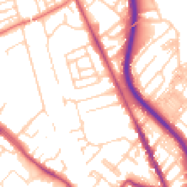
Daytime· 07:00 – 23:00
53.6dB

Night-time· 23:00 – 07:00
43.3dB