2 Cestrian Drive, Wirral, CH61 9PL
About 2 Cestrian Drive
2 Cestrian Drive is a three-bedroom detached house in Wirral (CH61 9PL). It has a recorded floor area of 109 m² (around 1173 sq ft), construction records dating it to 1950-1966 and council tax band D. The latest certificate (June 2020) shows a D (score 56), a step below the typical UK home. The recommended improvements would lift it to B (score 82), a 2-band jump.
Today's modelled estimate of £351,000 is 37.6% above the 2020 sale price. On a £-per-square-foot basis, the last sale (£217/sq ft) was about 56.2% above the typical sold price in the postcode. Most recent transfer: September 2020 at £255,000.
What this property has
Inside
- Bedrooms3
- Bathrooms1
- EnsuiteYes
Outside
- Private gardenRear
- GarageIntegral
Everything you need to know about 2 Cestrian Drive
The true value, the hidden risks and the full sale history, in one report.
30-day money-back guarantee

The data behind every report


Energy performance
2 Cestrian Drive's carbon output runs well above what efficient homes in the postcode produce.
EPC Rating
Planning history
2 Cestrian Drive has no planning applications on record.
The full report still covers planning activity across the surrounding area.
Sales history & valuation
Latest sale on 2 Cestrian Drive was the highest on Land Registry record across the postcode.
£351,000
Modelled from EPC, postcode comparables.
£255,000
Recorded with HM Land Registry.
Sales timeline
24 September 2020Most recent
£255,000
Median price across the last 5 sales in CH61 9PL: £177,000 (2021–2012).
Nearby sales in CH61 9PL
Versus other Cestrian Drive homes
Price per m² for 2 Cestrian Drive runs comfortably ahead of the street norm.
Price per m²
£2,339
Street avg £2,021
Floor Area
109 m²
Street avg 112 m²
Habitable Rooms
6 rooms
Street avg 5 rooms
CO₂ Emissions
6.0 t/year
Street avg 6.0 t/year
Everything you need to know about 2 Cestrian Drive
The true value, the hidden risks and the full sale history, in one report.
30-day money-back guarantee
The data behind every report
Similar properties nearby
1 Fender Way
CH61 9NP
1 Beech Avenue, Pensby
CH61 9NU
1 Cestrian Drive
CH61 9PL
1 Kings Drive, Thingwall
CH61 9PX
1 Belmont Drive
CH61 9NA
10 Bentley Road
CH61 9QB
1 Laurelhurst Avenue
CH61 9NY
10 Beech Avenue, Pensby
CH61 9NU
The neighbourhood at a glance
Daytime road noise here sits well below conversation level — a quiet pocket of the postcode.
Crime
2/mo
Steady year-on-year across the wider district.
Nearest stop
0.2 km
Wimbourne Avenue — bus stop.
Closest school
0.6 km
Thingwall Primary School. 14 schools nearby.
Go deeper on the local area
The full report breaks down crime, transport links, schools and air quality in depth.
Road noise across the postcode
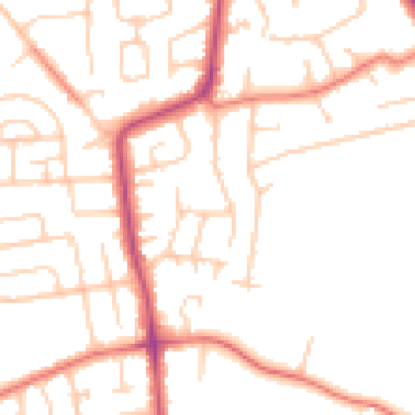
Daytime· 07:00 – 23:00
49.7dB

Night-time· 23:00 – 07:00
39.5dB