11 Broadmead, Vicars Cross, Chester, CH3 5PT
About 11 Broadmead
11 Broadmead is a property in Vicars Cross, Chester, Chester (CH3 5PT). It has council tax band C.
Energy performance
No EPC on record
This property doesn't have an Energy Performance Certificate yet. An EPC is required to sell or let — and unlocks our automated valuation.
Planning history
No planning applications are recorded against 11 Broadmead, Vicars Cross, Chester, CH3 5PT. The full report also covers planning activity across the surrounding area.
Sales history & valuation
No sales recorded with HM Land Registry
That can mean the property has never traded since the registry began publishing in 1995, was a new build that hasn't been registered yet, or is held in the same hands long-term.
Median price across the last 5 sales in CH3 5PT: £180,000 (2022–2016).
Nearby sales in CH3 5PT
10 Broadmead, Vicars Cross, Chester, CH3 5PT
Sold Dec 2022
£215,00024 Broadmead, Vicars Cross, Chester, CH3 5PT
Sold Apr 2019
£180,00019 Broadmead, Vicars Cross, Chester, CH3 5PT
Sold Apr 2018
£185,0008 Broadmead, Vicars Cross, Chester, CH3 5PT
Sold Nov 2017
£145,00015 Broadmead, Vicars Cross, Chester, CH3 5PT
Sold Dec 2016
£158,000
Similar properties nearby
1 Adder Hill, Great Boughton
CH3 5RA
1 Alexander Court, Dee Lane
CH3 5AW
1 Arkle Court, The Holkham, Vicars Cross
CH3 5PL
1 Bachelors Court, Bachelors Lane, Great Boughton
CH3 5XW
1 Bachelors Lane, Great Boughton
CH3 5XD
1 Ballater Crescent, Vicars Cross
CH3 5JD
1 Bank Cottages, Whitchurch Road
CH3 5QS
1 Barkhill Road, Vicars Cross
CH3 5JQ
The neighbourhood at a glance
Crime
1/mo
Steady year-on-year across the wider district.
Nearest stop
0.2 km
Marbury Road — bus stop.
Closest school
0.6 km
Oldfield Primary School. 17 schools nearby.
Road noise across the postcode
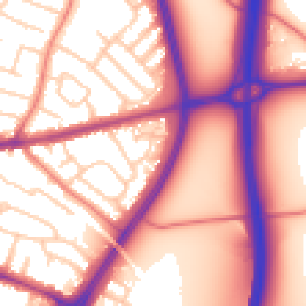
Daytime· 07:00 – 23:00
59.2dB

Night-time· 23:00 – 07:00
51.6dB