217 Chesterton Road, Cambridge, CB4 1AN
About 217 Chesterton Road
217 Chesterton Road is a semi-detached house in Cambridge (CB4 1AN). It has a recorded floor area of 256 m² (around 2756 sq ft), construction records dating it to before 1900 and council tax band A. The latest certificate (October 2017) shows a C (score 71).
At 256 m² the property is well over the postcode median (112 m² across 12 EPCs), placing it in the larger end of the local stock. Its energy rating outperforms most of the postcode (better than 75% of similar EPCs). 5 planning records sit against the property, 4 approved, 1 refused. Past consents include an extension and change of use to residential, meaningful when judging how the property has evolved. Across 1996–2020, sale prices on this property compounded at 9.6% per year. Today's modelled estimate of £1,545,000 is 34.3% above the 2020 sale price. On a £-per-square-foot basis, the last sale (£417/sq ft) was about 87.8% above the typical sold price in the postcode. Most recent transfer: July 2020 at £1,150,000.
Know exactly what you're buying at 217 Chesterton Road
Before you offer, see what the listing won't tell you, the true value, the red flags and the full history.
Already flagged here
Valuation
against the asking price
Risks
planning & flood
Sold prices
similar homes nearby
Trends
the local market
Energy performance
217 Chesterton Road's carbon output runs well above what efficient homes in the postcode produce.
EPC Rating
Planning history
217 Chesterton Road has 2 separate extension applications on the council record.
- Feb 2021ExtensionFullIn report
Extension: Single storey · Rear of property
Alternations to fenestration of existing single storey rear extension and removal of two dormers to the front and replace with a single pitch roof dormer.
- Agent
- Space+
- Council
- Cambridge City Council
- Documents
- 17 docs on file
- Reference
- 20/05122/HFUL
- Apr 2020Change of UseFullIn report
Change of use from Guest House (Class C1) to single dwelling (Class C3)
- Council
- Cambridge City Council
- Documents
- 17 docs on file
- Reference
- 20/0101/FUL
We flagged 2 things worth checking at 217 Chesterton Road
Independent checks surfaced things a buyer would want to understand before offering. The report explains each one in full, with the underlying data and what to ask.
- Signs of HMO activity in the area
- Larger development activity nearby
30-day money-back guarantee
Sales history & valuation
Latest sale on 217 Chesterton Road was the highest on Land Registry record across the postcode.
£1,545,000
Modelled from EPC, postcode comparables and a sale-price growth of 9.6% per year over 24 years.
£1,150,000
Growth on file: 9.6% per year over 24 years.
Sales timeline
8 July 2020Most recent
£1,150,000
+210.8%over 17 years11 September 2002
£370,000
+184.6%over 5 years6 October 1996
£130,000
Median price across the last 5 sales in CB4 1AN: £643,200 (2025–2005).
Nearby sales in CB4 1AN
203 Chesterton Road, Cambridge, CB4 1AN
Sold Mar 2025
£1,040,000213 Chesterton Road, Cambridge, CB4 1AN
Sold May 2023
£738,680211 Chesterton Road, Cambridge, CB4 1AN
Sold Jan 2021
£637,000227 Chesterton Road, Cambridge, CB4 1AN
Sold Dec 2005
£560,000229 Chesterton Road, Cambridge, CB4 1AN
Sold Dec 2004
£500,000
Everything we know about 217 Chesterton Road, in one report
What it's really worth, what could be wrong, and the planning, sales and area data in full.
What we flagged
- Signs of HMO activity in the area
- Larger development activity nearby

Versus other Chesterton Road homes
217 Chesterton Road outperforms the street on epc rating by a wide margin.
Price per m²
£4,492
Street avg £3,965
Floor Area
256 m²
Street avg 176 m²
Habitable Rooms
11 rooms
Street avg 7 rooms
CO₂ Emissions
7.6 t/year
Street avg 8.4 t/year
Similar properties nearby
1 Capstan Close
CB4 1BJ
1 Boathouse Court, Trafalgar Road
CB4 1DU
1 Chapel Street
CB4 1DY
1 Aylestone Road
CB4 1HF
1 Chesterton Hall Crescent
CB4 1AW
1 Chesterfield Road
CB4 1LN
1 Belvoir Road
CB4 1JQ
1 Anglers Way
CB4 1TZ
The neighbourhood at a glance
Crime
7/mo
Steady year-on-year across the wider district.
Nearest stop
2.2 km
Cambridge North Rail Station — railway station.
Closest school
0.4 km
Milton Road Primary School. 25 schools nearby.
Go deeper on the local area
The full report breaks down crime, transport links, schools and air quality in depth.
Road noise across the postcode
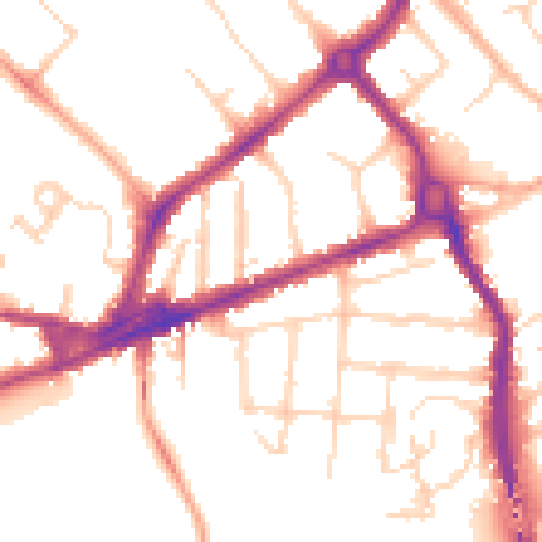
Daytime· 07:00 – 23:00
51.9dB

Night-time· 23:00 – 07:00
43.1dB