10 Nutfield Grove, Filton, Bristol, BS34 7LJ
About 10 Nutfield Grove
10 Nutfield Grove is a two-bedroom semi-detached house in Filton, Bristol, Bristol (BS34 7LJ). It has a recorded floor area of 55 m² (around 592 sq ft), construction records dating it to 1976-1982 and council tax band B. The latest certificate (January 2015) shows a D (score 62), on the cusp of jumping into the C band. The recommended improvements would lift it to B (score 86), a 2-band jump. The latest certificate is from January 2015, so improvements made since then won't be reflected.
A recent sale: £277,000 in February 2025. It lags the bulk of the postcode on energy efficiency (less efficient than 71% of similar EPCs). Across 1999–2025, sale prices on this property compounded at 5.5% per year. On a £-per-square-foot basis, the last sale (£468/sq ft) was about 91% above the typical sold price in the postcode.
What this property has
Inside
- Bedrooms2
- Bathrooms1
- Dining roomYes
Outside
- Private gardenYes
Everything you need to know about 10 Nutfield Grove
The true value, the hidden risks and the full sale history, in one report.
Pick your report · every report is £14.99
One time fee only - money back guarantee

The data behind every report


Energy performance
Recommended upgrades on file would lift this property by multiple EPC bands.
EPC Expired
This certificate is over 10 years old and is no longer valid.Expired 14 Jan 2025
EPC Rating
Get a survey for this property
Level 2 HomeBuyer Report
We've checked 10 risk factors against the available data for this property and believe a Level 2 HomeBuyer Report could be a suitable option for you.
From £545 · Includes VAT
Planning history
10 Nutfield Grove has no planning applications on record.
But the area is active
130 notable applications nearby — larger schemes and conversions that could reshape the street. The report maps them all.
Sales history & valuation
Sale price has grown by over 3x since 1999.
£297,000
Modelled from EPC, postcode comparables and a sale-price growth of 5.5% per year over 26 years.
£277,000
Growth on file: 5.5% per year over 26 years.
Sales timeline
17 February 2025Most recent
£277,000
+58.3%over 9 years25 June 2015
£175,000
13 September 2007
£175,000
+146.5%over 8 years19 August 1999
£71,000
Median price across the last 5 sales in BS34 7LJ: £283,000 (2025–2023).
Nearby sales in BS34 7LJ
29 Nutfield Grove, Filton, Bristol, BS34 7LJ
Sold Feb 2025
£278,2506 Nutfield Grove, Filton, Bristol, BS34 7LJ
Sold Jul 2024
£285,00015 Nutfield Grove, Filton, Bristol, BS34 7LJ
Sold Jul 2024
£283,0008 Nutfield Grove, Filton, Bristol, BS34 7LJ
Sold Dec 2023
£273,50058 Nutfield Grove, Filton, Bristol, BS34 7LJ
Sold Feb 2023
£325,000
Versus other Nutfield Grove homes
10 Nutfield Grove is notably below the street on years held.
Price per m²
£5,036
Street avg £3,413
Floor Area
55 m²
Street avg 55 m²
Habitable Rooms
3 rooms
Street avg 3 rooms
CO₂ Emissions
2.7 t/year
Street avg 2.5 t/year
Everything you need to know about 10 Nutfield Grove
The true value, the hidden risks and the full sale history, in one report.
Pick your report · every report is £14.99
One time fee only - money back guarantee
The data behind every report
Similar properties nearby
1 Elm Park, Filton
BS34 7PR
1 Canberra Grove, Filton
BS34 7DH
1 Blenheim Drive, Filton
BS34 7AX
1 Concorde House, Bevan Court, Filton
BS34 7QN
1 Glebelands Road, Filton
BS34 7AD
1 Charlton Avenue
BS34 7QX
1 Meadowsweet Avenue, Filton
BS34 7AN
1 Clyde Grove, Filton
BS34 7RL
The neighbourhood at a glance
Rail-style transport is unusually close for this postcode.
Crime
6/mo
Steady year-on-year across the wider district.
Nearest stop
0.1 km
Filton Abbey Wood Rail Station — railway station.
Closest school
0.5 km
Shield Road Primary School. 22 schools nearby.
Go deeper on the local area
A Local Area report breaks down crime, transport links, schools and air quality in depth.
Road noise across the postcode
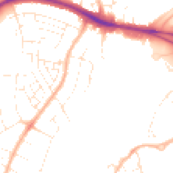
Daytime· 07:00 – 23:00
48.5dB

Night-time· 23:00 – 07:00
38.8dB