636 Filton Avenue, Filton, Bristol, BS34 7LD
About 636 Filton Avenue
636 Filton Avenue is a four-bedroom mid-terrace house in Filton, Bristol, Bristol (BS34 7LD). It has a recorded floor area of 95 m² (around 1023 sq ft), construction records dating it to 1930-1949 and council tax band B. The latest certificate (May 2025) shows a C (score 70). When first surveyed in October 2023 the rating was E, the property has climbed 2 bands since. Between certificates, hot-water efficiency went from Poor to Good; while wall efficiency dropped from Poor to Very Poor. The recommended improvements would push it to B (score 85).
At 95 m² the property is well over the postcode median (67 m² across 21 EPCs), placing it in the larger end of the local stock. Today's modelled estimate of £361,000 is 47.3% above the 2024 sale price. On a £-per-square-foot basis, the last sale (£240/sq ft) was about 24.1% above the typical sold price in the postcode. Sold October 2024 for £245,000.
What this property has
Inside
- Bedrooms4
- Bathrooms2
Everything you need to know about 636 Filton Avenue
The true value, the hidden risks and the full sale history, in one report.
Pick your report · every report is £14.99
One time fee only - money back guarantee

The data behind every report


Energy performance
EPC Rating
Property Improvements
Changes detected from historical EPC data
Heating controls upgraded for better temperature management
Hot water system upgraded
Get a survey for this property
Level 3 Building Survey
Because the property has solid (non-cavity) walls, we believe a Level 3 building survey should be considered.
From £955 · Includes VAT
Planning history
636 Filton Avenue has no planning applications on record.
But the area is active
130 notable applications nearby — larger schemes and conversions that could reshape the street. The report maps them all.
Sales history & valuation
636 Filton Avenue valuation sits well clear of the typical sold price in this postcode.
£361,000
Modelled from EPC, postcode comparables.
£245,000
Recorded with HM Land Registry.
Sales timeline
30 October 2024Most recent
£245,000
Median price across the last 5 sales in BS34 7LD: £287,000 (2025–2021).
Nearby sales in BS34 7LD
614 Filton Avenue, Filton, Bristol, BS34 7LD
Sold Feb 2025
£295,000620 Filton Avenue, Filton, Bristol, BS34 7LD
Sold Nov 2024
£287,000606 Filton Avenue, Filton, Bristol, BS34 7LD
Sold Jan 2024
£265,000640 Filton Avenue, Filton, Bristol, BS34 7LD
Sold Mar 2023
£350,000608 Filton Avenue, Filton, Bristol, BS34 7LD
Sold Sept 2021
£250,000
Versus other Filton Avenue homes
Years Held for 636 Filton Avenue lags the street by a wide margin.
Price per m²
£2,579
Street avg £3,203
Floor Area
95 m²
Street avg 87 m²
Habitable Rooms
5 rooms
Street avg 5 rooms
CO₂ Emissions
3.2 t/year
Street avg 3.7 t/year
Everything you need to know about 636 Filton Avenue
The true value, the hidden risks and the full sale history, in one report.
Pick your report · every report is £14.99
One time fee only - money back guarantee
The data behind every report
Similar properties nearby
1 Clyde Grove, Filton
BS34 7RL
1 Glebelands Road, Filton
BS34 7AD
1 Concorde House, Bevan Court, Filton
BS34 7QN
1 Blenheim Drive, Filton
BS34 7AX
1 Canberra Grove, Filton
BS34 7DH
1 Charlton Avenue
BS34 7QX
1 Dunkeld Avenue, Filton
BS34 7RH
1 Elm Park, Filton
BS34 7PR
The neighbourhood at a glance
Rail-style transport is unusually close for this postcode.
Crime
6/mo
Steady year-on-year across the wider district.
Nearest stop
0.1 km
Wallscourt Road — bus stop.
Closest school
0.4 km
Shield Road Primary School. 21 schools nearby.
Go deeper on the local area
A Local Area report breaks down crime, transport links, schools and air quality in depth.
Road noise across the postcode
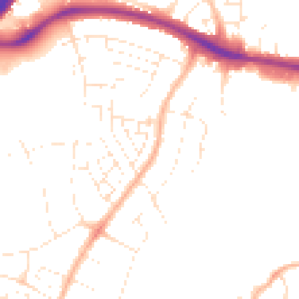
Daytime· 07:00 – 23:00
48.6dB

Night-time· 23:00 – 07:00
39.1dB