19 Blenheim Drive, Filton, Bristol, BS34 7AX
About 19 Blenheim Drive
19 Blenheim Drive is a semi-detached house in Filton, Bristol, Bristol (BS34 7AX). It has a recorded floor area of 77 m² (around 829 sq ft), construction records dating it to 1930-1949 and council tax band B. The latest certificate (July 2014) shows an E (score 48), well below the UK norm with real room to improve. The recommended improvements would lift it to C (score 74), a 2-band jump. The latest certificate is from July 2014, so improvements made since then won't be reflected.
Untraded for 20 years, with the last transfer in June 2006. Today's modelled estimate of £284,000 sits 75.3% above the 2006 sale of £162,000. At 77 m² it's 15.4% smaller than the typical home in the postcode (91 m² median across 19 EPCs).
Everything you need to know about 19 Blenheim Drive
The true value, the hidden risks and the full sale history, in one report.
Pick your report · every report is £14.99
One time fee only - money back guarantee

The data behind every report


Energy performance
Recommended upgrades on file would lift this property by multiple EPC bands.
EPC Expired
This certificate is over 10 years old and is no longer valid.Expired 03 Jul 2024
EPC Rating
Get a survey for this property
Level 2 HomeBuyer Report
We've checked 10 risk factors against the available data for this property and believe a Level 2 HomeBuyer Report could be a suitable option for you.
From £545 · Includes VAT
Planning history
19 Blenheim Drive has no planning applications on record.
But the area is active
130 notable applications nearby — larger schemes and conversions that could reshape the street. The report maps them all.
Sales history & valuation
19 Blenheim Drive valuation sits well clear of the typical sold price in this postcode.
£284,000
Modelled from EPC, postcode comparables.
£162,000
Recorded with HM Land Registry.
Sales timeline
8 June 2006Most recent
£162,000
Median price across the last 5 sales in BS34 7AX: £287,500 (2024–2021).
Nearby sales in BS34 7AX
24 Blenheim Drive, Filton, Bristol, BS34 7AX
Sold Oct 2024
£330,00011a, Blenheim Drive, Filton, Bristol, BS34 7AX
Sold Sept 2024
£241,00029 Blenheim Drive, Filton, Bristol, BS34 7AX
Sold Apr 2022
£195,0007 Blenheim Drive, Filton, Bristol, BS34 7AX
Sold Dec 2021
£329,95041 Blenheim Drive, Filton, Bristol, BS34 7AX
Sold Jun 2021
£287,500
Versus other Blenheim Drive homes
19 Blenheim Drive is notably below the street on epc rating.
Price per m²
£2,104
Street avg £2,583
Floor Area
77 m²
Street avg 91 m²
Habitable Rooms
5 rooms
Street avg 5 rooms
CO₂ Emissions
4.9 t/year
Street avg 4.3 t/year
Everything you need to know about 19 Blenheim Drive
The true value, the hidden risks and the full sale history, in one report.
Pick your report · every report is £14.99
One time fee only - money back guarantee
The data behind every report
Similar properties nearby
1 Mackie Road, Filton
BS34 7LY
1 Meadowsweet Avenue, Filton
BS34 7AN
1 Canberra Grove, Filton
BS34 7DH
1 Brookfield, Filton
BS34 7DY
1 Blenheim Drive, Filton
BS34 7AX
1 Bude Road, Filton
BS34 7HN
1 Concorde House, Bevan Court, Filton
BS34 7QN
1 Branksome Drive, Filton
BS34 7EG
The neighbourhood at a glance
Crime
6/mo
Steady year-on-year across the wider district.
Nearest stop
0.1 km
Blenheim Drive — bus stop.
Closest school
0.1 km
Filton Hill Primary School. 28 schools nearby.
Go deeper on the local area
A Local Area report breaks down crime, transport links, schools and air quality in depth.
Road noise across the postcode
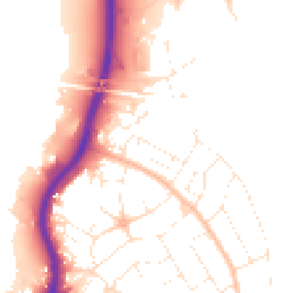
Daytime· 07:00 – 23:00
51.2dB

Night-time· 23:00 – 07:00
42.8dB