21 Bevington Close, Patchway, Bristol, BS34 5NN
About 21 Bevington Close
21 Bevington Close is a three-bedroom semi-detached house in Patchway, Bristol, Bristol (BS34 5NN). It has a recorded floor area of 82 m² (around 883 sq ft), construction records dating it to 1967-1975 and council tax band B. The latest certificate (July 2017) shows a D (score 56), a step below the typical UK home. The recommended improvements would push it to C (score 79).
Today's modelled estimate of £318,000 is 38.3% above the 2018 sale price. On a £-per-square-foot basis, the last sale (£261/sq ft) was about 36.1% above the typical sold price in the postcode. Last sale on file: £229,995 in July 2018.
What this property has
Inside
- Bedrooms3
- Bathrooms1
Outside
- Private gardenRear
- GarageYes
Building
- RefurbishedYes
Everything you need to know about 21 Bevington Close
The true value, the hidden risks and the full sale history, in one report.
Pick your report · every report is £14.99
One time fee only - money back guarantee

The data behind every report


Energy performance
EPC Rating
Get a survey for this property
Level 2 HomeBuyer Report
We've checked 10 risk factors against the available data for this property and believe a Level 2 HomeBuyer Report could be a suitable option for you.
From £595 · Includes VAT
Planning history
21 Bevington Close has no planning applications on record.
But the area is active
11 notable applications nearby — larger schemes and conversions that could reshape the street. The report maps them all.
Sales history & valuation
21 Bevington Close valuation sits well clear of the typical sold price in this postcode.
£318,000
Modelled from EPC, postcode comparables.
£229,995
Recorded with HM Land Registry.
Sales timeline
1 July 2018Most recent
£229,995
Median price across the last 5 sales in BS34 5NN: £307,500 (2024–2018).
Nearby sales in BS34 5NN
9 Bevington Close, Patchway, Bristol, BS34 5NN
Sold Nov 2024
£310,0003 Bevington Close, Patchway, Bristol, BS34 5NN
Sold Jun 2024
£307,50015 Bevington Close, Patchway, Bristol, BS34 5NN
Sold Jan 2024
£321,05017 Bevington Close, Patchway, Bristol, BS34 5NN
Sold Oct 2018
£240,00011 Bevington Close, Patchway, Bristol, BS34 5NN
Sold Sept 2018
£255,000
Versus other Bevington Close homes
EPC Rating for 21 Bevington Close lags the street by a wide margin.
Price per m²
£2,805
Street avg £2,675
Floor Area
82 m²
Street avg 89 m²
Habitable Rooms
4 rooms
Street avg 5 rooms
CO₂ Emissions
4.2 t/year
Street avg 3.4 t/year
Everything you need to know about 21 Bevington Close
The true value, the hidden risks and the full sale history, in one report.
Pick your report · every report is £14.99
One time fee only - money back guarantee
The data behind every report
Similar properties nearby
1 Donns Close, Patchway
BS34 5JW
1 Eagle Drive, Patchway
BS34 5RJ
1 Clermont Close, Patchway
BS34 5QJ
1 Birch Close, Patchway
BS34 5SB
1 Calves Garden, Patchway
BS34 5GZ
1 Buckleys Road, Patchway
BS34 5BJ
1 Broad Croft, Patchway
BS34 5FS
1 Eamoth Ground, Patchway
BS34 5SR
The neighbourhood at a glance
Crime
6/mo
Steady year-on-year across the wider district.
Nearest stop
0.0 km
Bevington Close — bus stop.
Closest school
0.5 km
Coniston Primary School. 17 schools nearby.
Go deeper on the local area
A Local Area report breaks down crime, transport links, schools and air quality in depth.
Road noise across the postcode
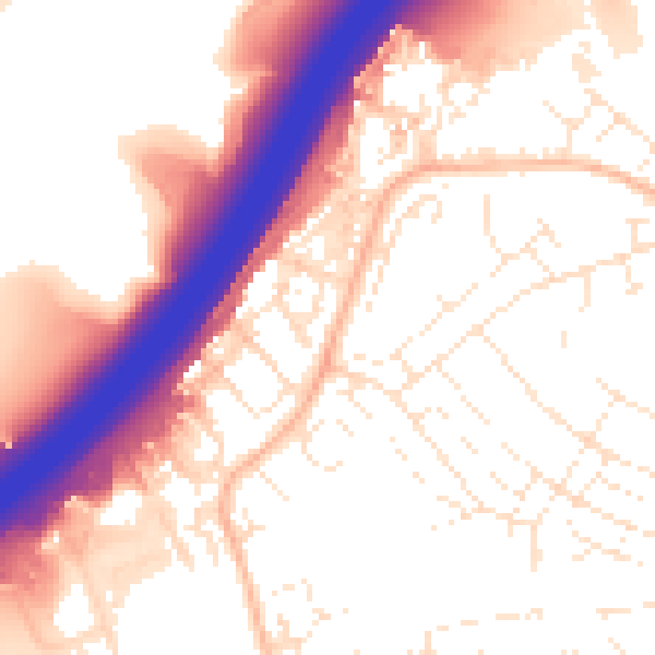
Daytime· 07:00 – 23:00
55.7dB

Night-time· 23:00 – 07:00
46.4dB