12 Donns Close, Patchway, Bristol, BS34 5JW
About 12 Donns Close
12 Donns Close is a two-bedroom semi-detached house in Patchway, Bristol, Bristol (BS34 5JW). It has a recorded floor area of 63 m² (around 678 sq ft), construction records dating it to 2012 onwards and council tax band B. The latest certificate (January 2024) shows a C (score 78), near the top of the C band. Earlier certificates rated it B (March 2014); the latest reading is one band lower. Between certificates, roof efficiency dropped from Very Good to Good and window efficiency dropped from Very Good to Good. The recommended improvements would lift it to A (score 92), a 2-band jump.
Across 2014–2021, sale prices on this property compounded at 4.9% per year. Today's modelled estimate of £283,000 is 13.2% above the 2021 sale price. On a £-per-square-foot basis, the last sale (£369/sq ft) was about 44.5% above the typical sold price in the postcode. Last sale on file: £250,000 in March 2021. That sale was during the post-pandemic price surge, when transactions cleared materially above pre-2020 trend.
What this property has
Inside
- Bedrooms2
- Bathrooms1
Outside
- Private gardenYes
- GarageYes
Everything you need to know about 12 Donns Close
The true value, the hidden risks and the full sale history, in one report.
Pick your report · every report is £14.99
One time fee only - money back guarantee

The data behind every report


Energy performance
12 Donns Close's carbon output is low for the local stock.
EPC Rating
Property Improvements
Changes detected from historical EPC data
Heating controls changed
Floor insulation added or improved
Get a survey for this property
Level 2 HomeBuyer Report
We've checked 10 risk factors against the available data for this property and believe a Level 2 HomeBuyer Report could be a suitable option for you.
From £545 · Includes VAT
Planning history
12 Donns Close has no planning applications on record.
But the area is active
11 notable applications nearby — larger schemes and conversions that could reshape the street. The report maps them all.
Sales history & valuation
12 Donns Close saw 3 transfers in just over a decade — high turnover for the postcode.
£283,000
Modelled from EPC, postcode comparables and a sale-price growth of 4.9% per year over 7 years.
£250,000
Growth on file: 4.9% per year over 7 years.
Sales timeline
26 March 2021Most recent
£250,000
+19.0%over 4 years17 February 2017
£210,000
+17.3%over 2 years3 April 2014
£178,995
Median price across the last 5 sales in BS34 5JW: £222,000 (2024–2019).
Nearby sales in BS34 5JW
16 Donns Close, Patchway, Bristol, BS34 5JW
Sold May 2024
£260,00034 Donns Close, Patchway, Bristol, BS34 5JW
Sold Aug 2022
£222,0003 Donns Close, Patchway, Bristol, BS34 5JW
Sold Apr 2021
£220,0004 Donns Close, Patchway, Bristol, BS34 5JW
Sold Mar 2021
£280,00032 Donns Close, Patchway, Bristol, BS34 5JW
Sold Jul 2017
£180,050
Versus other Donns Close homes
12 Donns Close outperforms the street on price per m² by a wide margin.
Price per m²
£3,968
Street avg £3,043
Floor Area
63 m²
Street avg 71 m²
Habitable Rooms
4 rooms
Street avg 4 rooms
CO₂ Emissions
1.4 t/year
Street avg 1.3 t/year
Everything you need to know about 12 Donns Close
The true value, the hidden risks and the full sale history, in one report.
Pick your report · every report is £14.99
One time fee only - money back guarantee
The data behind every report
Similar properties nearby
1 Bay Tree Close, Patchway
BS34 5EU
1 Brick Hill Way, Patchway
BS34 5UY
1 Arlingham Way, Patchway
BS34 5NH
1 Ashley House, Elmore Road, Patchway
BS34 5NU
1 Birch Close, Patchway
BS34 5SB
1 Donns Close, Patchway
BS34 5JW
1 Eagle Drive, Patchway
BS34 5RJ
1 Clermont Close, Patchway
BS34 5QJ
The neighbourhood at a glance
Rail-style transport is unusually close for this postcode.
Crime
6/mo
Steady year-on-year across the wider district.
Nearest stop
0.0 km
Callicroft Road — bus stop.
Closest school
0.4 km
Charlton Wood Primary Academy. 23 schools nearby.
Go deeper on the local area
A Local Area report breaks down crime, transport links, schools and air quality in depth.
Road noise across the postcode
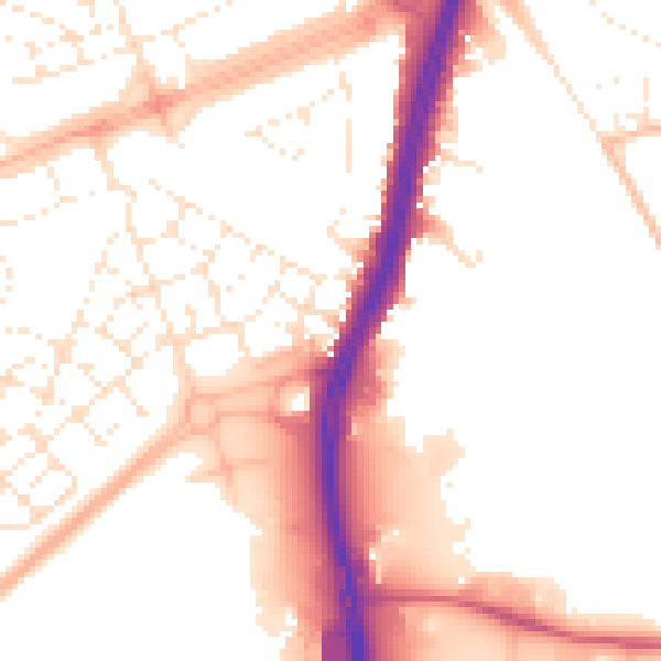
Daytime· 07:00 – 23:00
52.8dB

Night-time· 23:00 – 07:00
43.3dB