29 Ashford Road, Patchway, Bristol, BS34 5DX
About 29 Ashford Road
29 Ashford Road is a semi-detached house in Patchway, Bristol, Bristol (BS34 5DX). It has a recorded floor area of 135 m² (around 1453 sq ft), construction records dating it to 1950-1966 and council tax band B. The latest certificate (July 2013) shows an E (score 49), well below the UK norm with real room to improve. The recommended improvements would push it to D (score 62). The latest certificate is from July 2013, so improvements made since then won't be reflected.
It hasn't traded since March 1999, a hold of 27 years that's notably long for the area. Only one transfer is on record with HM Land Registry, suggesting it has stayed in the same hands for a long time. At 135 m² the property is well over the postcode median (86 m² across 17 EPCs), placing it in the larger end of the local stock. On energy efficiency it sits in the bottom 10% of properties in this postcode — significant headroom for improvement. Today's modelled estimate of £315,000 sits 573.8% above the 1999 sale of £46,750. On a £-per-square-foot basis, the last sale (£32/sq ft) was about 81.3% below the postcode norm. 2 planning records sit against the property, 1 approved, 0 refused. Past consents include an extension and a porch, meaningful when judging how the property has evolved.
Everything you need to know about 29 Ashford Road
The true value, the hidden risks and the full sale history, in one report.
Pick your report · every report is £14.99
One time fee only - money back guarantee

The data behind every report


Energy performance
29 Ashford Road sits at the bottom of the postcode for energy efficiency — meaningful headroom to improve.
EPC Expired
This certificate is over 10 years old and is no longer valid.Expired 24 Jul 2023
EPC Rating
Get a survey for this property
Level 2 HomeBuyer Report
We've checked 10 risk factors against the available data for this property and believe a Level 2 HomeBuyer Report could be a suitable option for you.
From £595 · Includes VAT
Planning history
2 applications on record at 29 Ashford Road, Patchway, Bristol, BS34 5DX
1 live now- May 2010PorchFullOutcome in report
Extension: Two storey · Side of property
Erection of two storey side extension to form additional living accommodation. Erection of front porch.
Extension- Documents
- 7 docs on file
- Reference
- PT10/0615/F
- More recent applications — locked
- ExtensionMay 2025Decision
Unlock 29 Ashford Road, Patchway, Bristol, BS34 5DX's full planning history
You're seeing the shape of it. The report has the substance.
- Every decision — granted, refused or withdrawn (1 on record)
- All 2 applications on this property in full, plus 11 notable nearby
- The 16 documents, officer reports & conditions
- What the pattern means for extending or converting here
One time fee only - money back guarantee
Sales history & valuation
29 Ashford Road's modelled value sits at over four times its earliest registered sale price (1999).
£315,000
Modelled from EPC, postcode comparables.
£46,750
Recorded with HM Land Registry.
Sales timeline
31 March 1999Most recent
£46,750
Median price across the last 5 sales in BS34 5DX: £295,000 (2024–2020).
Nearby sales in BS34 5DX
35 Ashford Road, Patchway, Bristol, BS34 5DX
Sold Jul 2024
£295,00033 Ashford Road, Patchway, Bristol, BS34 5DX
Sold May 2022
£302,50027 Ashford Road, Patchway, Bristol, BS34 5DX
Sold Apr 2022
£326,00023 Ashford Road, Patchway, Bristol, BS34 5DX
Sold Apr 2021
£270,00015 Ashford Road, Patchway, Bristol, BS34 5DX
Sold Aug 2020
£230,000
Versus other Ashford Road homes
29 Ashford Road is notably below the street on price per m².
Price per m²
£346
Street avg £2,979
Floor Area
135 m²
Street avg 86 m²
Habitable Rooms
7 rooms
Street avg 5 rooms
CO₂ Emissions
7.7 t/year
Street avg 3.5 t/year
Everything you need to know about 29 Ashford Road
The true value, the hidden risks and the full sale history, in one report.
Pick your report · every report is £14.99
One time fee only - money back guarantee
The data behind every report
Similar properties nearby
1 Donns Close, Patchway
BS34 5JW
1 Eagle Drive, Patchway
BS34 5RJ
1 Bay Tree Close, Patchway
BS34 5EU
1 Blakeney Road, Patchway
BS34 5LY
1 Birch Close, Patchway
BS34 5SB
1 Bushy Road, Patchway
BS34 5GP
1 Clermont Close, Patchway
BS34 5QJ
1 Ashford Road, Patchway
BS34 5DX
The neighbourhood at a glance
Rail-style transport is unusually close for this postcode.
Crime
6/mo
Steady year-on-year across the wider district.
Nearest stop
0.2 km
Fire Station — bus stop.
Closest school
0.4 km
Charlton Wood Primary Academy. 22 schools nearby.
Go deeper on the local area
A Local Area report breaks down crime, transport links, schools and air quality in depth.
Road noise across the postcode
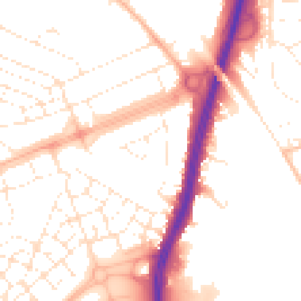
Daytime· 07:00 – 23:00
52.1dB

Night-time· 23:00 – 07:00
42.3dB