47 Eighteen Acre Drive, Patchway, Bristol, BS34 5AS
About 47 Eighteen Acre Drive
47 Eighteen Acre Drive is a two-bedroom mid-terrace house in Patchway, Bristol, Bristol (BS34 5AS). It has a recorded floor area of 58 m² (around 624 sq ft), construction records dating it to 2012 onwards and council tax band B. At 58 m² this is the 32nd smallest of 80 units on EPC record in the building, where floor areas span 45–110 m². The building's EPC ratings span C to B, with this unit at the bottom. Other recorded features include a balcony. The latest certificate (September 2023) shows a C (score 74). Earlier certificates rated it B (December 2012); the latest reading is one band lower. Between certificates, window efficiency dropped from Very Good to Good.
Across 2013–2024, sale prices on this property compounded at 4.3% per year. On a £-per-square-foot basis, the last sale (£352/sq ft) was about 66.7% above the typical sold price in the postcode. Sold June 2024 for £220,000.
What this property has
Inside
- Bedrooms2
- Bathrooms2
- EnsuiteYes
Outside
- DrivewayYes
- BalconyYes
Building
- Heating systemGas
- RefurbishedYes
Everything you need to know about 47 Eighteen Acre Drive
The true value, the hidden risks and the full sale history, in one report.
Pick your report · every report is £14.99
One time fee only - money back guarantee

The data behind every report


Energy performance
EPC Rating
Get a survey for this property
Level 2 HomeBuyer Report
We've checked 10 risk factors against the available data for this property and believe a Level 2 HomeBuyer Report could be a suitable option for you.
From £545 · Includes VAT
Planning history
47 Eighteen Acre Drive has no planning applications on record.
But the area is active
11 notable applications nearby — larger schemes and conversions that could reshape the street. The report maps them all.
Sales history & valuation
47 Eighteen Acre Drive valuation sits well clear of the typical sold price in this postcode.
£241,000
Modelled from EPC, postcode comparables and a sale-price growth of 4.3% per year over 11 years.
£220,000
Growth on file: 4.3% per year over 11 years.
Sales timeline
23 June 2024Most recent
£220,000
+21.2%over 8 years11 December 2015
£181,500
+33.0%over 2 years28 February 2013
£136,495
Median price across the last 5 sales in BS34 5AS: £140,000 (2024–2017).
Nearby sales in BS34 5AS
133 Eighteen Acre Drive, Patchway, Bristol, BS34 5AS
Sold Sept 2024
£116,000129 Eighteen Acre Drive, Patchway, Bristol, BS34 5AS
Sold Aug 2024
£140,00027 Eighteen Acre Drive, Patchway, Bristol, BS34 5AS
Sold Apr 2024
£230,000147 Eighteen Acre Drive, Patchway, Bristol, BS34 5AS
Sold Dec 2022
£116,00037 Eighteen Acre Drive, Patchway, Bristol, BS34 5AS
Sold Aug 2017
£187,500
Versus other Eighteen Acre Drive homes
Price per m² for 47 Eighteen Acre Drive runs comfortably ahead of the street norm.
Price per m²
£3,793
Street avg £2,705
Floor Area
58 m²
Street avg 55 m²
Habitable Rooms
3 rooms
Street avg 3 rooms
CO₂ Emissions
1.7 t/year
Street avg 1.1 t/year
Everything you need to know about 47 Eighteen Acre Drive
The true value, the hidden risks and the full sale history, in one report.
Pick your report · every report is £14.99
One time fee only - money back guarantee
The data behind every report
Similar properties nearby
1 Arlingham Way, Patchway
BS34 5NH
1 Brick Hill Way, Patchway
BS34 5UY
1 Bay Tree Close, Patchway
BS34 5EU
1 Ashley House, Elmore Road, Patchway
BS34 5NU
1 Birch Close, Patchway
BS34 5SB
1 Donns Close, Patchway
BS34 5JW
1 Eagle Drive, Patchway
BS34 5RJ
1 Clermont Close, Patchway
BS34 5QJ
The neighbourhood at a glance
Rail-style transport is unusually close for this postcode.
Crime
6/mo
Steady year-on-year across the wider district.
Nearest stop
0.1 km
Ring Mead — bus stop.
Closest school
0.3 km
Charlton Wood Primary Academy. 23 schools nearby.
Go deeper on the local area
A Local Area report breaks down crime, transport links, schools and air quality in depth.
Road noise across the postcode
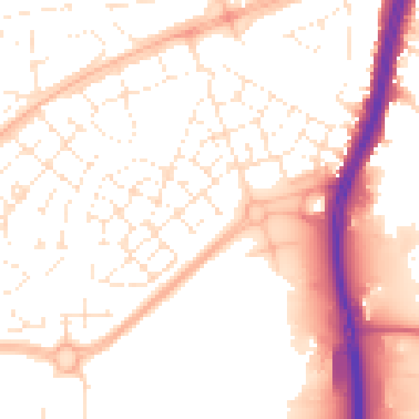
Daytime· 07:00 – 23:00
53.5dB

Night-time· 23:00 – 07:00
43.0dB