12a, River Road, Littlehampton, BN17 5BN
About 12a
12a is a seven-bedroom semi-detached house in Littlehampton (BN17 5BN). It has a recorded floor area of 260 m² (around 2799 sq ft), construction records dating it to 1900-1929 and council tax band B. The latest certificate (June 2025) shows an E (score 53), well below the UK norm with real room to improve. When first surveyed in July 2014 the rating was F, the property has climbed 1 band since. Between certificates, roof efficiency went from Very Poor to Average and lighting went from Very Poor to Very Good; while wall efficiency dropped from Poor to Very Poor. The recommended improvements would push it to D (score 67).
Untraded for 24 years, with the last transfer in November 2002. At 260 m² the property is well over the postcode median (82 m² across 28 EPCs), placing it in the larger end of the local stock. It lags the bulk of the postcode on energy efficiency (less efficient than 71% of similar EPCs). 7 bedrooms is on the larger side for this postcode, where 4 is the typical count. Across 1997–2002, sale prices on this property compounded at 8.3% per year. Today's modelled estimate of £668,000 sits 147.4% above the 2002 sale of £270,000. On a £-per-square-foot basis, the last sale (£96/sq ft) was about 49.2% below the postcode norm. One historical planning record sits against the property in 2018. The record references conservation-area consent, which constrain future alterations.
What this property has
Inside
- Bedrooms7
- Bathrooms3
- Dining roomYes
Outside
- ParkingOff road
Everything you need to know about 12a
The true value, the hidden risks and the full sale history, in one report.
30-day money-back guarantee

The data behind every report


Energy performance
12a's carbon output runs well above what efficient homes in the postcode produce.
EPC Rating
Property Improvements
Changes detected from historical EPC data
Heating controls upgraded for better temperature management
Windows upgraded, improving insulation
Loft insulation installed or upgraded to 250mm+
More low energy lighting installed
Planning history
12a sits within a conservation area — exterior works face additional planning controls.
- Aug 2018FullIn report
Replacement glass mono-pitch roof - This application may affect the setting of the Littlehampton (River Road) Conservation Area
Conservation Area- Reference
- LU/138/18/HH
We flagged 2 things worth checking at 12a
Independent checks surfaced things a buyer would want to understand before offering. The report explains each one in full, with the underlying data and what to ask.
- Signs of HMO activity in the area
- Environmental risk flagged
30-day money-back guarantee
Sales history & valuation
12a's estimated value is more than triple its earliest registered sale price (1997).
£668,000
Modelled from EPC, postcode comparables and a sale-price growth of 8.3% per year over 6 years.
£270,000
Growth on file: 8.3% per year over 6 years.
Sales timeline
29 November 2002Most recent
£270,000
+56.1%over 5 years27 April 1997
£173,000
Median price across the last 5 sales in BN17 5BN: £275,000 (2025–2021).
Nearby sales in BN17 5BN
8 Hampton Court, River Road, Littlehampton, BN17 5BN
Sold Nov 2025
£173,5007 River Road, Littlehampton, BN17 5BN
Sold Feb 2025
£430,0002 Hampton Court, River Road, Littlehampton, BN17 5BN
Sold May 2024
£193,0005 River Road, Littlehampton, BN17 5BN
Sold Aug 2023
£465,0005 Argyll Hall, River Road, Littlehampton, BN17 5BN
Sold Sept 2021
£275,000
Versus other River Road homes
On habitable rooms, 12a stands well clear of the street.
Price per m²
£1,038
Street avg £2,124
Floor Area
260 m²
Street avg 116 m²
Habitable Rooms
11 rooms
Street avg 5 rooms
CO₂ Emissions
10.0 t/year
Street avg 5.0 t/year
Everything you need to know about 12a
The true value, the hidden risks and the full sale history, in one report.
30-day money-back guarantee
The data behind every report
Similar properties nearby
1 Church Street
BN17 5EL
1 Cropthorne Drive, Climping
BN17 5GG
1 2 Kents Dairy Cottages, Brookpit Lane, Climping
BN17 5QU
1 Britannia Walk, Pier Road
BN17 5TH
1 Atherington Cottages, Climping Street, Climping
BN17 5RN
1 Fairlight Court, Pier Road
BN17 5DU
1 Church Farm Cottages, Horsemere Green Lane, Climping
BN17 5QX
1 Beach Mews, Western Road
BN17 5PG
The neighbourhood at a glance
Rail-style transport is unusually close for this postcode.
Crime
5/mo
Steady year-on-year across the wider district.
Nearest stop
0.1 km
Littlehampton Railway Station — bus stop.
Closest school
0.4 km
River Beach Primary School. 8 schools nearby.
Go deeper on the local area
The full report breaks down crime, transport links, schools and air quality in depth.
Road noise across the postcode
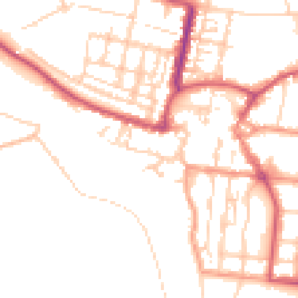
Daytime· 07:00 – 23:00
50.0dB

Night-time· 23:00 – 07:00
40.4dB