33 Haverstock Road, Bournemouth, BH9 3HQ
About 33 Haverstock Road
33 Haverstock Road is a four-bedroom detached house in Bournemouth (BH9 3HQ). It has a recorded floor area of 123 m² (around 1324 sq ft), construction records dating it to 1900-1929 and council tax band E. The latest certificate (September 2020) shows a D (score 67), on the cusp of jumping into the C band. The recommended improvements would lift it to B (score 81), a 2-band jump.
At 123 m² it's 20% larger than the typical home in the postcode (103 m² median across 14 EPCs). Across 1997–2021, sale prices on this property compounded at 5.8% per year. Today's modelled estimate of £548,000 is 21.2% above the 2021 sale price. On a £-per-square-foot basis, the last sale (£341/sq ft) was about 42.1% above the typical sold price in the postcode. Last sale on file: £452,000 in March 2021. That sale was during the post-pandemic price surge, when transactions cleared materially above pre-2020 trend.
What this property has
Inside
- Bedrooms4
- Bathrooms1
- Dining roomYes
- CloakroomYes
- EnsuiteYes
Outside
- Private gardenYes
- GarageYes
Building
- Heating systemGas
Everything you need to know about 33 Haverstock Road
The true value, the hidden risks and the full sale history, in one report.
Pick your report · every report is £14.99
One time fee only - money back guarantee

The data behind every report


Energy performance
Recommended upgrades on file would lift this property by multiple EPC bands.
EPC Rating
Get a survey for this property
Level 3 Building Survey
Because the property was built before 1919, we believe a Level 3 building survey should be considered.
From £1,085 · Includes VAT
Planning history
33 Haverstock Road has no planning applications on record.
But the area is active
1 notable application nearby — larger schemes and conversions that could reshape the street. The report maps them all.
Sales history & valuation
33 Haverstock Road has more than tripled in price since its earliest registered sale in 1997.
£548,000
Modelled from EPC, postcode comparables and a sale-price growth of 5.8% per year over 23 years.
£452,000
Growth on file: 5.8% per year over 23 years.
Sales timeline
12 March 2021Most recent
£452,000
+273.6%over 23 years9 October 1997
£121,000
Median price across the last 5 sales in BH9 3HQ: £406,000 (2025–2019).
Nearby sales in BH9 3HQ
17 Haverstock Road, Bournemouth, BH9 3HQ
Sold Feb 2025
£406,00039 Haverstock Road, Bournemouth, BH9 3HQ
Sold Apr 2024
£500,00029 Haverstock Road, Bournemouth, BH9 3HQ
Sold May 2023
£475,00037 Haverstock Road, Bournemouth, BH9 3HQ
Sold Oct 2019
£380,00035 Haverstock Road, Bournemouth, BH9 3HQ
Sold May 2019
£400,000
Versus other Haverstock Road homes
EPC Rating for 33 Haverstock Road runs comfortably ahead of the street norm.
Price per m²
£3,675
Street avg £3,682
Floor Area
123 m²
Street avg 112 m²
Habitable Rooms
6 rooms
Street avg 6 rooms
CO₂ Emissions
4.4 t/year
Street avg 6.1 t/year
Everything you need to know about 33 Haverstock Road
The true value, the hidden risks and the full sale history, in one report.
Pick your report · every report is £14.99
One time fee only - money back guarantee
The data behind every report
Similar properties nearby
1 Bosworth Mews
BH9 3SD
1 Colehill Crescent
BH9 3QG
1 Bradford Road
BH9 3PJ
1 Claremont Avenue
BH9 3EY
1 Haverstock Road
BH9 3HQ
1 Castle Lane West
BH9 3LJ
1 Franklin Road
BH9 3AY
1 Huntvale Road
BH9 3HW
The neighbourhood at a glance
Daytime road noise here sits well below conversation level — a quiet pocket of the postcode.
Crime
4/mo
Steady year-on-year across the wider district.
Nearest stop
0.2 km
Haverstock Road — bus stop.
Closest school
0.3 km
St. Walburga's Catholic Primary School. 25 schools nearby.
Go deeper on the local area
A Local Area report breaks down crime, transport links, schools and air quality in depth.
Road noise across the postcode
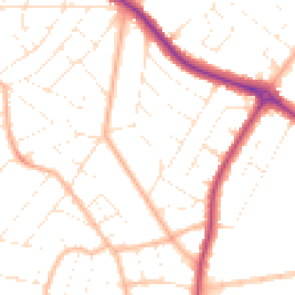
Daytime· 07:00 – 23:00
49.9dB

Night-time· 23:00 – 07:00
39.9dB