7 Throop Close, Bournemouth, BH8 0DD
About 7 Throop Close
7 Throop Close is a semi-detached house in Bournemouth (BH8 0DD). It has a recorded floor area of 86 m² (around 926 sq ft), construction records dating it to 2003-2006 and council tax band C. The latest certificate (March 2024) shows a C (score 76), near the top of the C band. The recommended improvements would push it to B (score 89).
It hasn't traded since April 2005, a hold of 21 years that's notably long for the area. Today's modelled estimate of £256,000 sits 201.2% above the 2005 sale of £85,000. On a £-per-square-foot basis, the last sale (£92/sq ft) was about 64.6% below the postcode norm. One historical planning record sits against the property in 2022.
Everything you need to know about 7 Throop Close
The true value, the hidden risks and the full sale history, in one report.
Pick your report · every report is £14.99
One time fee only - money back guarantee

The data behind every report


Energy performance
EPC Rating
Get a survey for this property
Level 2 HomeBuyer Report
We've checked 10 risk factors against the available data for this property and believe a Level 2 HomeBuyer Report could be a suitable option for you.
From £545 · Includes VAT
Planning history
1 application on record at 7 Throop Close, Bournemouth, BH8 0DD
- Sept 2022FullOutcome in report
Variation of condition no. 8 of application no: 7/1999/18827/A restricting the housing to be Development to be for affordable housing only
- Documents
- 3 docs on file
- Reference
- 7-2020-18827-D
Unlock 7 Throop Close, Bournemouth, BH8 0DD's full planning history
You're seeing the shape of it. The report has the substance.
- Every decision — granted, refused or withdrawn (1 on record)
- All 1 application on this property in full
- The 3 documents, officer reports & conditions
- What the pattern means for extending or converting here
One time fee only - money back guarantee
Sales history & valuation
7 Throop Close's estimated value is more than triple its earliest registered sale price (2005).
£256,000
Modelled from EPC, postcode comparables.
£85,000
Recorded with HM Land Registry.
Sales timeline
28 April 2005Most recent
£85,000
Median price across the last 5 sales in BH8 0DD: £242,000 (2023–2010).
Nearby sales in BH8 0DD
Versus other Throop Close homes
On price per m², 7 Throop Close runs well behind the street norm.
Price per m²
£988
Street avg £3,124
Floor Area
86 m²
Street avg 86 m²
Habitable Rooms
3 rooms
Street avg 4 rooms
CO₂ Emissions
2.3 t/year
Street avg 2.8 t/year
Everything you need to know about 7 Throop Close
The true value, the hidden risks and the full sale history, in one report.
Pick your report · every report is £14.99
One time fee only - money back guarantee
The data behind every report
Similar properties nearby
The neighbourhood at a glance
Crime
14/mo
Steady year-on-year across the wider district.
Nearest stop
0.1 km
War Memorial Homes — bus stop.
Closest school
0.2 km
Jewell Academy Bournemouth. 20 schools nearby.
Go deeper on the local area
A Local Area report breaks down crime, transport links, schools and air quality in depth.
Road noise across the postcode
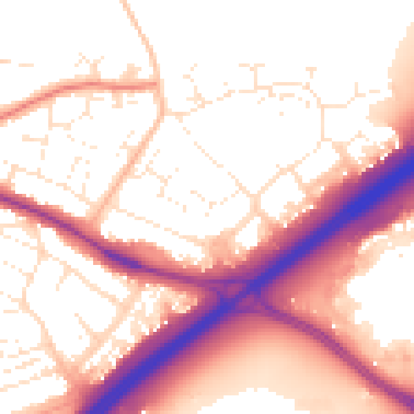
Daytime· 07:00 – 23:00
56.0dB

Night-time· 23:00 – 07:00
47.4dB