Meriden, Ball Lane, Coven Heath, Wolverhampton, WV10 7EY
About Meriden
Meriden is a property in Coven Heath, Wolverhampton, Wolverhampton (WV10 7EY). It has council tax band E.
Across 1995–2021, sale prices on this property compounded at 6.3% per year. Last sale on file: £402,500 in September 2021. That sale was during the post-pandemic price surge, when transactions cleared materially above pre-2020 trend.
Everything you need to know about Meriden
The true value, the hidden risks and the full sale history, in one report.
Pick your report · every report is £14.99
One time fee only - money back guarantee

The data behind every report


Energy performance
No EPC on record
This property doesn't have an Energy Performance Certificate yet. An EPC is required to sell or let — and unlocks our automated valuation.
Get a survey for this property
Level 2 HomeBuyer Report
We've checked 10 risk factors against the available data for this property and believe a Level 2 HomeBuyer Report could be a suitable option for you.
Planning history
Meriden has no planning applications on record.
But the area is active
4 notable applications nearby — larger schemes and conversions that could reshape the street. The report maps them all.
Sales history & valuation
Latest sale on Meriden was the highest on Land Registry record across the postcode.
£402,500
Growth on file: 6.3% per year over 26 years.
Sales timeline
23 September 2021Most recent
£402,500
+390.9%over 26 years3 August 1995
£82,000
Median price across the last 5 sales in WV10 7EY: £173,750 (2024–2004).
Nearby sales in WV10 7EY
Winrush, Ball Lane, Coven Heath, Wolverhampton, WV10 7EY
Sold Jun 2024
£400,0001 Ball Lane, Coven Heath, Wolverhampton, WV10 7EY
Sold Dec 2020
£294,5002b, Ball Lane, Coven Heath, Wolverhampton, WV10 7EY
Sold Aug 2004
£169,9952 Ball Lane, Coven Heath, Wolverhampton, WV10 7EY
Sold Jul 2004
£166,000Old Meldrum, Ball Lane, Coven Heath, Wolverhampton, WV10 7EY
Sold Feb 2003
£160,000
Everything you need to know about Meriden
The true value, the hidden risks and the full sale history, in one report.
Pick your report · every report is £14.99
One time fee only - money back guarantee
The data behind every report
Similar properties nearby
1 Dairy Farm Barns, Little Saredon
WV10 7LJ
1 Featherstone Hall Barn, New Road, Featherstone
WV10 7NW
1 Ball Lane, Coven Heath
WV10 7EY
1 College Way, Brinsford
WV10 7FJ
1 Albert Barns, Brinsford Lane
WV10 7PR
1 Cranesbill Close, Featherstone
WV10 7TY
1 Bridge Cottages, Straight Mile, Calf Heath
WV10 7DP
1 Brooklime Gardens, Featherstone
WV10 7TW
The neighbourhood at a glance
Crime
6/mo
Steady year-on-year across the wider district.
Nearest stop
0.1 km
Ball Lane — bus stop.
Closest school
1.5 km
St Anthony's Catholic Primary Academy. 10 schools nearby.
Go deeper on the local area
A Local Area report breaks down crime, transport links, schools and air quality in depth.
Road noise across the postcode
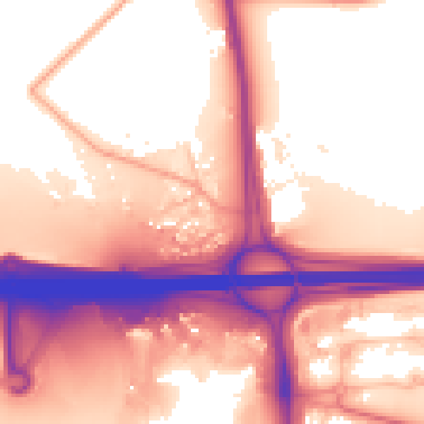
Daytime· 07:00 – 23:00
59.2dB
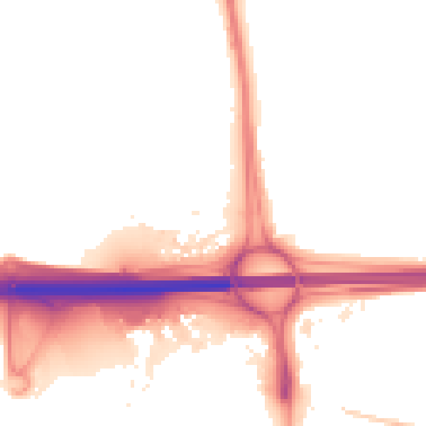
Night-time· 23:00 – 07:00
52.8dB