40 Leslie Road, Wolverhampton, WV10 0BU
About 40 Leslie Road
40 Leslie Road is a mid-terrace house in Wolverhampton (WV10 0BU). It has a recorded floor area of 76 m² (around 818 sq ft), construction records dating it to 1900-1929 and council tax band A. The latest certificate (January 2021) shows a C (score 72). The recommended improvements would push it to B (score 86).
Untraded for 23 years, with the last transfer in January 2003. Today's modelled estimate of £156,000 sits 280.5% above the 2003 sale of £41,000. On a £-per-square-foot basis, the last sale (£50/sq ft) was about 31% below the postcode norm.
Everything you need to know about 40 Leslie Road
The true value, the hidden risks and the full sale history, in one report.
Pick your report · every report is £14.99
One time fee only - money back guarantee

The data behind every report


Energy performance
EPC Rating
Get a survey for this property
Level 3 Building Survey
Because the property was built before 1919 and has solid (non-cavity) walls, we believe a Level 3 building survey should be considered.
From £820 · Includes VAT
Planning history
40 Leslie Road has no planning applications on record.
But the area is active
4 notable applications nearby — larger schemes and conversions that could reshape the street. The report maps them all.
Sales history & valuation
40 Leslie Road's estimated value is more than triple its earliest registered sale price (2003).
£156,000
Modelled from EPC, postcode comparables.
£41,000
Recorded with HM Land Registry.
Sales timeline
17 January 2003Most recent
£41,000
Median price across the last 5 sales in WV10 0BU: £90,000 (2025–2023).
Nearby sales in WV10 0BU
Versus other Leslie Road homes
On price per m², 40 Leslie Road runs well behind the street norm.
Price per m²
£539
Street avg £908
Floor Area
76 m²
Street avg 77 m²
Habitable Rooms
4 rooms
Street avg 4 rooms
CO₂ Emissions
2.6 t/year
Street avg 3.8 t/year
Everything you need to know about 40 Leslie Road
The true value, the hidden risks and the full sale history, in one report.
Pick your report · every report is £14.99
One time fee only - money back guarantee
The data behind every report
Similar properties nearby
The neighbourhood at a glance
Crime
6/mo
Steady year-on-year across the wider district.
Nearest stop
1.3 km
Wolverhampton Rail Station — railway station.
Closest school
0.3 km
Trinity CofE Primary Academy. 36 schools nearby.
Go deeper on the local area
A Local Area report breaks down crime, transport links, schools and air quality in depth.
Road noise across the postcode
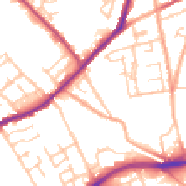
Daytime· 07:00 – 23:00
52.2dB

Night-time· 23:00 – 07:00
42.9dB