17a, Mount Street, Hednesford, Cannock, WS12 4DE
About 17a
17a is a two-bedroom end-of-terrace house in Hednesford, Cannock, Cannock (WS12 4DE). It has a recorded floor area of 71 m² (around 764 sq ft), construction records dating it to 1900-1929 and council tax band A. The latest certificate (April 2019) shows a C (score 71). When first surveyed in March 2009 the rating was E, the property has climbed 2 bands since. Between certificates, wall efficiency went from Very Poor to Poor, hot-water efficiency went from Poor to Good and lighting went from Very Poor to Poor; while window efficiency dropped from Good to Average. At 71 m² this is the 20th smallest of 30 units on EPC record in the building, where floor areas span 39–94 m². The building's EPC ratings span E to B across 30 units on file.
At 71 m² it's 18.3% larger than the typical home in the postcode (60 m² median across 29 EPCs). Across 2019–2023, sale prices on this property compounded at 8.8% per year. Today's modelled estimate of £125,000 is 13.6% above the 2023 sale price. On a £-per-square-foot basis, the last sale (£144/sq ft) was about 22.7% above the typical sold price in the postcode. Sold July 2023 for £110,000.
Know exactly what you're buying at 17a
Before you offer, see what the listing won't tell you, the true value, the red flags and the full history.
Already flagged here
Valuation
against the asking price
Risks
planning & flood
Sold prices
similar homes nearby
Trends
the local market
What this property has
Inside
- Bedrooms2
- Bathrooms2
Energy performance
EPC Rating
Property Improvements
Changes detected from historical EPC data
Replaced storage heaters with gas boiler
Connected to mains gas supply
Heating controls upgraded for better temperature management
Hot water system upgraded
More low energy lighting installed
Heating controls upgraded for better temperature management
Wall insulation improved
Low energy lighting percentage decreased
Planning history
17a has no planning applications on record.
Notable planning nearby
3applications of note in the surrounding area
We flagged 1 thing worth checking at 17a
Independent checks surfaced things a buyer would want to understand before offering. The report explains each one in full, with the underlying data and what to ask.
- Larger development activity nearby
30-day money-back guarantee
Sales history & valuation
17a valuation sits well clear of the typical sold price in this postcode.
£125,000
Modelled from EPC, postcode comparables and a sale-price growth of 8.8% per year over 4 years.
£110,000
Growth on file: 8.8% per year over 4 years.
Sales timeline
6 July 2023Most recent
£110,000
+41.0%over 4 years4 June 2019
£78,000
Median price across the last 5 sales in WS12 4DE: £141,000 (2024–2022).
Nearby sales in WS12 4DE
35 Mount Street, Hednesford, Cannock, WS12 4DE
Sold Jul 2024
£155,00017c, Mount Street, Hednesford, Cannock, WS12 4DE
Sold Aug 2022
£105,00025 Mount Street, Hednesford, Cannock, WS12 4DE
Sold Feb 2022
£132,50033 Mount Street, Hednesford, Cannock, WS12 4DE
Sold Feb 2022
£156,00019 Mount Street, Hednesford, Cannock, WS12 4DE
Sold Feb 2022
£141,000
Everything we know about 17a, in one report
What it's really worth, what could be wrong, and the planning, sales and area data in full.
What we flagged
- Larger development activity nearby

Versus other Mount Street homes
On years held, 17a runs well behind the street norm.
Price per m²
£1,549
Street avg £1,449
Floor Area
71 m²
Street avg 56 m²
Habitable Rooms
3 rooms
Street avg 3 rooms
CO₂ Emissions
2.7 t/year
Street avg 2.8 t/year
Similar properties nearby
1 Bramwell Drive, Hednesford
WS12 4GG
1 Barley Close, Hednesford
WS12 4XY
1 Arnotdale Drive, Hednesford
WS12 4JG
1 Bluebell Close, Hednesford
WS12 4AG
1 Bracken Road
WS12 4NS
1 Balmoral Drive, Hednesford
WS12 4LT
1 Braemar Gardens, Hednesford
WS12 4LS
1 Abbey Street, Hednesford
WS12 4BB
The neighbourhood at a glance
Rail-style transport is unusually close for this postcode.
Crime
2/mo
Falling year-on-year across the wider district.
Nearest stop
0.2 km
Mount Street — bus stop.
Closest school
0.5 km
West Hill Primary School. 17 schools nearby.
Go deeper on the local area
The full report breaks down crime, transport links, schools and air quality in depth.
Road noise across the postcode
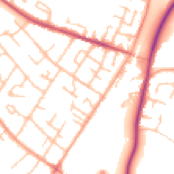
Daytime· 07:00 – 23:00
51.6dB

Night-time· 23:00 – 07:00
42.1dB