83 Bromwich Road, Worcester, WR2 4AR
About 83 Bromwich Road
83 Bromwich Road is a semi-detached house in Worcester (WR2 4AR). It has a recorded floor area of 112 m² (around 1206 sq ft), construction records dating it to 1900-1929 and council tax band B. At 112 m² this is the 3rd smallest of 9 units on EPC record in the building, where floor areas span 43–349 m². The building's EPC ratings span E to D, with this unit at the top. On EPC score it ranks first in the building (66 versus a worst of 40). The latest certificate (January 2020) shows a D (score 66), on the cusp of jumping into the C band. The rating has held steady at D across 2 certificates since April 2019. The recommended improvements would push it to C (score 77).
At 112 m² it sits well below the postcode median (222 m² across 8 EPCs), making it one of the more compact homes locally. One planning record on file: subdivision approved in 2022. Past consents include subdivision, meaningful when judging how the property has evolved. On a £-per-square-foot basis, the last sale (£241/sq ft) was about 79.4% above the typical sold price in the postcode. Most recent transfer: March 2020 at £290,000.
Everything you need to know about 83 Bromwich Road
The true value, the hidden risks and the full sale history, in one report.
Pick your report · from £14.99
One time fee only - money back guarantee

The data behind every report







Energy performance
EPC Rating
Certificate validity
Valid until 21 January 2030

Get a survey for this property
Level 3 Building Survey
Because the property was built before 1919, has been extended more than once, and has solid (non-cavity) walls, we believe a Level 3 building survey should be considered.
From £955 · Includes VAT
Planning history
Council records show a subdivision application — the property's legal arrangement has been altered.
1 application on record at 83 Bromwich Road, Worcester, WR2 4AR
- Jan 2022SubdivisionFullOutcome in report
Proposed change of use from two flats to one residential property. Proposed alterations window and door position to facade. New raised terrace with external stairs to garden and rendering to envelope building.
- Documents
- 11 docs on file
- Reference
- 21/00572/FUL
Unlock 83 Bromwich Road, Worcester, WR2 4AR's full planning history
You're seeing the shape of it. The report has the substance.
- Every decision — granted, refused or withdrawn (1 on record)
- All 1 application on this property in full, plus 5 notable nearby
- The 11 documents, officer reports & conditions
- What the pattern means for extending or converting here
One time fee only - money back guarantee
Sales history & valuation
The latest sale landed in the post-pandemic price surge — useful context when reading the figure.
£310,000
Modelled from EPC, postcode comparables.
£290,000
Recorded with HM Land Registry.
Sales timeline
25 March 2020Most recent
£290,000
Median price across the last 5 sales in WR2 4AR: £338,000 (2022–2017).
Nearby sales in WR2 4AR
Everything you need to know about 83 Bromwich Road
The true value, the hidden risks and the full sale history, in one report.
Pick your report · from £14.99
One time fee only - money back guarantee
The data behind every report
Similar properties nearby
1 Bramley Close, Powick
WR2 4SR
1 Bastonford Villas, Bastonford, Powick
WR2 4SL
1 Alton Park, Callow End
WR2 4UJ
1 Bowling Green Road, Powick
WR2 4SD
1 Byron Close, Powick
WR2 4PU
1 Calgary Drive
WR2 4DW
1 Berry Close, Powick
WR2 4QN
1 Catherine Road
WR2 4JL
The neighbourhood at a glance
Daytime road noise here sits well below conversation level — a quiet pocket of the postcode.
Crime
133/mo
Falling year-on-year across the wider district.
Nearest stop
0.1 km
Georgina Avenue — bus stop.
Closest school
0.3 km
Christopher Whitehead Language College. 19 schools nearby.
Go deeper on the local area
A Local Area report breaks down crime, transport links, schools and air quality in depth.
Road noise across the postcode
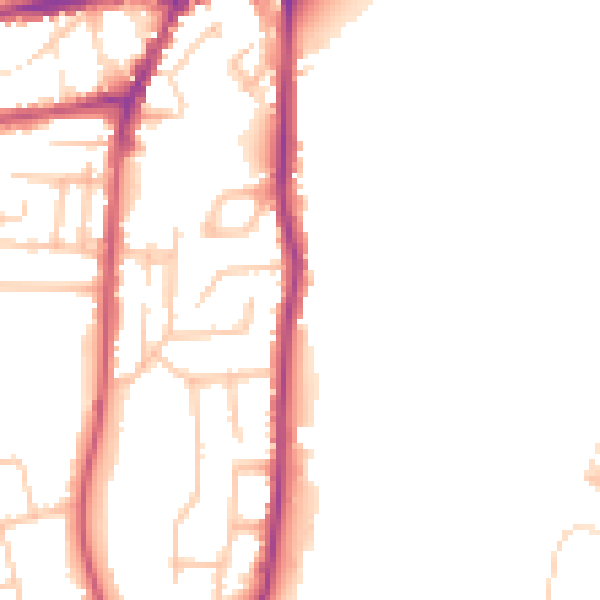
Daytime· 07:00 – 23:00
49.2dB

Night-time· 23:00 – 07:00
41.2dB