345 Worcester Road, Malvern, WR14 1AN
About 345 Worcester Road
345 Worcester Road is a three-bedroom detached house in Malvern (WR14 1AN). It has a recorded floor area of 132 m² (around 1417 sq ft), construction records dating it to before 1900 and council tax band D. It is a listed building, which means external alterations are tightly controlled but it may qualify for heritage tax reliefs. Our model identifies extension potential, subject to local planning policy. The latest certificate (October 2011) shows a G (score 20), near the bottom of the EPC scale. The recommended improvements would push it to F (score 33). Main heating runs on electricity. The latest certificate is from October 2011, so improvements made since then won't be reflected.
At 132 m² it's 27.2% larger than the typical home in the postcode (104 m² median across 6 EPCs). On energy efficiency it sits in the bottom 10% of properties in this postcode — significant headroom for improvement. Across 2006–2022, sale prices on this property compounded at 5.5% per year. On a £-per-square-foot basis, the last sale (£232/sq ft) was about 67.5% above the typical sold price in the postcode. 5 planning records sit against the property, 1 approved, 0 refused. Most recent transfer: November 2022 at £329,000. That sale was during the post-pandemic price surge, when transactions cleared materially above pre-2020 trend.
Know exactly what you're buying at 345 Worcester Road
Before you offer, see what the listing won't tell you, the true value, the red flags and the full history.
Already flagged here
Valuation
against the asking price
Risks
planning & flood
Sold prices
similar homes nearby
Trends
the local market
What this property has
Inside
- Bedrooms3
- Bathrooms1
- Dining roomYes
Outside
- Private gardenRear
- GarageYes
Building
- Listed buildingYes
- Extension potentialPossible
Energy performance
345 Worcester Road sits at the bottom of the postcode for energy efficiency — meaningful headroom to improve.
EPC Expired
This certificate is over 10 years old and is no longer valid.Expired 26 Oct 2021
EPC Rating
Planning history
- Dec 2024FullIn report
Installation of driveway, extension of dropped kerb, opening of entrance and erection of wall
- Documents
- 16 docs on file
- Reference
- M/24/00851/HP
- Jun 2023RenovationHeritageIn report
Removal of stud wall between bathroom and toilet to make one bathroom, repair floor.
- Documents
- 16 docs on file
- Reference
- M/23/00441/LB
We flagged 1 thing worth checking at 345 Worcester Road
Independent checks surfaced things a buyer would want to understand before offering. The report explains each one in full, with the underlying data and what to ask.
- Larger development activity nearby
30-day money-back guarantee
Sales history & valuation
345 Worcester Road has more than doubled in price since the earliest registered sale in 2006.
£339,000
Modelled from EPC, postcode comparables and a sale-price growth of 5.5% per year over 16 years.
£329,000
Growth on file: 5.5% per year over 16 years.
Sales timeline
11 November 2022Most recent
£329,000
+68.7%over 10 years15 August 2012
£195,000
+39.3%over 5 years20 December 2006
£140,000
Median price across the last 5 sales in WR14 1AN: £250,000 (2022–2017).
Nearby sales in WR14 1AN
Everything we know about 345 Worcester Road, in one report
What it's really worth, what could be wrong, and the planning, sales and area data in full.
What we flagged
- Larger development activity nearby

Versus other Worcester Road homes
On epc rating, 345 Worcester Road runs well behind the street norm.
Price per m²
£2,499
Street avg £2,511
Floor Area
132 m²
Street avg 105 m²
Habitable Rooms
6 rooms
Street avg 5 rooms
CO₂ Emissions
23.0 t/year
Street avg 5.7 t/year
Similar properties nearby
1 Bracken Way
WR14 1JH
1 Bosbury Road
WR14 1TR
1 Bradley Drive
WR14 1JS
1 Albert Park Mews, Albert Park Road
WR14 1HN
1 Balmoral Close
WR14 1YB
1 Biggin Hill Close
WR14 1GX
1 Albion Road
WR14 1PU
1 Chase End Close
WR14 1FS
The neighbourhood at a glance
Rail-style transport is unusually close for this postcode.
Crime
3/mo
Steady year-on-year across the wider district.
Nearest stop
0.0 km
Spring Lane — bus stop.
Closest school
0.6 km
St Matthias Church of England Primary School. 10 schools nearby.
Go deeper on the local area
The full report breaks down crime, transport links, schools and air quality in depth.
Road noise across the postcode
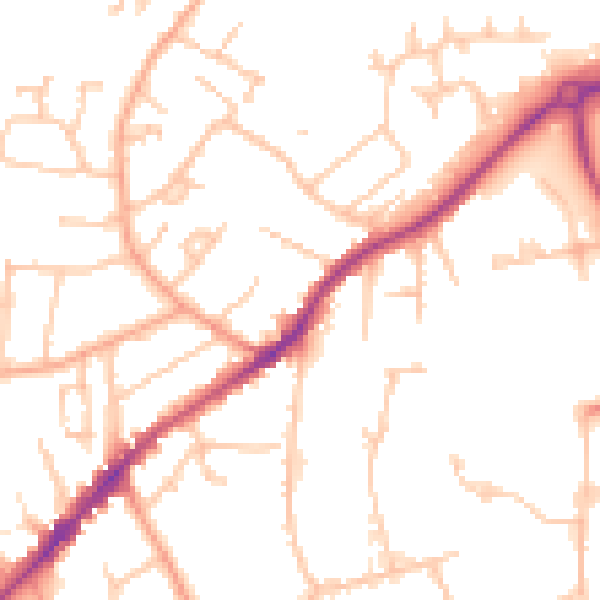
Daytime· 07:00 – 23:00
50.4dB

Night-time· 23:00 – 07:00
40.4dB