3 Culcheth Avenue, Abram, Wigan, WN2 5QW
About 3 Culcheth Avenue
3 Culcheth Avenue is a semi-detached house in Abram, Wigan, Wigan (WN2 5QW). It has a recorded floor area of 99 m² (around 1066 sq ft), construction records dating it to 1930-1949 and council tax band A. The latest certificate (November 2024) shows a C (score 73). The recommended improvements would push it to B (score 84).
One planning record on file: an extension approved in 2012. Past consents include an extension, meaningful when judging how the property has evolved.
Everything you need to know about 3 Culcheth Avenue
The true value, the hidden risks and the full sale history, in one report.
Pick your report · every report is £14.99
One time fee only - money back guarantee

The data behind every report


Energy performance
EPC Rating
Get a survey for this property
Level 3 Building Survey
Because the property has been extended more than once, we believe a Level 3 building survey should be considered.
From £820 · Includes VAT
Planning history
3 Culcheth Avenue has an approved single-storey rear extension on the planning record.
1 application on record at 3 Culcheth Avenue, Abram, Wigan, WN2 5QW
- Nov 2012ExtensionFullOutcome in report
Extension: Single storey · Rear of property
To extend dwellinghouse - single storey to rear
- Documents
- 6 docs on file
- Reference
- A/12/77408
Unlock 3 Culcheth Avenue, Abram, Wigan, WN2 5QW's full planning history
You're seeing the shape of it. The report has the substance.
- Every decision — granted, refused or withdrawn (1 on record)
- All 1 application on this property in full, plus 8 notable nearby
- The 6 documents, officer reports & conditions
- What the pattern means for extending or converting here
One time fee only - money back guarantee
Sales history & valuation
3 Culcheth Avenue has no Land Registry sales on file, suggesting it has stayed in the same hands since registration began.
£164,000
Modelled from EPC, postcode comparables.
No sales recorded with HM Land Registry
That can mean the property has never traded since the registry began publishing in 1995, was a new build that hasn't been registered yet, or is held in the same hands long-term.
Median price across the last 5 sales in WN2 5QW: £123,000 (2024–2017).
Nearby sales in WN2 5QW
4 Culcheth Avenue, Abram, Wigan, WN2 5QW
Sold Aug 2024
£178,00016 Culcheth Avenue, Abram, Wigan, WN2 5QW
Sold May 2021
£123,0007 Culcheth Avenue, Abram, Wigan, WN2 5QW
Sold Feb 2021
£155,00019 Culcheth Avenue, Abram, Wigan, WN2 5QW
Sold Feb 2019
£115,0009 Culcheth Avenue, Abram, Wigan, WN2 5QW
Sold Nov 2017
£108,000
Versus other Culcheth Avenue homes
3 Culcheth Avenue outperforms the street on floor area by a wide margin.
EPC Rating
73 (C)
Street avg 65 (D)
Floor Area
99 m²
Street avg 89 m²
CO₂ Emissions
3.1 t/year
Street avg 3.8 t/year
Habitable Rooms
6 rooms
Street avg 5 rooms
Everything you need to know about 3 Culcheth Avenue
The true value, the hidden risks and the full sale history, in one report.
Pick your report · every report is £14.99
One time fee only - money back guarantee
The data behind every report
Similar properties nearby
1 Brown Street, Bickershaw
WN2 5TT
1 Chapel Street, Platt Bridge
WN2 5EB
1 Beech Grove, Abram
WN2 5YG
1 Ainscough Close, Bickershaw
WN2 5FR
1 Ashwood Avenue, Abram
WN2 5YE
1 Brampton Close, Platt Bridge
WN2 5HS
1 Calder Close, Platt Bridge
WN2 5FN
1 Crown Wood Court, Bamfurlong
WN2 5LY
The neighbourhood at a glance
Nearest stop
0.2 km
Watson Depot — bus stop.
Closest school
0.1 km
St John's Church of England Primary School, Abram. 11 schools nearby.
Go deeper on the local area
A Local Area report breaks down crime, transport links, schools and air quality in depth.
Road noise across the postcode
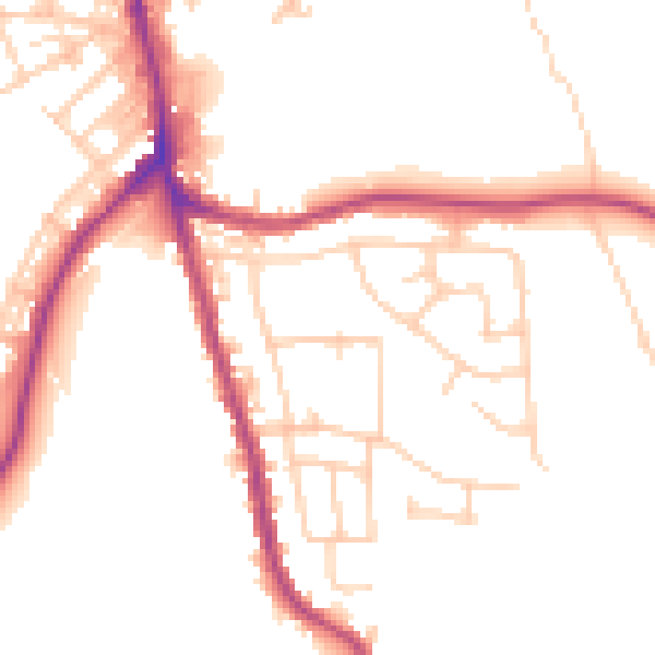
Daytime· 07:00 – 23:00
50.3dB

Night-time· 23:00 – 07:00
42.1dB