3 Castleford Lane, Knottingley, WF11 8QS
Notable views
About 3 Castleford Lane
A plain-English summary derived from public records, EPC certificates, sold prices and local data.
3 Castleford Lane is a three-bedroom semi-detached house in Knottingley (WF11 8QS). It has a recorded floor area of 97 m² (around 1044 sq ft), construction records dating it to 1930-1949 and council tax band A. Tenure is freehold. The latest certificate (June 2023) shows a C (score 72). When first surveyed in June 2013 the rating was D, the property has climbed 1 band since. Between certificates, lighting went from Poor to Very Good; while wall efficiency dropped from Good to Average. The recommended improvements would push it to B (score 84). Other recorded features include notable views.
Sale prices here have outpaced England HPI: 2.2% per year against 0% for the wider region. On a £-per-square-foot basis, the last sale (£185/sq ft) was about 54.6% above the typical sold price in the postcode. It changed hands recently, sold April 2025 for £193,000. Across the public record there are 4 sales, relatively high churn for a single property. At 97 m² it's 25.2% larger than the typical home in the postcode (78 m² median across 6 EPCs). Its energy rating outperforms most of the postcode (better than 83% of similar EPCs).
Before you offer
Know exactly what you're buying at 3 Castleford Lane
Before you offer, see what the listing won't tell you, the true value, the red flags and the full history.
Already flagged here
Larger development activity nearby
£9.99£14.99
Launch offer · save £5
What this property has
Pulled from EPC certificates, claim submissions and our property model. Empty categories are hidden — we only show what's known.
Inside
- Bedrooms3
- Bathrooms1
- Utility roomYes
Outside
- Parking
Energy performance
Every EPC certificate filed against this property — current rating, recorded improvements, and where there's headroom to reach a higher band.
Current Certificate(1 of 2)
Jun 2023
EPC Rating
A
B
C
C72
D
E
F
G
Main Heating
Gas
Main Fuel
Gas
Hot Water
Good
Windows
Good
CO2 Emissions
3.3 t/year
Occupancy
Owner Occupied
Planning history
Applications and permits filed against 3 Castleford Lane, Knottingley, WF11 8QS, sourced from the PlanIt planning register.
3 Castleford Lane has no planning applications on record.
Notable planning nearby
4applications of note in the surrounding area
Before you offer
We flagged 1 thing worth checking at 3 Castleford Lane
Independent checks surfaced things a buyer would want to understand before offering. The report explains each one in full, with the underlying data and what to ask.
- Larger development activity nearby
£9.99£14.99
30-day money-back guarantee
Sales history & valuation
Recorded transactions, our model's current estimate, and a quick read on what neighbouring properties have sold for.
Latest sale on 3 Castleford Lane was the highest on Land Registry record across the postcode.
Current estimate
See how we calculated this£209,000
Modelled from EPC, postcode comparables and a sale-price growth of 2.2% per year over 20 years.
Last sold (2025)
£193,000
Growth on file: 2.2% per year over 20 years.
Sales timeline
Before you offerLaunch offer · save £5
Everything we know about 3 Castleford Lane, in one report
What it's really worth, what could be wrong, and the planning, sales and area data in full.
What we flagged
- Larger development activity nearby
£9.99£14.99
Versus other Castleford Lane homes
Four headline reads against 6 similar houses on this street, drawn from the latest EPC and Land Registry data.
On epc rating, 3 Castleford Lane stands well clear of the street.
EPC Rating
72 (C)
Street avg 62 (D)
Floor Area
97 m²
Street avg 75 m²
CO₂ Emissions
3.3 t/year
Similar properties nearby
A handful of close matches in the same postcode area, ranked by likeness on bedrooms, type and floor area.
The neighbourhood at a glance
A condensed read of the local area. Each tile links through to the full breakdown on the Knottingley district page.
Crime
5/mo
Steady year-on-year across the wider district.
Nearest stop
0.0 km
Castleford Lane — bus stop.
Road noise across the postcode
Modelled day and night-time noise levels around WF11 8QS from Defra's strategic mapping. The pin marks this postcode's centroid.
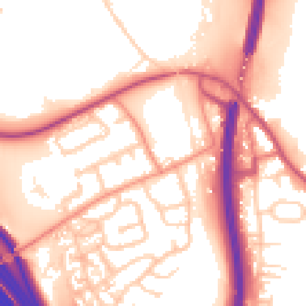
Daytime· 07:00 – 23:00
56.2dB

Everything within walking distance
Schools, transport stops and scenic spots near this property — 43 points of interest in total.
Common questions
The questions buyers, sellers and homeowners most often ask about 3 Castleford Lane, Knottingley, WF11 8QS. Each answer is also embedded as structured data for search engines.
