1 Edlington View, Knottingley, WF11 8LT
3 sales on record
About 1 Edlington View
A plain-English summary derived from public records, EPC certificates, sold prices and local data.
1 Edlington View is an end-of-terrace house in Knottingley (WF11 8LT). It has a recorded floor area of 108 m² (around 1163 sq ft), construction records dating it to 2007 onwards and council tax band C. The latest certificate (July 2018) shows a C (score 79), near the top of the C band. The recommended improvements would push it to B (score 89).
Sale prices here have outpaced England HPI: 1.6% per year against 0% for the wider region. At 108 m² the property is well over the postcode median (70 m² across 11 EPCs), placing it in the larger end of the local stock. Sold October 2024 for £184,000.
Energy performance
Every EPC certificate filed against this property — current rating, recorded improvements, and where there's headroom to reach a higher band.
EPC Rating
A
B
C
C79
D
E
F
G
Main Heating
Gas
Main Fuel
Gas
Hot Water
Good
Windows
Good
CO2 Emissions
2.4 t/year
Occupancy
Rented
Planning history
Applications and permits filed against 1 Edlington View, Knottingley, WF11 8LT, sourced from the PlanIt planning register.
No planning applications are recorded against 1 Edlington View, Knottingley, WF11 8LT. The full report also covers planning activity across the surrounding area.
Full planning data for 1 Edlington View, Knottingley, WF11 8LT
Every application and decision on this property and nearby, in full, in the report.
Sales history & valuation
Recorded transactions, our model's current estimate, and a quick read on what neighbouring properties have sold for.
1 Edlington View valuation sits well clear of the typical sold price in this postcode.
Current estimate
See how we calculated this£194,000
Modelled from EPC, postcode comparables and a sale-price growth of 1.6% per year over 15 years.
Last sold (2024)
£184,000
Growth on file: 1.6% per year over 15 years.
Sales timeline
Launch offer · 33% off
The complete analysis of 1 Edlington View, Knottingley, WF11 8LT
Everything we know about this property, compiled into one in-depth, downloadable report.
Detailed analysis
A written breakdown of everything that matters
Versus other Edlington View homes
Four headline reads against 9 similar houses on this street, drawn from the latest EPC and Land Registry data.
On years held, 1 Edlington View runs well behind the street norm.
Price per m²
£1,704
Street avg £1,154
Floor Area
108 m²
Street avg 75 m²
Habitable Rooms
5 rooms
Similar properties nearby
A handful of close matches in the same postcode area, ranked by likeness on bedrooms, type and floor area.
The neighbourhood at a glance
A condensed read of the local area. Each tile links through to the full breakdown on the Knottingley district page.
Rail-style transport is unusually close for this postcode.
Crime
5/mo
Steady year-on-year across the wider district.
Nearest stop
0.2 km
Hill Top — bus stop.
Road noise across the postcode
Modelled day and night-time noise levels around WF11 8LT from Defra's strategic mapping. The pin marks this postcode's centroid.
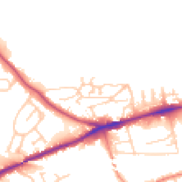
Daytime· 07:00 – 23:00
50.8dB

Everything within walking distance
Schools, transport stops and scenic spots near this property — 40 points of interest in total.
Common questions
The questions buyers, sellers and homeowners most often ask about 1 Edlington View, Knottingley, WF11 8LT. Each answer is also embedded as structured data for search engines.
