3 Ashcombe Drive, Knottingley, WF11 0JU
Extendable
About 3 Ashcombe Drive
A plain-English summary derived from public records, EPC certificates, sold prices and local data.
3 Ashcombe Drive is a three-bedroom semi-detached house in Knottingley (WF11 0JU). It has a recorded floor area of 76 m² (around 818 sq ft), construction records dating it to 1930-1949 and council tax band A. The latest certificate (October 2023) shows a D (score 61), on the cusp of jumping into the C band. Earlier certificates rated it C (April 2012); the latest reading is one band lower. Between certificates, window efficiency went from Average to Good; while wall efficiency dropped from Good to Average and roof efficiency dropped from Good to Very Poor. The recommended improvements would lift it to B (score 83), a 2-band jump. Our model identifies extension potential, subject to local planning policy.
Sale prices here have outpaced England HPI: 0.7% per year against 0% for the wider region. Today's modelled estimate of £162,000 is 22.7% above the 2024 sale price. On a £-per-square-foot basis, the last sale (£161/sq ft) was about 31.4% above the typical sold price in the postcode. Most recent transfer: May 2024 at £132,000.
What this property has
Pulled from EPC certificates, claim submissions and our property model. Empty categories are hidden — we only show what's known.
Inside
- Bedrooms3
- Bathrooms1
- Open-plan layoutYes
- Dining roomYes
Energy performance
Every EPC certificate filed against this property — current rating, recorded improvements, and where there's headroom to reach a higher band.
Recommended upgrades on file would lift this property by multiple EPC bands.
Current Certificate(1 of 2)
Oct 2023
EPC Rating
A
B
C
D
D61
E
F
G
Main Heating
Gas
Main Fuel
Gas
Hot Water
Good
Windows
Good
CO2 Emissions
3.7 t/year
Occupancy
Owner Occupied
Planning history
Applications and permits filed against 3 Ashcombe Drive, Knottingley, WF11 0JU, sourced from the PlanIt planning register.
No planning applications are recorded against 3 Ashcombe Drive, Knottingley, WF11 0JU. The full report also covers planning activity across the surrounding area.
Full planning data for 3 Ashcombe Drive, Knottingley, WF11 0JU
Every application and decision on this property and nearby, in full, in the report.
Sales history & valuation
Recorded transactions, our model's current estimate, and a quick read on what neighbouring properties have sold for.
3 Ashcombe Drive's sale-price growth has lagged the wider UK trajectory across its history on file.
Current estimate
See how we calculated this£162,000
Modelled from EPC, postcode comparables and a sale-price growth of 0.7% per year over 13 years.
Last sold (2024)
£132,000
Growth on file: 0.7% per year over 13 years.
Sales timeline
Launch offer · 33% off
The complete analysis of 3 Ashcombe Drive, Knottingley, WF11 0JU
Everything we know about this property, compiled into one in-depth, downloadable report.
Detailed analysis
A written breakdown of everything that matters
Versus other Ashcombe Drive homes
Four headline reads against 11 similar houses on this street, drawn from the latest EPC and Land Registry data.
On floor area, 3 Ashcombe Drive runs well behind the street norm.
Price per m²
£1,737
Street avg £1,360
Floor Area
76 m²
Street avg 84 m²
Habitable Rooms
5 rooms
Similar properties nearby
A handful of close matches in the same postcode area, ranked by likeness on bedrooms, type and floor area.
The neighbourhood at a glance
A condensed read of the local area. Each tile links through to the full breakdown on the Knottingley district page.
Rail-style transport is unusually close for this postcode.
Crime
5/mo
Steady year-on-year across the wider district.
Nearest stop
0.1 km
Eastfield Avenue — bus stop.
Road noise across the postcode
Modelled day and night-time noise levels around WF11 0JU from Defra's strategic mapping. The pin marks this postcode's centroid.
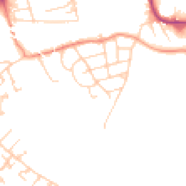
Daytime· 07:00 – 23:00
49.0dB

Everything within walking distance
Schools, transport stops and scenic spots near this property — 39 points of interest in total.
Common questions
The questions buyers, sellers and homeowners most often ask about 3 Ashcombe Drive, Knottingley, WF11 0JU. Each answer is also embedded as structured data for search engines.
