49 Eddystone Rise, Knottingley, WF11 0HS
About 49 Eddystone Rise
A plain-English summary derived from public records, EPC certificates, sold prices and local data.
49 Eddystone Rise is a two-bedroom mid-terrace house in Knottingley (WF11 0HS). It has a recorded floor area of 69 m² (around 743 sq ft), construction records dating it to 1967-1975 and council tax band A. The latest certificate (May 2019) shows a D (score 61), on the cusp of jumping into the C band. The recommended improvements would lift it to B (score 88), a 2-band jump.
On energy efficiency it sits in the bottom 10% of properties in this postcode — significant headroom for improvement. Across 2006–2020, sale prices here grew 0.1% per year, broadly in step with England's 0% HPI growth. Today's modelled estimate of £129,000 sits 61.3% above the 2020 sale of £80,000. On a £-per-square-foot basis, the last sale (£108/sq ft) was about 20.8% below the postcode norm. Last sale on file: £80,000 in November 2020.
What this property has
Pulled from EPC certificates, claim submissions and our property model. Empty categories are hidden — we only show what's known.
Inside
- Bedrooms2
- Bathrooms1
- StudyYes
Outside
- Private garden
Energy performance
Every EPC certificate filed against this property — current rating, recorded improvements, and where there's headroom to reach a higher band.
49 Eddystone Rise sits at the bottom of the postcode for energy efficiency — meaningful headroom to improve.
EPC Rating
A
B
C
D
D61
E
F
G
Main Heating
Gas
Main Fuel
Gas
Hot Water
Poor
Windows
Average
CO2 Emissions
3.7 t/year
Occupancy
Owner Occupied
Planning history
Applications and permits filed against 49 Eddystone Rise, Knottingley, WF11 0HS, sourced from the PlanIt planning register.
No planning applications are recorded against 49 Eddystone Rise, Knottingley, WF11 0HS. The full report also covers planning activity across the surrounding area.
Full planning data for 49 Eddystone Rise, Knottingley, WF11 0HS
Every application and decision on this property and nearby, in full, in the report.
Sales history & valuation
Recorded transactions, our model's current estimate, and a quick read on what neighbouring properties have sold for.
49 Eddystone Rise's sale-price growth has lagged the wider UK trajectory across its history on file.
Current estimate
See how we calculated this£129,000
Modelled from EPC, postcode comparables and a sale-price growth of 0.1% per year over 14 years.
Last sold (2020)
£80,000
Growth on file: 0.1% per year over 14 years.
Sales timeline
Launch offer · 33% off
The complete analysis of 49 Eddystone Rise, Knottingley, WF11 0HS
Everything we know about this property, compiled into one in-depth, downloadable report.
Detailed analysis
A written breakdown of everything that matters
Similar properties nearby
A handful of close matches in the same postcode area, ranked by likeness on bedrooms, type and floor area.
The neighbourhood at a glance
A condensed read of the local area. Each tile links through to the full breakdown on the Knottingley district page.
Rail-style transport is unusually close for this postcode.
Crime
5/mo
Steady year-on-year across the wider district.
Nearest stop
0.2 km
Knottingley Rail Station — railway station.
Road noise across the postcode
Modelled day and night-time noise levels around WF11 0HS from Defra's strategic mapping. The pin marks this postcode's centroid.
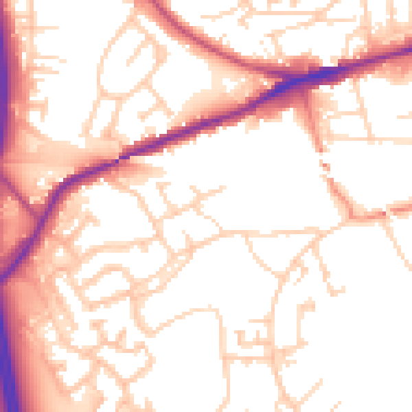
Daytime· 07:00 – 23:00
54.0dB

Everything within walking distance
Schools, transport stops and scenic spots near this property — 41 points of interest in total.
Common questions
The questions buyers, sellers and homeowners most often ask about 49 Eddystone Rise, Knottingley, WF11 0HS. Each answer is also embedded as structured data for search engines.
