Are you a property professional?Get qualified leads from motivated homeowners.
Get started3a, Culmington Road, Ealing, London, W13 9NB
2 planning records
About 3a
A plain-English summary derived from public records, EPC certificates, sold prices and local data.
3a is a property in Ealing, London, London (W13 9NB). It has a recorded floor area of 66 m² (around 708 sq ft) and construction records dating it to 1900-1929. At 66 m² this is the 3rd smallest of 8 units on EPC record in the building, where floor areas span 54–281 m². The building's EPC ratings span E to B, with this unit at the bottom. On EPC score it ranks last in the building (46 versus a best of 89). The latest certificate (February 2010) shows an E (score 46), well below the UK norm with real room to improve. The latest certificate is from February 2010, so improvements made since then won't be reflected.
At 66 m² it sits well below the postcode median (137 m² across 8 EPCs), making it one of the more compact homes locally. It lags the bulk of the postcode on energy efficiency (less efficient than 75% of similar EPCs). 2 planning records sit against the property, 1 approved, 1 refused. Past consents include an extension, a basement excavation and subdivision, meaningful when judging how the property has evolved.
Energy performance
Every EPC certificate filed against this property — current rating, recorded improvements, and where there's headroom to reach a higher band.
3a's EPC is over a decade old — improvements since won't be reflected.
EPC Expired
This certificate is over 10 years old and is no longer valid.Expired 08 Feb 2020
Planning history
Applications and permits filed against 3a, Culmington Road, Ealing, London, W13 9NB, sourced from the PlanIt planning register.
Council records show a subdivision application — the property's legal arrangement has been altered.
- Dec 2007BasementFullGrant with Conditions
Conversion of residential house into six self-contained flats, part two storey and part first floor side extension and excavation of forecourt to provide lightwell to basement, vehicular access and parking
Sales history & valuation
Recorded transactions, our model's current estimate, and a quick read on what neighbouring properties have sold for.
3a has no Land Registry sales on file, suggesting it has stayed in the same hands since registration began.
Current estimate
See how we calculated this£485,000
Modelled from EPC, postcode comparables.
No sales recorded with HM Land Registry
That can mean the property has never traded since the registry began publishing in 1995, was a new build that hasn't been registered yet, or is held in the same hands long-term.
Launch offer · 33% off
The complete analysis of 3a, Culmington Road, Ealing, London, W13 9NB
Everything we know about this property, compiled into one in-depth, downloadable report.
Detailed AI analysis
An AI-written breakdown of everything that matters
Versus other Culmington Road homes
Four headline reads against 3 similar flats on this street, drawn from the latest EPC and Land Registry data.
EPC Rating for 3a lags the street by a wide margin.
EPC Rating
46 (E)
Street avg 66 (D)
Floor Area
66 m²
Street avg 48 m²
CO₂ Emissions
5.3 t/year
Street avg 2.2 t/year
Similar properties nearby
A handful of close matches in the same postcode area, ranked by likeness on bedrooms, type and floor area.
The neighbourhood at a glance
A condensed read of the local area. Each tile links through to the full breakdown on the London district page.
Rail-style transport is unusually close for this postcode.
Crime
4/mo
Rising year-on-year across the wider district.
Nearest stop
0.1 km
Dane Road — bus stop.
Road noise across the postcode
Modelled day and night-time noise levels around W13 9NB from Defra's strategic mapping. The pin marks this postcode's centroid.
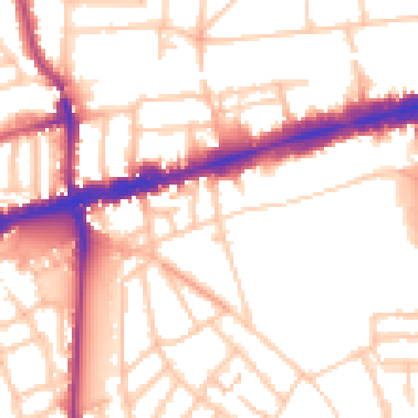
Daytime· 07:00 – 23:00
53.3dB

Everything within walking distance
Schools, transport stops and scenic spots near this property — 69 points of interest in total.
Common questions
The questions buyers, sellers and homeowners most often ask about 3a, Culmington Road, Ealing, London, W13 9NB. Each answer is also embedded as structured data for search engines.
