Are you a property professional?Get qualified leads from motivated homeowners.
Get started2 Culmington Road, Ealing, London, W13 9NB
Extendable
About 2 Culmington Road
A plain-English summary derived from public records, EPC certificates, sold prices and local data.
2 Culmington Road is a four-bedroom detached house in Ealing, London, London (W13 9NB). It has a recorded floor area of 151 m² (around 1625 sq ft), construction records dating it to 1900-1929 and council tax band G. The latest certificate (April 2023) shows an E (score 50), well below the UK norm with real room to improve. The recommended improvements would lift it to B (score 84), a 3-band jump. Our model identifies extension potential, subject to local planning policy.
At 151 m² the property is well over the postcode median (94 m² across 8 EPCs), placing it in the larger end of the local stock. It lags the bulk of the postcode on energy efficiency (less efficient than 75% of similar EPCs). 2 planning records sit against the property, 2 approved, 0 refused. Past consents include an extension and partial demolition, meaningful when judging how the property has evolved. On a £-per-square-foot basis, the last sale (£766/sq ft) was about 25.2% above the typical sold price in the postcode. Most recent transfer: June 2024 at £1,245,000.
What this property has
Pulled from EPC certificates, claim submissions and our property model. Empty categories are hidden — we only show what's known.
Inside
- Bedrooms4
- Bathrooms2
- Dining roomYes
- EnsuiteYes
Energy performance
Every EPC certificate filed against this property — current rating, recorded improvements, and where there's headroom to reach a higher band.
2 Culmington Road's carbon output runs well above what efficient homes in the postcode produce.
EPC Rating
A
B
C
D
E
E50
F
G
Main Heating
Gas
Main Fuel
Gas
Hot Water
Average
Windows
Average
CO2 Emissions
8.2 t/year
Occupancy
Owner Occupied
Planning history
Applications and permits filed against 2 Culmington Road, Ealing, London, W13 9NB, sourced from the PlanIt planning register.
Planning history includes recorded demolition works, indicating a major rebuild phase at this address.
- Jun 2024DemolitionFullGrant with Conditions
Single storey rear/side extension following demolition of the existing conservatory and store building
Sales history & valuation
Recorded transactions, our model's current estimate, and a quick read on what neighbouring properties have sold for.
2 Culmington Road valuation sits well clear of the typical sold price in this postcode.
Current estimate
See how we calculated this£1,352,000
Modelled from EPC, postcode comparables.
Last sold (2024)
£1,245,000
Recorded with HM Land Registry.
Sales timeline
Launch offer · 33% off
The complete analysis of 2 Culmington Road, Ealing, London, W13 9NB
Everything we know about this property, compiled into one in-depth, downloadable report.
Detailed AI analysis
An AI-written breakdown of everything that matters
Versus other Culmington Road homes
Four headline reads against 4 similar houses on this street, drawn from the latest EPC and Land Registry data.
Price per m² for 2 Culmington Road runs comfortably ahead of the street norm.
Price per m²
£8,245
Street avg £6,462
Floor Area
151 m²
Street avg 210 m²
CO₂ Emissions
8.2 t/year
Similar properties nearby
A handful of close matches in the same postcode area, ranked by likeness on bedrooms, type and floor area.
The neighbourhood at a glance
A condensed read of the local area. Each tile links through to the full breakdown on the London district page.
Rail-style transport is unusually close for this postcode.
Crime
4/mo
Rising year-on-year across the wider district.
Nearest stop
0.1 km
Dane Road — bus stop.
Road noise across the postcode
Modelled day and night-time noise levels around W13 9NB from Defra's strategic mapping. The pin marks this postcode's centroid.
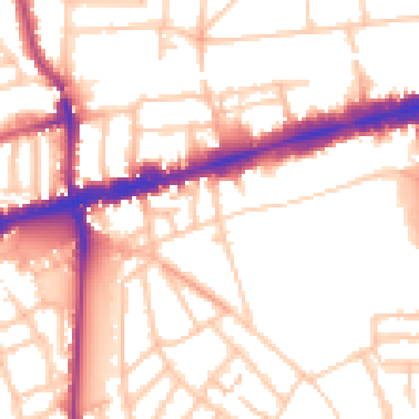
Daytime· 07:00 – 23:00
53.3dB

Everything within walking distance
Schools, transport stops and scenic spots near this property — 69 points of interest in total.
Common questions
The questions buyers, sellers and homeowners most often ask about 2 Culmington Road, Ealing, London, W13 9NB. Each answer is also embedded as structured data for search engines.
