1 Bywell Grove, Ormesby, Middlesbrough, TS7 9LL
About 1 Bywell Grove
1 Bywell Grove is a three-bedroom semi-detached house in Ormesby, Middlesbrough, Middlesbrough (TS7 9LL). It has a recorded floor area of 87 m² (around 936 sq ft), construction records dating it to 1950-1966 and council tax band A. The latest certificate (July 2015) shows a D (score 63), on the cusp of jumping into the C band. When first surveyed in August 2011 the rating was E, the property has climbed 1 band since. Between certificates, window efficiency went from Very Poor to Average and hot-water efficiency went from Average to Good; while roof efficiency dropped from Good to Average and lighting dropped from Very Good to Average. The recommended improvements would push it to C (score 77). The latest certificate is from July 2015, so improvements made since then won't be reflected.
On the market in June 2016 and unlisted since — roughly 10 years. Across 2011–2016, sale prices on this property compounded at 4.6% per year. Today's modelled estimate of £128,000 is 34.7% above the 2016 sale price.
What this property has
Inside
- Bedrooms3
- CloakroomYes
Outside
- Private gardenYes
- GarageDetached
Building
- Central heatingYes
- RefurbishedYes
Everything you need to know about 1 Bywell Grove
The true value, the hidden risks and the full sale history, in one report.
Pick your report · every report is £14.99
One time fee only - money back guarantee

The data behind every report


Energy performance
EPC Expired
This certificate is over 10 years old and is no longer valid.Expired 29 Jul 2025
EPC Rating
Property Improvements
Changes detected from historical EPC data
Heating system upgraded to a more efficient system
Heating controls upgraded for better temperature management
Hot water system upgraded
Single glazing replaced with double or better glazing
Low energy lighting percentage decreased
Get a survey for this property
Level 2 HomeBuyer Report
We've checked 10 risk factors against the available data for this property and believe a Level 2 HomeBuyer Report could be a suitable option for you.
From £495 · Includes VAT
Planning history
1 Bywell Grove has no planning applications on record.
But the area is active
1 notable application nearby — larger schemes and conversions that could reshape the street. The report maps them all.
Sales history & valuation
1 Bywell Grove valuation sits well clear of the typical sold price in this postcode.
£128,000
Modelled from EPC, postcode comparables and a sale-price growth of 4.6% per year over 4 years.
£95,000
Growth on file: 4.6% per year over 4 years.
Sales timeline
2 June 2016Most recent
£95,000
+22.6%over 4 years9 December 2011
£77,500
Median price across the last 5 sales in TS7 9LL: £97,500 (2025–2021).
Nearby sales in TS7 9LL
15 Bywell Grove, Ormesby, Middlesbrough, TS7 9LL
Sold Aug 2025
£110,0006 Bywell Grove, Ormesby, Middlesbrough, TS7 9LL
Sold Apr 2025
£130,00022 Bywell Grove, Ormesby, Middlesbrough, TS7 9LL
Sold Mar 2022
£92,00017 Bywell Grove, Ormesby, Middlesbrough, TS7 9LL
Sold Aug 2021
£97,50021 Bywell Grove, Ormesby, Middlesbrough, TS7 9LL
Sold Jul 2018
£62,000
Versus other Bywell Grove homes
On floor area, 1 Bywell Grove stands well clear of the street.
Price per m²
£1,092
Street avg £1,230
Floor Area
87 m²
Street avg 80 m²
Habitable Rooms
4 rooms
Street avg 4 rooms
CO₂ Emissions
4.2 t/year
Street avg 3.6 t/year
Everything you need to know about 1 Bywell Grove
The true value, the hidden risks and the full sale history, in one report.
Pick your report · every report is £14.99
One time fee only - money back guarantee
The data behind every report
Similar properties nearby
1 Cherry Tree Close, Ormesby
TS7 9PH
1 Farmbank Road, Ormesby
TS7 9EG
1 Cooks Court, Ormesby
TS7 9NL
1 Appletree Gardens, Ormesby
TS7 9NR
1 Cleveland Close, Ormesby
TS7 9BX
1 Ainsworth Way, Ormesby
TS7 9QA
1 Ancroft Drive, Ormesby
TS7 9NH
1 Dew Lane, Ormesby
TS7 9AR
The neighbourhood at a glance
Crime
4/mo
Steady year-on-year across the wider district.
Nearest stop
0.2 km
Ormesby Primary School — bus stop.
Closest school
0.2 km
Ormesby Primary School. 30 schools nearby.
Go deeper on the local area
A Local Area report breaks down crime, transport links, schools and air quality in depth.
Road noise across the postcode
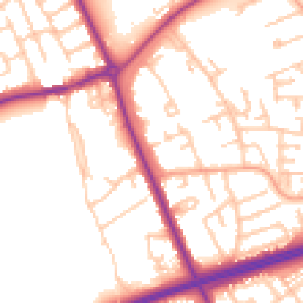
Daytime· 07:00 – 23:00
53.4dB

Night-time· 23:00 – 07:00
44.6dB