14 Solway Drive, Sutton Hill, Telford, TF7 4JA
Property type
Detached
Habitable rooms
4
From EPC
Floor area
101 m²
1087 sq ft
Energy rating
C
Score 69
Council tax
Band A
Tenure
Owner Occupied
About 14 Solway Drive
A plain-English summary derived from public records, EPC certificates, sold prices and local data.
14 Solway Drive is a detached house in Sutton Hill, Telford, Telford (TF7 4JA). It has a recorded floor area of 101 m² (around 1087 sq ft), construction records dating it to 1967-1975 and council tax band A. The latest certificate (November 2024) shows a C (score 69), just inside the C band. The recommended improvements would push it to B (score 83).
Held since September 2007 — that's 19 years off the open market, well above the local norm. That sale landed at the peak of the pre-credit-crunch market, which is a useful reference point when interpreting the price. At 101 m² it's 18.8% larger than the typical home in the postcode (85 m² median across 17 EPCs). Its energy rating outperforms most of the postcode (better than 71% of similar EPCs). Today's modelled estimate of £189,000 is 35% above the 2007 sale price. On a £-per-square-foot basis, the last sale (£129/sq ft) was about 21.8% above the typical sold price in the postcode.
Before you offer
Know exactly what you're buying at 14 Solway Drive
Before you offer, see what the listing won't tell you, the true value, the red flags and the full history.
£9.99£14.99
Launch offer · save £5
Trusted by UK homebuyers
Valuation
against the asking price
Risks
planning & flood
Sold prices
similar homes nearby
Trends
the local market
Energy performance
Every EPC certificate filed against this property — current rating, recorded improvements, and where there's headroom to reach a higher band.
EPC Rating
A
B
C
C69
D
E
F
G
Main Heating
Gas
Main Fuel
Gas
Hot Water
Good
Windows
Average
CO2 Emissions
3.9 t/year
Occupancy
Owner Occupied
Planning history
Applications and permits filed against 14 Solway Drive, Sutton Hill, Telford, TF7 4JA, sourced from the PlanIt planning register.
14 Solway Drive has no planning applications on record.
Notable planning nearby
3applications of note in the surrounding area
Sales history & valuation
Recorded transactions, our model's current estimate, and a quick read on what neighbouring properties have sold for.
The latest sale landed at the peak of the pre-credit-crunch market — a high-water reference point.
Current estimate
See how we calculated this£189,000
Modelled from EPC, postcode comparables.
Last sold (2007)
£140,000
Recorded with HM Land Registry.
Sales timeline
18 September 2007Most recent
£140,000
Median price across the last 5 sales in TF7 4JA: £125,000 (2025–2022).
Nearby sales in TF7 4JA
Before you offerLaunch offer · save £5
Everything we know about 14 Solway Drive, in one report
What it's really worth, what could be wrong, and the planning, sales and area data in full.
- Am I paying too much?
- Is something wrong with it?
- Is the agent's story true?
- Will it hold its value?
£9.99£14.99
Trusted by UK homebuyers

Versus other Solway Drive homes
Four headline reads against 17 similar houses on this street, drawn from the latest EPC and Land Registry data.
On years held, 14 Solway Drive stands well clear of the street.
Price per m²
£1,386
Street avg £1,326
Floor Area
101 m²
Street avg 96 m²
Habitable Rooms
4 rooms
Street avg 5 rooms
CO₂ Emissions
3.9 t/year
Street avg 3.9 t/year
Similar properties nearby
A handful of close matches in the same postcode area, ranked by likeness on bedrooms, type and floor area.
£188k
1 Coppice Close, Madeley
TF7 4DW
£194k
1 Little Dawley Close, Severn Gorge Park
TF7 4GH
£183k
1 Hilda Hooke Close, Madeley
TF7 4HU
£180k
1 Kemberton Drive, Madeley
TF7 4EL
£169k
1 Hills Lane Drive, Madeley
TF7 4BP
£214k
1 Halesfield Road, Madeley
TF7 4EF
3 bed1 bath
£154k
1 Meadow Close, Madeley
TF7 4DQ
£152k
1 Greenwood Close, Madeley
TF7 4LW
The neighbourhood at a glance
A condensed read of the local area. Each tile links through to the full breakdown on the Telford district page.
Reported crime in the wider district is trending notably upward year-on-year.
Crime
5/mo
Rising year-on-year across the wider district.
Nearest stop
0.1 km
Sandcroft — bus stop.
Closest school
0.4 km
Sir Alexander Fleming Primary School. 13 schools nearby.
Go deeper on the local area
The full report breaks down crime, transport links, schools and air quality in depth.
Road noise across the postcode
Modelled day and night-time noise levels around TF7 4JA from Defra's strategic mapping. The pin marks this postcode's centroid.
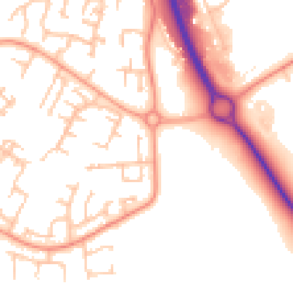
Daytime· 07:00 – 23:00
52.4dB

Night-time· 23:00 – 07:00
43.0dB
55 dB
60 dB
65 dB
70 dB
75 dB
80 dB
Defra Road Noise Strategic Mapping, Round 4Everything within walking distance
Schools, transport stops and scenic spots near this property — 43 points of interest in total.
Common questions
The questions buyers, sellers and homeowners most often ask about 14 Solway Drive, Sutton Hill, Telford, TF7 4JA. Each answer is also embedded as structured data for search engines.