6 Levins Court, Madeley, Telford, TF7 4DR
3 sales on record
About 6 Levins Court
A plain-English summary derived from public records, EPC certificates, sold prices and local data.
6 Levins Court is a two-bedroom mid-terrace house in Madeley, Telford, Telford (TF7 4DR). It has a recorded floor area of 58 m² (around 624 sq ft), construction records dating it to 1996-2002 and council tax band B. The latest certificate (December 2013) shows a D (score 67), on the cusp of jumping into the C band. The recommended improvements would lift it to B (score 88), a 2-band jump. The latest certificate is from December 2013, so improvements made since then won't be reflected.
Held since February 2008 — that's 18 years off the open market, well above the local norm. That sale landed at the peak of the pre-credit-crunch market, which is a useful reference point when interpreting the price. Sale prices here have outpaced England HPI: 10.5% per year against 0% for the wider region. Today's modelled estimate of £147,000 is 30.7% above the 2008 sale price. On a £-per-square-foot basis, the last sale (£180/sq ft) was about 37.9% above the typical sold price in the postcode. At 58 m² it's 24.7% smaller than the typical home in the postcode (77 m² median across 13 EPCs). It lags the bulk of the postcode on energy efficiency (less efficient than 85% of similar EPCs).
Before you offer
Know exactly what you're buying at 6 Levins Court
Before you offer, see what the listing won't tell you, the true value, the red flags and the full history.
£9.99£14.99
Launch offer · save £5
What this property has
Pulled from EPC certificates, claim submissions and our property model. Empty categories are hidden — we only show what's known.
Inside
- Bedrooms2
- Bathrooms1
Energy performance
Every EPC certificate filed against this property — current rating, recorded improvements, and where there's headroom to reach a higher band.
Recommended upgrades on file would lift this property by multiple EPC bands.
EPC Expired
This certificate is over 10 years old and is no longer valid.Expired 04 Dec 2023
Planning history
Applications and permits filed against 6 Levins Court, Madeley, Telford, TF7 4DR, sourced from the PlanIt planning register.
6 Levins Court has no planning applications on record.
Notable planning nearby
3applications of note in the surrounding area
Sales history & valuation
Recorded transactions, our model's current estimate, and a quick read on what neighbouring properties have sold for.
6 Levins Court has more than doubled in price since the earliest registered sale in 1999.
Current estimate
See how we calculated this£147,000
Modelled from EPC, postcode comparables and a sale-price growth of 10.5% per year over 9 years.
Last sold (2008)
£112,500
Growth on file: 10.5% per year over 9 years.
Sales timeline
Before you offerLaunch offer · save £5
Everything we know about 6 Levins Court, in one report
What it's really worth, what could be wrong, and the planning, sales and area data in full.
- Am I paying too much?
- Is something wrong with it?
Versus other Levins Court homes
Four headline reads against 13 similar houses on this street, drawn from the latest EPC and Land Registry data.
On epc rating, 6 Levins Court runs well behind the street norm.
Price per m²
£1,940
Street avg £1,847
Floor Area
58 m²
Street avg 73 m²
Habitable Rooms
3 rooms
Street avg 5 rooms
Similar properties nearby
A handful of close matches in the same postcode area, ranked by likeness on bedrooms, type and floor area.
The neighbourhood at a glance
A condensed read of the local area. Each tile links through to the full breakdown on the Telford district page.
Reported crime in the wider district is trending notably upward year-on-year.
Crime
5/mo
Rising year-on-year across the wider district.
Nearest stop
0.1 km
Hills Lane — bus stop.
Road noise across the postcode
Modelled day and night-time noise levels around TF7 4DR from Defra's strategic mapping. The pin marks this postcode's centroid.
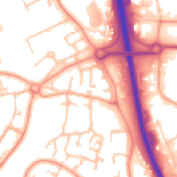
Daytime· 07:00 – 23:00
55.6dB

Everything within walking distance
Schools, transport stops and scenic spots near this property — 44 points of interest in total.
Common questions
The questions buyers, sellers and homeowners most often ask about 6 Levins Court, Madeley, Telford, TF7 4DR. Each answer is also embedded as structured data for search engines.
