189 Monkmoor Road, Shrewsbury, SY2 5BQ
About 189 Monkmoor Road
189 Monkmoor Road is a three-bedroom semi-detached house in Shrewsbury (SY2 5BQ). It has a recorded floor area of 88 m² (around 947 sq ft), construction records dating it to 1950-1966 and council tax band C. The latest certificate (October 2021) shows a D (score 55), a step below the typical UK home. The recommended improvements would push it to C (score 79).
Across 2022–2024, sale prices on this property compounded at 4.5% per year. Today's modelled estimate of £255,000 is 18.6% above the 2024 sale price. On a £-per-square-foot basis, the last sale (£227/sq ft) was about 44.3% above the typical sold price in the postcode. Last sale on file: £215,000 in September 2024.
What this property has
Inside
- Bedrooms3
- Bathrooms1
Everything you need to know about 189 Monkmoor Road
The true value, the hidden risks and the full sale history, in one report.
30-day money-back guarantee

The data behind every report


Energy performance
EPC Rating
Planning history
189 Monkmoor Road has no planning applications on record.
Notable planning nearby
3applications of note in the surrounding area
We flagged 1 thing worth checking at 189 Monkmoor Road
Independent checks surfaced things a buyer would want to understand before offering. The report explains each one in full, with the underlying data and what to ask.
- Larger development activity nearby
30-day money-back guarantee
Sales history & valuation
189 Monkmoor Road valuation sits well clear of the typical sold price in this postcode.
£255,000
Modelled from EPC, postcode comparables and a sale-price growth of 4.5% per year over 3 years.
£215,000
Growth on file: 4.5% per year over 3 years.
Sales timeline
18 September 2024Most recent
£215,000
+12.0%over 2 years4 March 2022
£192,000
Median price across the last 5 sales in SY2 5BQ: £210,000 (2022–2016).
Nearby sales in SY2 5BQ
Versus other Monkmoor Road homes
On years held, 189 Monkmoor Road runs well behind the street norm.
Price per m²
£2,443
Street avg £2,118
Floor Area
88 m²
Street avg 104 m²
Habitable Rooms
6 rooms
Street avg 6 rooms
CO₂ Emissions
5.1 t/year
Street avg 3.6 t/year
Everything you need to know about 189 Monkmoor Road
The true value, the hidden risks and the full sale history, in one report.
30-day money-back guarantee
The data behind every report
Similar properties nearby
The neighbourhood at a glance
Crime
1/mo
Steady year-on-year across the wider district.
Nearest stop
1.5 km
Shrewsbury Rail Station — railway station.
Closest school
0.4 km
Wilfred Owen Primary School. 17 schools nearby.
Go deeper on the local area
The full report breaks down crime, transport links, schools and air quality in depth.
Road noise across the postcode
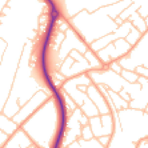
Daytime· 07:00 – 23:00
52.4dB

Night-time· 23:00 – 07:00
41.2dB