10 Battlefield Court, Shrewsbury, SY1 4AR
About 10 Battlefield Court
10 Battlefield Court is a two-bedroom semi-detached house in Shrewsbury (SY1 4AR). It has a recorded floor area of 97 m² (around 1044 sq ft), construction records dating it to 2003-2006 and council tax band B. At 97 m² this is the largest unit on EPC record across the building (64–97 m²). The building's EPC ratings span C to B, with this unit at the bottom. The property has solar panels on record, all of which lower running costs and tend to lift resale appeal. The latest certificate (November 2020) shows a C (score 79), near the top of the C band. Earlier certificates rated it B (September 2010); the latest reading is one band lower. Between certificates, hot-water efficiency dropped from Very Good to Good and main heating dropped from Very Good to Good. The recommended improvements would push it to B (score 81).
At 97 m² the property is well over the postcode median (69 m² across 23 EPCs), placing it in the larger end of the local stock. Sold March 2024 for £153,500. Across the public record there are 4 sales, relatively high churn for a single property. One planning record on file: tree works approved in 2017. Past consents include tree works, meaningful when judging how the property has evolved. Across 2006–2024, sale prices on this property compounded at 0.6% per year. On a £-per-square-foot basis, the last sale (£147/sq ft) was about 20.3% below the postcode norm.
What this property has
Inside
- Bedrooms2
- Bathrooms2
- Dining roomYes
- EnsuiteYes
Outside
- Communal gardenYes
- ParkingAllocated
Building
- Solar panelsYes
Everything you need to know about 10 Battlefield Court
The true value, the hidden risks and the full sale history, in one report.
Pick your report · from £14.99
One time fee only - money back guarantee

The data behind every report


Energy performance
EPC Rating
Certificate validity
Valid until 7 November 2030

Get a survey for this property
Level 2 HomeBuyer Report
We've checked 10 risk factors against the available data for this property and believe a Level 2 HomeBuyer Report could be a suitable option for you.
From £495 · Includes VAT
Planning history
1 application on record at 10 Battlefield Court, Shrewsbury, SY1 4AR
- Jun 2017Tree WorksTreesOutcome in report
Crown lift to 5m, reduce eastfacting limbs by approximately 2m as they are making contact with the building, causing excessive shading to residents and potential to damage drainage on property 1 No Oak tree protected by Town and Country Planning Act 1971, Section 60. Shrewsbury & Atcham Borough Council (Battlefields, Lion Coppice) Tree Preservation Order 1979 made on 12th October 1979 and confirmed on 10th April 1980.
- Documents
- 4 docs on file
- Reference
- 17/02172/TPO
Unlock 10 Battlefield Court, Shrewsbury, SY1 4AR's full planning history
You're seeing the shape of it. The report has the substance.
- Every decision — granted, refused or withdrawn (1 on record)
- All 1 application on this property in full
- The 4 documents, officer reports & conditions
- What the pattern means for extending or converting here
One time fee only - money back guarantee
Sales history & valuation
10 Battlefield Court's sale-price growth has lagged the wider UK trajectory across its history on file.
£162,000
Modelled from EPC, postcode comparables and a sale-price growth of 0.6% per year over 18 years.
£153,500
Growth on file: 0.6% per year over 18 years.
Sales timeline
13 March 2024Most recent
£153,500
+27.9%over 3 years15 December 2020
£120,000
-16.7%over 14 years28 September 2006
£144,000
+3.6%27 April 2006
£138,995
Median price across the last 5 sales in SY1 4AR: £146,000 (2026–2022).
Nearby sales in SY1 4AR
22 Battlefield Court, Shrewsbury, SY1 4AR
Sold Mar 2026
£154,0002 Battlefield Court, Shrewsbury, SY1 4AR
Sold Oct 2025
£146,00019 Battlefield Court, Shrewsbury, SY1 4AR
Sold Oct 2024
£130,00011 Battlefield Court, Shrewsbury, SY1 4AR
Sold Jul 2024
£148,00016 Battlefield Court, Shrewsbury, SY1 4AR
Sold Mar 2022
£135,000
Versus other Battlefield Court homes
On price per m², 10 Battlefield Court runs well behind the street norm.
Price per m²
£1,582
Street avg £1,950
Floor Area
97 m²
Street avg 69 m²
Habitable Rooms
3 rooms
Street avg 3 rooms
CO₂ Emissions
2.1 t/year
Street avg 1.4 t/year
Everything you need to know about 10 Battlefield Court
The true value, the hidden risks and the full sale history, in one report.
Pick your report · from £14.99
One time fee only - money back guarantee
The data behind every report
Similar properties nearby
The neighbourhood at a glance
Crime
211/mo
Steady year-on-year across the wider district.
Closest school
1.0 km
Harlescott Junior School. 9 schools nearby.
Go deeper on the local area
A Local Area report breaks down crime, transport links, schools and air quality in depth.
Road noise across the postcode
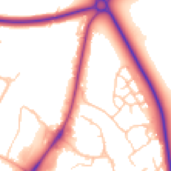
Daytime· 07:00 – 23:00
54.5dB

Night-time· 23:00 – 07:00
46.8dB