9 Blore Close, Wandsworth, London, SW8 4HP
About 9 Blore Close
A plain-English summary derived from public records, EPC certificates, sold prices and local data.
9 Blore Close is a three-bedroom mid-terrace house in Wandsworth, London, London (SW8 4HP). It has a recorded floor area of 85 m² (around 915 sq ft), construction records dating it to 1950-1966 and council tax band C. The latest certificate (September 2015) shows a C (score 74). The latest certificate is from September 2015, so improvements made since then won't be reflected.
Sale prices here have outpaced London HPI: 4.5% per year against 0% for the wider region. On a £-per-square-foot basis, the last sale (£492/sq ft) was about 77.4% above the typical sold price in the postcode. A recent sale: £450,000 in June 2025.
What this property has
Pulled from EPC certificates, claim submissions and our property model. Empty categories are hidden — we only show what's known.
Inside
- Bedrooms3
Energy performance
Every EPC certificate filed against this property — current rating, recorded improvements, and where there's headroom to reach a higher band.
EPC Expired
This certificate is over 10 years old and is no longer valid.Expired 15 Sept 2025
EPC Rating
A
B
C
C74
D
E
F
G
Main Heating
Gas
Main Fuel
Gas
Hot Water
Good
Windows
Good
CO2 Emissions
2.2 t/year
Occupancy
Owner Occupied
Planning history
Applications and permits filed against 9 Blore Close, Wandsworth, London, SW8 4HP, sourced from the PlanIt planning register.
No planning applications are recorded against 9 Blore Close, Wandsworth, London, SW8 4HP. The full report also covers planning activity across the surrounding area.
Full planning data for 9 Blore Close, Wandsworth, London, SW8 4HP
Every application and decision on this property and nearby, in full, in the report.
Sales history & valuation
Recorded transactions, our model's current estimate, and a quick read on what neighbouring properties have sold for.
9 Blore Close has more than doubled in price since the earliest registered sale in 2006.
Current estimate
See how we calculated this£448,000
Modelled from EPC, postcode comparables and a sale-price growth of 4.5% per year over 19 years.
Last sold (2025)
£450,000
Growth on file: 4.5% per year over 19 years.
Sales timeline
Launch offer · 33% off
The complete analysis of 9 Blore Close, Wandsworth, London, SW8 4HP
Everything we know about this property, compiled into one in-depth, downloadable report.
Detailed analysis
A written breakdown of everything that matters
Versus other Blore Close homes
Four headline reads against 21 similar flats on this street, drawn from the latest EPC and Land Registry data.
On years held, 9 Blore Close runs well behind the street norm.
Price per m²
£5,294
Street avg £4,414
Floor Area
85 m²
Street avg 85 m²
Habitable Rooms
5 rooms
Street avg 4 rooms
Similar properties nearby
A handful of close matches in the same postcode area, ranked by likeness on bedrooms, type and floor area.
The neighbourhood at a glance
A condensed read of the local area. Each tile links through to the full breakdown on the London district page.
Rail-style transport is unusually close for this postcode.
Crime
12/mo
Rising year-on-year across the wider district.
Nearest stop
0.0 km
Blore Close — bus stop.
Road noise across the postcode
Modelled day and night-time noise levels around SW8 4HP from Defra's strategic mapping. The pin marks this postcode's centroid.
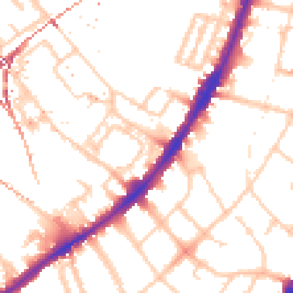
Daytime· 07:00 – 23:00
52.4dB

Everything within walking distance
Schools, transport stops and scenic spots near this property — 122 points of interest in total.
Common questions
The questions buyers, sellers and homeowners most often ask about 9 Blore Close, Wandsworth, London, SW8 4HP. Each answer is also embedded as structured data for search engines.
